Trip Report
Intermediate Snowshoe - Lake Valhalla via Smithbrook Road
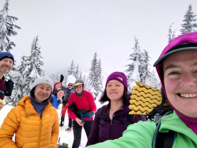
Successful outing with a great group in excellent conditions
- Sun, Jan 15, 2023
- Intermediate Snowshoe - Lake Valhalla via Smithbrook Road
- Lake Valhalla (winter)
- Snowshoeing
- Successful
-

- Road suitable for all vehicles
-
The pullout on the side of highway 2 had room for plenty of cars and there were a couple of cutouts in the berm so it was easy to get over.
Our destination was the saddle overlooking Lake Valhalla, which worked out well in terms of time and effort; I did not want to have to get up too early (it's a long drive for most participants) or hike out in the dark. If you start earlier, or don't mind pushing the end later (since you are just following the road for 3 miles), or if days are longer, it would be feasible to also go down to the lake itself or summit Mount McCausland.
There are a couple of important navigation points to pay attention to; see trip report below. Our .gpx tracks showed about 9 miles of travel and 1700ft elevation gain.
We lucked out with a favorable avalanche forecast (Low-Medium-Medium) for the day, and a relatively dry weather forecast. Avy gear was optional for the trip, and those of us who had brought beacons did a beacon check before we all set off for the 3 mile road warmup.
There are a few important navigational points you want to get right on this route, depending on snow conditions of course:
* at the end of the road (the summer trailhead) we had hoped to leave the trail altogether and do a rising traverse towards the PCT. However, there is a steep, rocky stream that was open and would have been impossible to cross there, so we followed the summer trail for a bit and left it at the 4320ft switchback. At that level the creek was a lot tamer, its banks were less steep and we were able to cross easily on a large snow bridge.
* when you reach the Smith Brook at the head of the valley, the bed of the creek is also very steep, essentially a ravine. Our beta suggested gaining about 100-120ft of elevation and we were able to do this by gaining a ridge and following it until the ravine petered out. We crossed the creek bed easily, and from there it was a gentle descent to the saddle.
There were plenty of interesting animal tracks along the PCT, including hares and pine martens.
Times: meet at 8am; 1h45 from cars to end of road; 2h from road to saddle overlooking the lake (we broke trail for at least half of this); 1h return to the end of the road; 1h30min return to cars.
Many thanks to Patrick Podenski for sharing his track and essential beta from a previous trip.
 Alina Badus