
Trip Report
Intermediate Alpine Climb - Poster Peak/Blue Buttress
A fun route, somewhat long and committing.
- Sat, Jul 10, 2021
- Intermediate Alpine Climb - Poster Peak/Blue Buttress
- Poster Peak/Blue Buttress
- Climbing
- Successful
-

- Road suitable for all vehicles
-
Thanks to the prolonged heat wave, by now snow melted out just enough to be able to leave the Mountaineering boots, traction devices, and ice axes at home, rely only on approach shoes, and climb with just a tiny summit pack, but just a couple weeks earlier this might not have been the case, and carrying more gear over the summit might have been necessary. During the descent, we had to end run lingering patches of snow that would have been unavoidable earlier in the season.
Between Ian Nicholson's book and Andrew Lee's outstanding trip report that captures the overall spirit of this route pretty well, much beta is already out there, so let me just focus here on the personal angle and the differences.
We drove up the Friday night and car camped at the Blue Lake trailhead, which was 80% empty. Not much of a flat space there to camp in the bushes, so I was happy to have brought a self-supporting alpine tent and just stood it up on the pavement right behind Steve's car. While falling asleep, I was thinking of the woman in Montana recently mauled by a bear. Fortunately, the bear had other commitments that night. Clocked in a decent 5 hours.
The hairpin turn in the morning was also surprisingly about 80% empty. I expected many more climbing parties there on this kind of a nice July weekend.
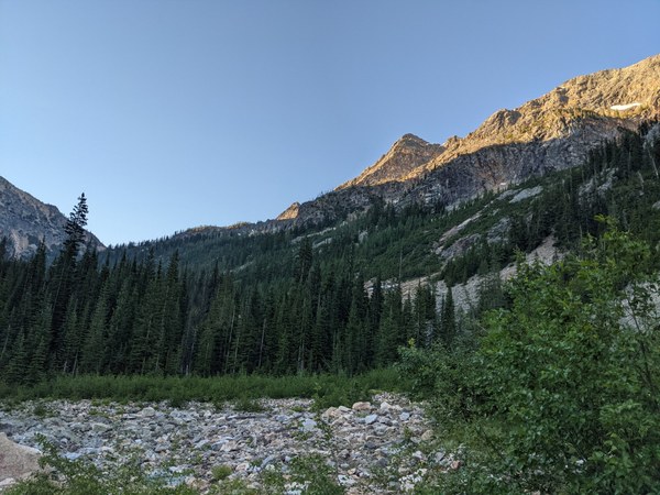
Looking up from the trailhead:
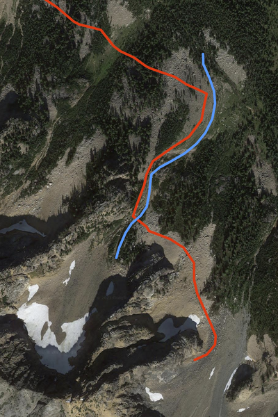
We left the trailhead at about 6:30am and took a little over half an hour to get to the point where you turn right onto the climber's trail. For some reason, we missed the climber's trail, as I got confused by a GPX track of some past ascent that kept wanting to pull us into the bushes. Wasted some time trying to reconcile this bogus GPX track with the reality. Eventually, we decided to ignore it and proceed on the path of least resistance, up the creek, and shortly thereafter, we have found patches of the climber's trail running along the creek. The intuitively obvious way to go on approach is the right way. This is shown below, with the blue line representing the creek, and the red line being the correct approach along the climber's trail.
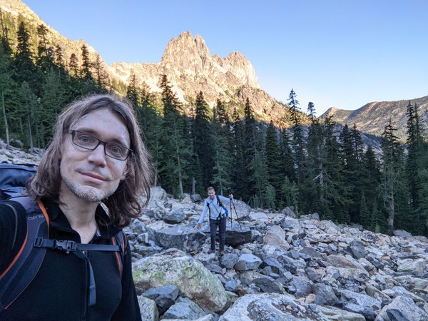
Negotiating scree on approach:
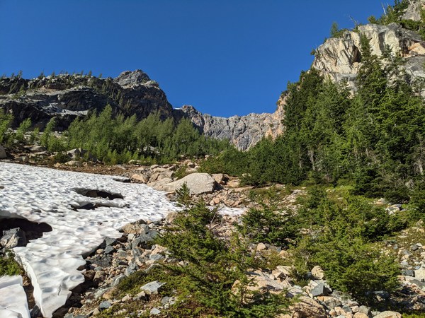
Leftover patches of snow on approach, all easy to bypass:
Bonus observation: the creek looks like one that would continue to run all summer, so don't bother carrying any water from the car, and just have a squeeze bottle with you to fill up on the final creek crossing @ 6200 to shave off a couple thousand vertical pound-feet from the pack.
While passing by the various buttresses, I saw roofs everywhere. Later in the day, all rock looked like diamond rock for some definition of diamond, and all cracks looked like someone might have thought that they were nice. In reality, the beta was not supposed to be that subtle.
Between the momentary confusion on approach and the endless piles of scree, it took us almost two hours to get to the base of the climb.
Base of the climb:
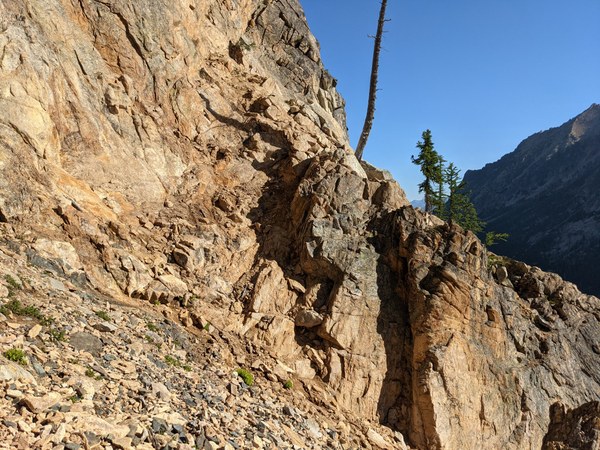
After gearing up, we were on the route shortly before 9am. We scrambled up the first easy ramp to the nearby the 20-foot snag, and we roped up there.
After reading past reports talking about simulclimbing the lower half of the route, we thought we would simul it as well and not worry too much about the exact places where belays were supposed to be. With that in mind, we brought 70m of rope, two full sets of cams, regular and offset nuts, and a pink tricam for good luck, so that we were not going to run out of gear easily.
I don't know how one simulclimbs this route, perhaps except if placing no pro. Despite extending pro with doubles, rope drag was horrendous, possibly in part due to us having pitched it out too low, not sure.
Anyway, I ended the first pitch somewhere that did not look at all like the first belay, possibly somewhere above it, at a beefy belay tree, after Steve radioed me that I only had a few meters of rope left. That in itself was not bad at all (certainly much nicer to belay from a beefy tree rather than having to construct a gear anchor), but pulling the rope from there was a major upper body workout.
I would strongly suggest to just properly pitch things out and put belays where the beta tells you to in order to avoid bad rope drag and unnecessary routefinding confusion.
On our second pitch, we got off route, quite possibly having made a mistake somewhere around the diamond rock. Did I mention all rock looked like diamond rock? We ended a full 60m or so pitch in some weird-land, at a beefy tree above another beefy tree with a rap sling on it that must have been left by someone bailing from there, and terrain features that did not match anything on the topo. In the middle of it, there was an "offwidth" crack 6 feet wide and 8-10 foot deep with overhanging walls, climbing out of which was not possible. On the right was some spicy scrambling that looked like it would require a left-ward traverse above that looked uber sketchy. Lower on the left was a ramp that led around to what looked like an uber sketchy airy catwalk above a vertical dropoff.
At that point, another climbing party caught up with us that seemed similarly confused, and did not feel like climbing either left or right.
In the end, we decided going up a crack on the lower left just at the corner. I would rate this crack at around 5.6, as at least for me, it required some layback and stemming frictiony moves to get off the ground. Otherwise, though, it was only about 2 moves and over, and from what I recall, it would have been under 10 feet in total. Above that, we found some scramble-land that eventually led us to our second belay. We have never seen anything that would qualify as a 3-inch nice crack, 5.4 cracks, a blocky rotten chimney, or a 5.4 groove feature. I regret not taking photos, and I hope that someone else eventually will.
After a second belay, more scrambling and low 5th class led to a broad ridge right below the crux of the route, where we put in a belay from a few large cams. In general, I found the #2 and #3 cams to be exceedingly useful in many places on the (off) route we followed, and we were glad to have brought doubles in these sizes. I think even carrying triples in these sizes would not have been unreasonable. On the other hand, we found nuts to have been a pure useless ballast. Cracks on this route were pretty rectangular, and any rock that inspired borderline minimum confidence took regular cams very well. If anything, don't skimp on cams in large and micro sizes, just take a full double rack. In addition to lots of #2 and #3, we also placed 0.3 in several places, and one 0.2 worked well where nothing else would fit.
Unlike most parties, we took what looked like it would be the layback variant of the crux, on the climber's right. A single 5-6 inch crack that required a committing entry right off the ground, but that offered secure feet and was basically over in about 2 moves. I would agree with the 5.6+ or so rating on this one. It looked hard at first, but I was able to feel a half-decent handhold above on the right. Grabbing that handhold and wedging the other hand in the crack makes for the initial layback move, after which another half-decent handhold can be reached to gain good feet.
Rock on this route is extremely grabby, and I think virtually all the harder moves at least for me involved smearing, more so than edging or crack climbing, especially in the runout upper sections of the route. Given the exceptional bond between the rubber and the rock, the challenges on this route felt more mental than physical.
Shortly above the crux was the third class gulley that, judging from past reports, I expected to have been filled with ball bearings and whispers of dead climbers. Expecting immense danger, I took care to put large cams where I could on the ridge leading up to it, somewhere 30 feet before the gulley itself.
Once in the gulley, I found it in a much better shape than expected. Although it was quite sandy, there were chunks of solid rock poking through the sand that offered good purchase, and two solid live trees right in the middle of the gulley, spaced some 10 feet apart, that took slings well, and offered much security. The gully was not long at all, and compared to all other challenges we have encountered later on the route, I would describe it as comparatively easy and well-protectable.
After the gulley, the topo warned us of mediocre rock and scarce 5.5 pro "place it where you can get it". I'm not sure we followed the same route at that point. The flakes we climbed could go at about 5.5, but they did seem to offer quite a few options for decent pro. We did not seem to have much trouble reaching the notch.
Right past the notch is the airy step that for whatever reason is not marked on the topo. We did find it challenging to protect, and ended up putting some pro on the ledges leading to it. The step has one decent, and one poor hand, starts with one foot on the pointy rock, and the other relying on friction on the opposing wall. I did find it quite sketchy and requiring good mental composure.
Above the airy step, we seem to have gotten off route again, possibly by overshooting the belay. We found ourselves standing below some giant downward D-shaped flakes that perhaps could have gone at 5.10 for a skilled climber, but that we did not feel capable of attempting. There was nothing on the left, and a somewhat steep and featureless traverse on the right. I tried to explore a bit of the latter, but found it too sketchy to continue.
Ended up downclimbing some 20 feet to where the rock seemed more traversable. According to the topo, there was supposed to be a triangular pointy rock somewhere in there, but despite looking really around hard, neither of us saw nothing on the sort.
For the lack of a better idea, I took the right-ward traverse, which was much longer than expected and felt very runout. Feet offered very solid friction on good rock, but there was not a lot in the way of handholds, and climbing relied on balance. After going some 50 feet to the right, I saw easy 5th class climbing above, and continued up. At that point, due to all the turns, rope drag was so extreme that it felt like hauling a 200lbs body hanging off my harness up the wall. I've eventually found myself screaming "slack" all the time, trying to get Steve to just continuously pay rope at a constant rate, since relying on rope tension at this point was basically totally impossible. I don't know how one could have done that without the benefit of radios.
Eventually, Steve radioed in that there was little rope left. Ended up making a belay contraption with two slings on a pair of adjacent giant horns, and an extended master point leading to a small ledge 10 feet below.
Regardless of whether this was on-route or off, I would agree with the 5.6 rating. Not sure what, if any, pitches on the correct route this traverse corresponded to, but it was less than half the rope from there to the summit crest where we were hit by direct sunshine, so I would guess it must have been something in the ballpark of pitch 9, combined with half of pitch 10, or thereabouts. Could have ended up the pitch sooner, as I managed to place a few large cams and sling some horns in the last 30-50 feet leading to the belay. Once again, trying to stretch the rope as much as possible was probably unnecessary, and whatever time savings it was going to offer were overshadowed by complications in building a secure belay at a suboptimal spot.
The last less than half rope led to a very spatious ledge, some 20-30 feet below the summit. On the opposite end of that ledge, on the far climber's left, there seemed to be a traveled dirt path leading down, and I wondered if it led to a descent route, although from a distance it looked like it would hit a patch of steep wall. We did not take it, though, so it shall remain a mystery until someone decides to explore it.
We resisted the unrope fever and belayed ourselves on the last very short pitch to the summit, where we took a half-hour break and switched to approach shoes. My left foot was completely numb by then after 12 pitches in TC pros.
From the summit, the descent route goes directly climber's left (relative to where we came up), onto a short slab followed by one airy down-step, after which it was all secure scramble-land. We protected that part as well, because why wouldn't you? Good cams right after the downstep for the second.
Steve coiled the rope there, while I peeled all gear off of him and started making my way down.
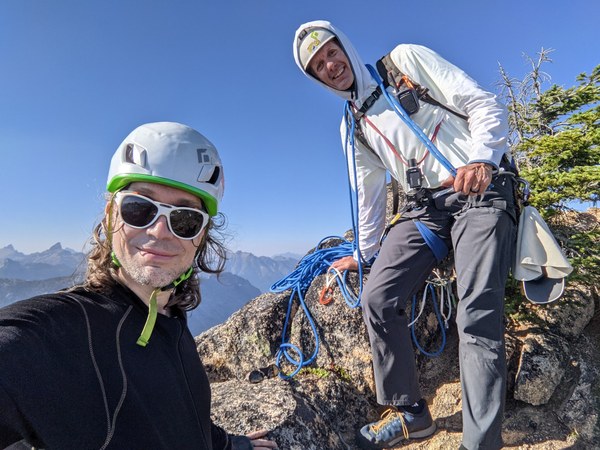
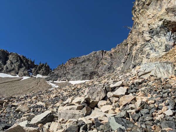
After the first half of the scree-fest, you turn left onto another scree slope that leads back to the start of the route, where we stashed some of our gear. We found the top of that second slope to be mostly covered by a patch of snow, but fortunately, leaving a gap of dirt on the skier's left that we used to end run it. Just a few weeks earlier in the season, this could have been a sketchy part to negotiate without good traction, and if in doubt, I would recommend carrying some traction and an ice ax just to be on a safe side. Trekking poles would also have made the scree fest quite a bit more enjoyable, but we did not carry any. Not knowing for sure what the route is like, I opted to go in more streamlined. In retrospect, you can climb it just fine with a regular-sized pack. There were no awkward chimneys or overhead features that would have made it a problem.
Looking down on the scree fest:
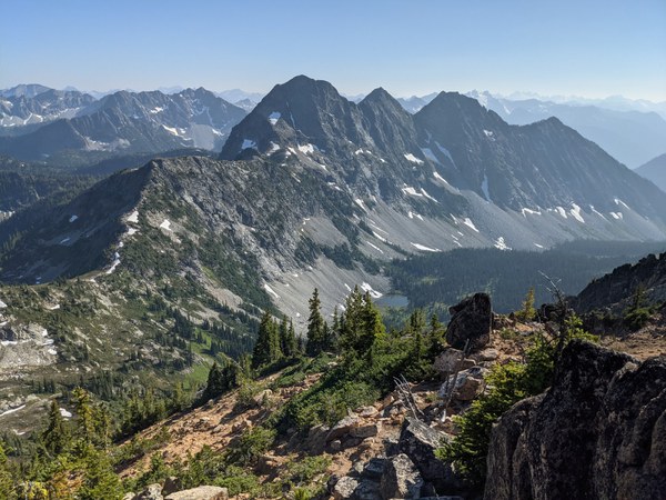
Descent route from the base of the climb:
It ended up being a long day, but we made it down well before dark, and enjoyed riding back into the sunset. Overall, we felt this was a harder and more committing climb compared to classics such as North Face of Lexington and South Face of Concord that for both of us were immediately preceding this climb (by a couple of weeks for Steve, and a couple of summers for me). I would definitely recommend this route as a way to build experience after doing a couple of other shorter Intermediate rock climbs. Not sure why it's done so rarely, but perhaps this is starting to change, since we were one of 3 parties on the route that day.
 Krzysztof Ostrowski