Trip Report
Basic Glacier Climb - Whitman Crest/Fryingpan Glacier
Glacier quite broken up, summit not attained and unlikely for other parties unless speedy and highly motivated
- Sun, Sep 17, 2023
- Basic Glacier Climb - Whitman Crest/Fryingpan Glacier
- Meany Crest
- Climbing
- Successful
- Road suitable for all vehicles
-
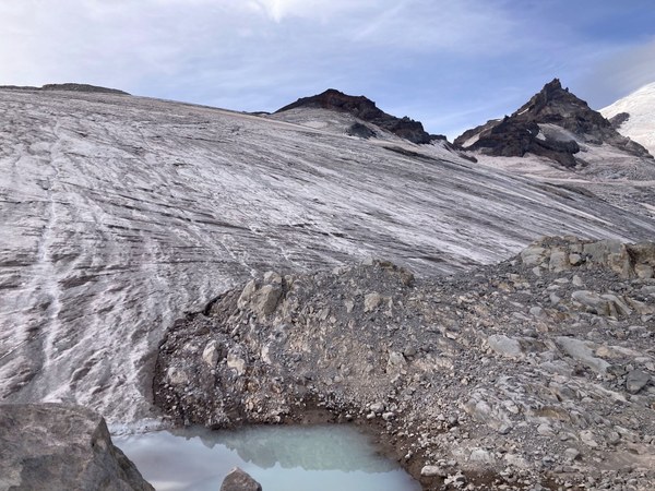
Glacier has receded to ~7,700', is mostly ice (pickets not useful, bring only ice screws for crevasse rescue), and is significantly broken up
We left the Summerland trailhead at ~5:30 and arrived at Summerland after ~2hr 15min hiking. Another 2 hours and change brought us to the saddle next to Meany Crest, and an hour after that to our rope up point at ~7,700'. After a leisurely 40min for food, roping up, etc we started up the glacier.
 Our break stop, and where we got on the glacier
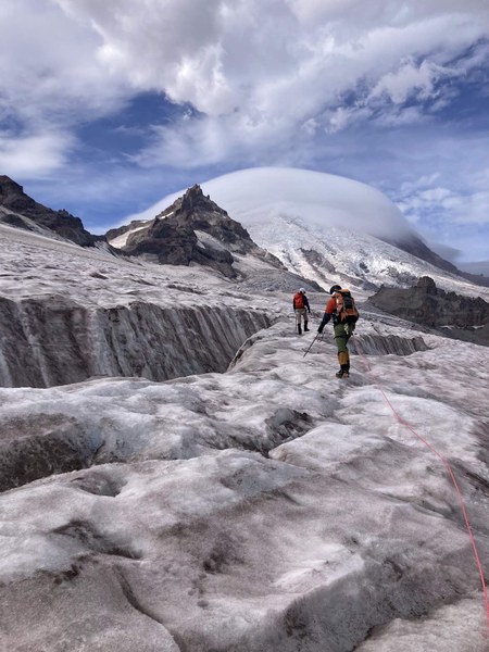
The glacier is all ice at this point, although soft enough that crampons felt very secure for walking (and the angle is fortunately low throughout). We quickly encountered bands of crevasses that spanned a substantial width of the glacier. We were able to end run the first band by heading climber's right, and thread a path through the second band after heading back a way climber's left (although this involved a step down/step up move that we decided to protect using a screw on our way back).
 Navigating the first band of crevasses
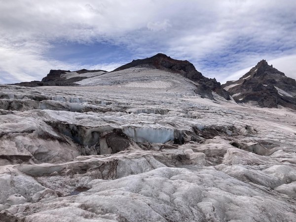
At the third band (~8,300') we decided to turn around as it was clear we would not summit based on both time and the route ahead of us. From looking ahead to the summit, it doesn't seem like one could navigate the glacier directly below. Perhaps the best bet would be to try and follow the dirt spit that goes up and to the right to the ridge - but in any case we weren't confident in a route from our last location to the dirt strip.
 View from our closest position to the summit
We spent about 1hr 20min on the way up the glacier, and 50 min on the way back as we were retracing our steps. It would take a very motivated (and fast) party to reach the summit in the glacier's current state. On the bright side, with things as melted out as they are it seems very unlikely to fall into a crevasse you don't see. Some of the crevasses, especially lower on the route you can see the bottom only 15-20 feet below.
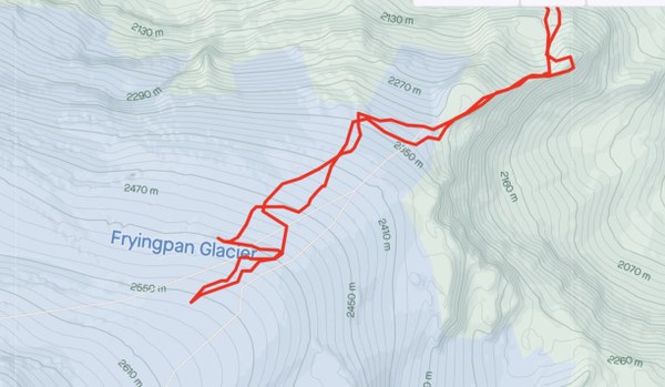
 Our route
While this was an especially early year for snow melt, it seems the trend is that this route is no longer a viable late season, last ditch glacier climb (Mark Scheffer recalled a similar turnaround in Sept 2021). All in all we were 12 hr car to car.
 Melanie Stam