Trip Report
Basic Alpine Climb - Mount Mystery/East Col
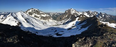
Three day alpine traverse/climb visiting Mount Fricaba, Mount Mystery, and Royal Basin. The entire trip was ~18 miles, ~8500' elevation gain with ~7 miles of off trail travel.
- Sat, Jun 4, 2016 — Mon, Jun 6, 2016
- Basic Alpine Climb - Mount Mystery/East Col
- Deception, Mystery, Fricaba & Hal Foss
- Climbing
- Successful
-

- Road suitable for all vehicles
-
Perfect conditions, but as our ford of the Dungeness was a bit spicy I'd take the earliest possible ferry next time to get there a bit earlier in the day with lower flow rates. For an ideal trip this trip needs to be early enough in the year (with snow allowing an easier ascent of Mystery from its E col), yet late enough in the season so lower River levels allow an easier ford. I think this trip was the perfect time.
Perfect weather for wonderful 3 day traverse over June 4-6, 2016. My photos can be seen here.
Everyone felt our ford of the Dungeness River at elevation ~3240' (at 1pm) was a bit on the spicy side with its gauging station near Sequim reporting ~670 ft³/sec at the time of our crossing (discovered retroactively). We ascended an excellent game trail through open mature forest (with greatly appreciated shade) on the ridge just north of the avalanche track that is below and due east of Pt 6138. There is even access to a stream running down the avalanche track at ~4400'. We encountered open terrain at the broad bench at ~5600' before continuing up the ridge past Point 6138. The ridge above this area has a few spots with solid scrambling (at the end of a long day with overnight packs), so parties are advised to use a moderate pace throughout the day and to camp at the broad flat spot on the ridge at ~6440' (NE of Mt Fricaba). We reached camp at 7:30pm. We completed our ascent of Fricaba the following morning, then descended ~500' on its SW ridge before descending to our next night's camp at ~5800' in Deception Basin.
After dropping our overnight gear we reached the east col of Mystery at 11am to begin our ascent. Snow conditions were perfect and we did not use crampons. This section of the climb involves steep snow with cliffs below the entire time. Due to the bad runout we traveled as two 40 meter rope teams using 6 pickets, with pickets placed every 20 meters until reaching rock just below the summit ridge (on both ascent and descent). Our ascent from the east col ascended a steep section of snow (~40-50 degrees ) before traversing to the north at ~7000', then turned upwards to reach the final snow finger (~50-60 degrees). This final snow finger is obscured by a large towering rock (that we passed on the north) and this rock has a large blocky ledge on its west/uphill side that facilitates the ascent of the final snow finger. From the top of this last snow finger there is a short section of easy scrambling (on very rotten rock) to reach the summit ridge. All members of the party should ascend the snow finger before starting this 'one at a time' scramble, as any rocks knocked loose are channeled directly down the finger. After dropping down a short distance on the west side of Mystery, traverse north a short distance to pass through a notch, then scramble up a short distance to the summit. The roped climbing was 5 hours up and 4 hours down. A photo of the final snow finger can be seen here. A photo of the roped portion of the route can be seen here.
On our third day we slept in and had a very leisurely breakfast before using the standard route to reach Royal Basin and the trail back to our cars on the Dungeness River. We left our camp in Deception Basin at 10am and reached the cars at 4pm. Photos of the entire trip can be seen here. A summit video can be seen here.
 Dave Morgan
 admin
admin