Trip Report
Basic Alpine Climb - Mount Logan/Banded Glacier
Successful 3 day climb of Mount Logan.
- Fri, Jul 6, 2018 — Sun, Jul 8, 2018
- Basic Alpine Climb - Mount Logan/Banded Glacier
- Mount Logan/Banded Glacier
- Climbing
- Successful
-

- Road suitable for all vehicles
-
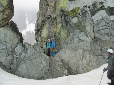
We crossed rocks and snow fields to Christmas Tree Col without any difficulties. The gully down from Christmas Tree col is very loose and steep. We took considerable time to pick our way down and not cause undue rockfall. The lake at the base of the Banded Glacier is substantially larger than shown on the USGS map – it extends up to at least 7200ft. We picked our way around the NE side of the lake on snow and scree.
Climbing the Banded Glacier we stayed to the far left between a rock band and glacier ice feature and then turned right at the top and traversed above most of the crevasses. We climbed the final section to the Banded-Douglas Col on a snow section between crevasses on the right and large separations from the rock on the left.
From the Col we followed the snow finger to the rock band and then scrambled to the summit.
We descended the climbing route. Climbing the gully at Christmas Tree Col was the biggest challenge in order to avoid party-induced rockfall.
Time: 2h30m camp to Christmas Tree Col; 4h Christmas Tree Col to Banded-Douglas Col; 1h10m B-D Col to Summit; descent: 6h to camp.
General Activity Notes:
This route is recommended for strong parties. The trip was done over three long days.
Approach conditions:
Easy Pass Trail was easy to follow and relatively snow-free, with some snow sections on the final switchbacks up to Easy Pass.
Fisher Creek Trail is a spectacular trail, with impressive, seldom seen views, especially on the descent from Easy Pass.
The bushwhack from Fisher Creek Trail to the unnamed lake at 5160 was vastly understated in the route description. This was the most distasteful section of the entire trip. There is no climber’s trail to follow – this is a pure bushwhack up a relatively steep, wooded and bushy slope. Our approach was especially difficult due to a thunderstorm that blew in as we were about 600 vertical feet from the top. The area around the unnamed lake at 5160 was extremely boggy – very wet. There was no easy way to cross the stream that flows just before the lake – we basically had to wade across. We were able to camp on rocks at the SE end of the lake.
On the return descent from Easy Pass we descended the snowfields on skier’s right, rather than taking the trail with the switchbacks.
Time: 2h40m TH to Easy Pass; 3h45m Easy Pass to bushwhack section; 2h15m to lake. Return: 10h from camp to TH.
Permits required?
NW Forest Pass.
North Cascades National Park camping permit (Logan XC zone)
Driving / parking notes:
Parking lot at Easy Pass Trailhead is relatively small but there was adequate parking for our team.
Equipment notes:
Carried and used helmets, crampons, glacier rescue gear and 30m ropes.
Carried but did not use pickets, small rack of rock pro.
Required Skills:
Glacier climbing and scrambling skills, especially scree-filled gullies.
Weather Notes:
Day 1: mostly overcast, with some sun breaks. Late afternoon thunderstorm. Intermittent rain showers most of the night.
Day 2: mostly overcast, becoming afternoon broken clouds.
Day 3: mostly sunny and clear.
Flora and Fauna:
Sighted a bear at the unnamed lake 5160.
Mountain goats with kid at the foot of the Banded Glacier.
 Curtis Stock