Trip Report
Alpine Scramble - Pitcher Mountain
A scramble to one of the worst Rainier 100 peaks with a great view from the top.
- Sat, Oct 3, 2020
- Alpine Scramble - Pitcher Mountain
- Pitcher Mountain
- Scrambling
- Successful
-

- Road recommended for high clearance only
-
Forest Road 7710 and 7720 are in pretty bad shape. A high clearance vehicle will have no problems.
There is no official route or trail to the top of Pitcher. You leave the road and find the best way possible.
The approach to Pitcher is fairly steep and slick even when it is dry out. Poles are very helpful but an ice ax is probably a better choice.
We assembled a very experienced group of Mountaineers to scramble the other worst Rainier 100 peak, Pigeon. With the continuing closure of 410 and a great weekend we couldn't waste we decided to relocate this scramble to another contender for worst Rainier 100 peak, Pitcher mountain.
For those that don't know Pitcher mountain is located just outside of the Northwest boundary of Mt. Rainier National Park. It is approached from forest road 7710 and then forest road 7720. These forest roads are not in the best of shape. They have deep potholes in some sections and large rocks sticking up into the road in other sections. Sometimes these are combined for a stretch. Forest road 7720 for some sections is limited to a single lane. For the approach to Pitcher mountain you will find a camping spot just off the left side of the road before the hairpin turn that leads to the summit lake trail head. This spot has room for around three vehicles to be parked well off the road.
From our parking area we walked up the road to the hairpin turn looking for our takeoff point to Pitcher mountain. Supposedly there is an old road that you can take that will get you most of the way to the meadow but we did not see any signs of it. What we did see was that someone had placed ribbons in the trees about every ten feet or so heading in the direction we needed to head so we decided to follow them. Since there was no sign of a trail we started brush bashing as soon as we stepped off the road. Following the trail of ribbon through the woods quickly lead us to a rocky outcropping. At this point we consulted our maps and decided that our best course of action was to get on top of this outcropping and work the ridge to the meadow under Pitcher mountain. We were reassured that we must have made the correct choice because we once again saw ribbon marking the way we were heading. If we had any doubts about the reports of how bad of a brush bash we were in for they were quickly put to rest. By this point we had only been off the road for around five minutes and we were getting hot however none of us wanted to take a layer off due to the amount of brush we were pushing through. At this time we decided leather gloves would be a great idea.
The first rock outcropping, we went climbers right and up it. Better path would be go left and descend under it.
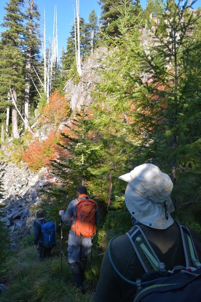
Once we gained the ridge we were happy to find a more open forest. From this point we took a bearing to where we wanted to go and headed off. Initially we made great progress but we found as we followed our bearing towards the meadow we were descending into a creek/stream area. As we got closer to the creek the brush got much denser and wetter. Once again we consulted as a group and decided to head back up the ridge and find a different route to the meadow. This proved to be a good choice because we quickly came out into a meadow and got our first view of our goal.
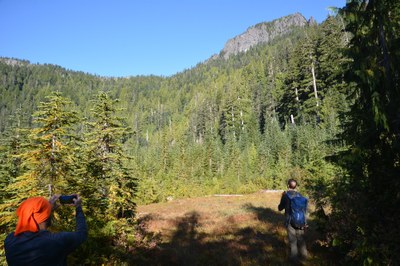
Our first view of Pitcher, we followed the slope climbers right around to our approach gully.
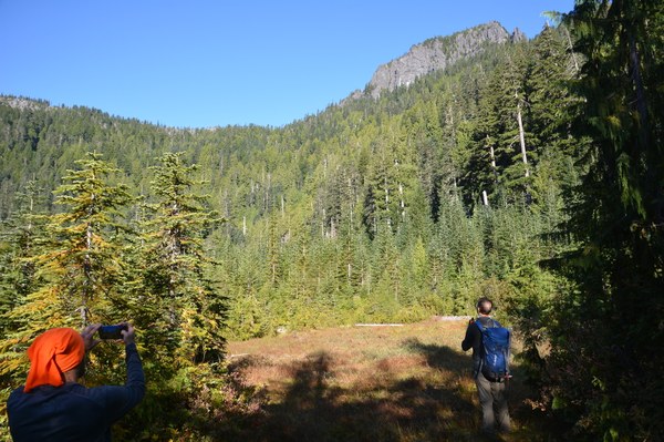
Upon looking around this meadow we figured out that to reach our goal we would have to move straight ahead or slightly left to get to our approach gully to the saddle. After a quick look around we all decided that the forest in either of those directions was way to thick to attempt to move through. Instead we decided to head climbers right up the side of the basin and use it to work our way above and around the meadow to our approach gully. This worked out very well once we found a game trail going in that direction.
Once we reached the forest on the opposite side of the meadow we started our ascent. From this point on the going gets very steep. There are lots of vegi belays and trees that you can use to help but I found having and using my Ice Ax to be extremely beneficial. The going was much slower than I anticipated mainly due to the steepness of the slope and how slick it was in places. Our goal was not to reach the exact saddle but to come out just to the East of it. At this point we heard there was an easy gully that we could use to gain the ridge. We managed to find the gully which proved to be an easy route to gain the final ridge run to Pitcher. By this point the brush bashing was minimal but the terrain was still steep and slick.
The gully to gain the ridge to Pitcher as viewed from below.
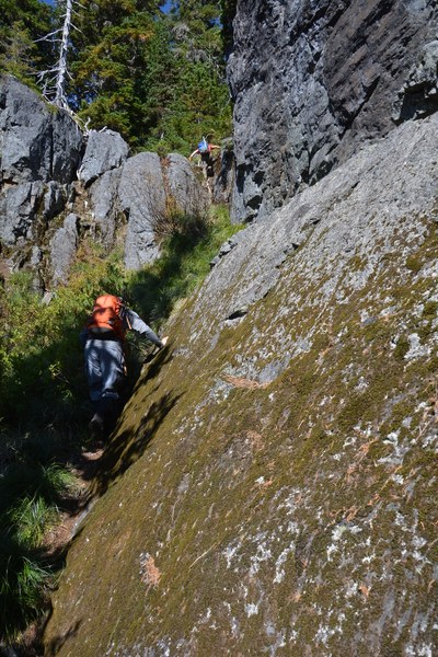
Ascent gully from above
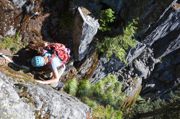
From this point on it was a steep walk to the summit of Pitcher where we had great views of the area. On this day we could easily see Stuart, Rainier, and St. Helens. After a nice lunch break and picture taking we decided to head down. For our route down we pretty much stayed in the same vicinity as our ascent route choosing the best terrain to descend on. Our goal was to reach the meadow below us again. Once we reached it we sighted the remains of the cabin that we heard was in the meadow. We decided to head in its direction to check it out as well as explore an alternative route back to the car. This section of the meadow was very brushy as well as marshy. For the most part we could move through it without to much difficulty but you had to watch your footing as well as for downed trees hidden in the brush. Once we passed the cabin we discovered a boot path or game trail heading in the direction we needed to go. This lead us back into the forest which much to our surprise was not to overgrown. From this point on we made fairly good time. As we proceeded through the woods we once again found ribbons marking a very well defined path heading in the direction we needed to go. Once on this path it took us below the rock outcropping we initially decided to go up and over. Thinking this path must go somewhere good we decided to stay on it past the rock out cropping. Much to our disappointment it once again disappeared leaving us in thick brush. We initially attempted to bash around the brush looking for a continuance of the path but quickly decided that it would be much more effective to work in the direction that we knew the road and our vehicles were at. After around five minutes of this we covered the final hundred yards and emerged from the forest right where we parked our vehicles.
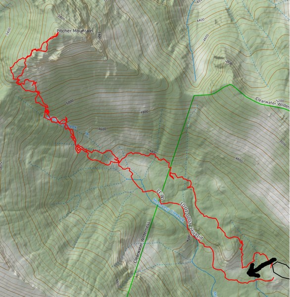
Total distance right around 4 miles with around 2,100 feet of elevation gain.
Total time to do this trip was just under eight hours with numerous breaks for food and navigation.
Today's route. Arrow pointing to exit route that would work much better for an approach route. Hairpin turn of FR7020 lower right.
 Jerrick Linde