Trip Report
Alpine Scramble - Mount Wow (Goat Creek Direct)
Memorial Day scramble up Mt. Wow from Goat Creek directly up a WSW ridge. We did not traverse south over to the Boundary Trail.
- Mon, May 27, 2019
- Alpine Scramble - Mount Wow
- Mount Wow
- Scrambling
- Successful
-

- Road recommended for high clearance only
-
Road 59 from SR 702 is in pretty good shape, however road 037 to the Goat Creek trailhead is rough as a lot of large puddles. Our three Suburu's made it, but a Honda Fit or Toyota Prius may not make it.
We went from Goat Creek directly up the WSW ridge and did not travel south to Boundary Trail. To see the GPS track, please go here: https://www.gaiagps.com/public/CTmik2ewL67gB12Bf2YrImSk
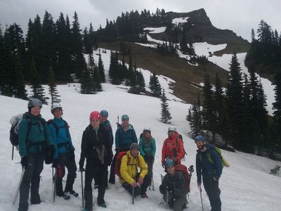
Led an 11 person Mountaineers group. We had 3 scramble students. The weather was cloudy but mild. There was no snow until above 5,700 feet. Instead of taking the Boundary Trail from the park entrance or Goat Creek to the Boundary Trail, we went straight up an ENE heading all the way up to about 5,600 feet where there is a small summit and then on the backside of the summit is the final traverse up to Mt. Wow itself. Unfortunately, it was pretty cloudy so we did not have those "wow" views. The "direct route" has a lot of devil's club and other brush for the first 300 feet of elevation gain from the creek, but we ascended, there was little brush and we just had to ascend about 2,000 feet of rather steep hill side. Around 5,300 feet, the forest opens up and we were ascending a heather field. After a lunch break, we came back down more or less the same route all the way down to Goat Creek. The ground was soft so a number of us used microspikes the whole way down. We ended up at the creek a little north of where we should have been so we did have to find a creek crossing before heading back to the cars. Overall, fun trip. We were up in four hours. Also down in just under four hours due to a routefinding issue at Goat Creek.
 Paul Kallmann