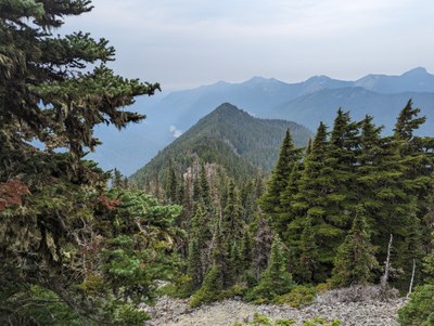
Tirzah & Wallace Peaks
Two challenging, short scrambles on the north side of the Carbon River and two of the "100 Highest" in Mount Rainier National Park. They can be scrambled individually or together, out-and-back or in a loop. There are not many views, but a side trip to Chenuis Falls is a worthy addition to your trip.
Emergency closure
As of April 14, 2025, the Fairfax bridge at milepost 11.5 has been closed until further notice. This closes access to Mount Rainier National Park's Mowich Lake and Carbon River entrances. Check WSDOT.com for status.
getting there
From Buckley drive SR-165 through Wilkeson and Carbonado to its end following signs to the Carbon River Ranger Station.
approach & ascent
Tirzah Peak (5,208 ft)
5 miles round trip, 3,500 feet of elevation gain, difficulty: Strenuous 3, Technical 4
Hike or bike the Carbon River Trail from Carbon River Entrance 3.6 miles and 410 feet of elevation gain, to the Chenuis Falls Trailhead (stow bikes here). Cross the Carbon River and follow the trail 0.9 mile, gaining 660 feet of elevation, past Chenuis Falls until reaching ~2,800 ft at the park boundary (this is incorrectly shown on USGS map). Leave the trail and begin a very steep 1.2 mile climb, gaining 2,390 feet of elevation to the summit. Head south to a gentle ridge at ~3,200 ft. Follow the ridge uphill through old-growth forest. The gently rounded ridge becomes more apparent through the ascent. As the ridge steepens, stay to the left to follow the best terrain. There are many rock outcroppings. Most are easy to navigate. The first is at ~4,000 ft. The next one at ~4,500 ft is best passed on the left to locate a distinct notch. There’s another notch at ~4,700 ft which appears on the USGS topo map. Finally, there’s a gully near the summit at ~4,850 ft. Tirzah Peak is a small rock pile surrounded by trees with minimal views. When descending, be sure to take the correct ridge at ~4,800 ft.
Wallace Peak (5,760 ft)
12.5 miles round trip, 4,300 feet of elevation gain, Difficulty: strenuous 3, Technical 3
Hike or bike the Carbon River Trail from Carbon River Entrance 4.9 miles and 630 feet of elevation gain, to Ipsut Creek Campground (stow bike). Continue hiking 2.4 miles, gaining 600 feet of elevation, while intersecting the Wonderland Trail east, crossing the Carbon River at the Lower Crossing, then reaching a junction with the Northern Loop Trail. Turn left and hike the Northern Loop Trail 1.7 miles, gaining 1,740 feet of elevation in a series of switchbacks. Leave the trail at 4,600 ft and head north on a rising traverse to the saddle west of Chenuis Lakes. Follow the ridge from the saddle northwest to Wallace Peak. Near the summit block, avoid Class 5 climbing by traversing left around the peak. Locate the southwest ridge and scramble ~100 feet to the summit. The off-trail ascent from the Northern Loop Trail gains 1,200 feet of elevation.
Tirzah & Wallace Peaks Loop
19 miles round trip, 4,000 feet of elevation gain, difficulty: Strenuous 5, Technical 4
The loop can be done in either direction by connecting the 1.1 mi ridge between the two peaks. Consideration should be given to steepness of the west side of Tirzah Peak. It may be preferable to ascend this terrain, but check the status of the Carbon River Lower Crossing before committing. The ridge from Tirzah Peak to Wallace Peak descends 260 feet and ascends 840 feet. Probe left or right of rock outcroppings along the ridge as necessary to follow best terrain. A large talus and boulder field is at the east end of the ridge, where you might consider approaching Wallace Peak from the northwest to a small saddle before descending to the southwest ridge and scrambling ~100 feet to the summit. If going counterclockwise, consider stowing bike at the Chenuis Falls Trailhead and hiking to Ipsut Campground.
- Suitable Activities: Scrambling
- Seasons: July, August, September
- Weather: View weather forecast
- Difficulty: Strenuous 3, Technical 4
- Length: 5.0 mi
- Elevation Gain: 3,500 ft
- 5,208 ft
- Land Manager: Mount Rainier National Park
- Parking Permit Required: National Park Entrance Fee
- Recommended Party Size: 12
- Maximum Party Size: 12
- Maximum Route/Place Capacity: 12
- USGS Mowich Lake
- Green Trails Mt Rainier West No. 269
- USGS Mt Rainier West
- Green Trails Mount Rainier Wonderland No. 269SX
This is a list of titles that represent the variations of trips you can take at this route/place. This includes side trips, extensions and peak combinations. Not seeing a title that fits your trip? Log in and send us updates, images, or resources.
- Tirzah Peak
- Wallace Peak
- Tirzah & Wallace Peaks Loop
There are no resources for this route/place. Log in and send us updates, images, or resources.
