
San Juan Islands from Anacortes
Paddle directly from Anacortes into the islands, or wheel your sea kayak or drive onto the ferry to reach launch points on one of the islands. Trips vary in difficulty and length depending on the launch point and islands visited.
launch Points
- Washington Park. Use the day use area adjacent to the parking lot and boat launch. Then move your car to a day use parking area up the road or in Lot A to allow others to access this prime day use location by the water. Please do not park in the parking lot of, or launch from the boat launch. If the day use area next to the ramp is busy, park and launch from Lot A, a slightly longer carry.
- Skyline Marina
- Guemes Ferry Dock
- Note that launching and landing is prohibited at the Anacortes San Juan ferry terminal.
- See San Juan Islands & Lummi Island from Gooseberry Point and Padilla Bay & Nearby Islands for other nearby launch points into the islands.
- See info below for taking a ferry to launch points on the islands.
on the water
- Paddling from Washington Park
- Wheeling Kayaks onto the Ferry to Reach Island Launch Points
- Driving onto the Ferry to Reach Island Launch Points
- San Juan Islands Paddling Destinations
paddling from Washington Park
- Currents can be strong and turbulent in Rosario Strait, where Guemes Channel, Bellingham Channel and Thatcher Pass all converge, especially during ebb tide. Significant wind waves can also build in this exposed area. Crossings should be made only when strong winds and fog are not a threat.
- Commercial ships and pleasure boats ply the shipping channel and surrounding waters. VHF radios should be used to monitor traffic. Consider coordinating your crossing with Vessel Traffic Service.
washingtoN park to JAMES island
7.5 nm round trip, Difficulty: Sea Kayak III+
Sea kayak 3.5 miles across Rosario Strait, with potential exposure to strong tidal currents, turbulence, wind and boat traffic. Then relax for an overnight camp on pleasant James Island Marine State Park. The park has three clusters of campsites, two for general boating use and one Cascadia Marine Trail cluster of three sites on a hill above the west cove. There is no potable water available on the island, but there are plenty of aggressive raccoons to keep you company and steal your food. Enjoy white sand beaches and forested trails.
Washington Park to Cornet Bay
Difficulty: Sea Kayak III+
Sea kayak from Washington Park in Anacortes to Cornet Bay with a car shuttle between them.
Washington Park to Friday Harbor
22 nm round trip, Difficulty: Sea Kayak IV
A classic one-way trip representing a serious test of paddling skills, navigation, tide and current planning, weather prediction, and risk assessment. Paddle across Rosario Strait with a heading to compensate for the current. Depending on the route planned, cross the strait as far north as Belle Rocks or as far south as Boulder Island. If seas are already standing up crossing Rosario Strait, expect five-foot breaking waves at Belle Rocks. Destinations further south will have far less chaos. Lesser tide rips exist at Bird Rocks and Kellett Ledge. There is a rest beach at Watmough Head. From there the classic route proceeds around the south end of Lopez Island with shelter and rest points in a series of small bays. Expect a counter current on this stretch even while the adjacent currents indicate ebb. On the north side of Iceberg Point on the southwest end of Lopez eat lunch and wait for the flood to build. It is possible to climb a steep trail to a stunning overlook. From Iceberg Point one can traverse cattle pass and find turbulent water by Whale Rocks or play in the standing waves off Davis Point. Conditions are far calmer on the east side of Deadman's Island. After kayaking through Cattle Pass, ride the current to Turn Island and on into Friday Harbor. Rosario Strait and Cattle Pass both have the potential to be very rough and, at or near maximum flood on big tides swings, even form whirlpools. A swell coming from the southwest will produce breaking waves along the south end of Lopez. The traditional return trip uses wheels to roll onto the ferry and return (free) to Anacortes. It is only a 1.5-mile walk from the Anacortes ferry terminal back to Washington Park, or stage one car at the Anacortes ferry terminal (fee) and shuttle back.
Burrows & Allan Islands
Difficulty: Sea Kayak III
Sea kayak in a "Figure 8" around these two islands. Currents are an interesting feature of this trip. The trip can be done in any current cycle, and because it’s a “Figure 8,” the currents will be against you at some point. Use eddies to make progress. This is great practice in paying attention to the local conditions. Currents are strongest in a flood. A clean 3-4 kt eddy line develops at the northeast corner of Burrows island on a strong flood. There are two landing points for breaks. First is the marine trail camp side on the east end of Burrows. On the west side of Burrows you can land in the small cove just north of the light house and walk up to the light house. This is a great place for practice in wind and waves. In a strong southerly blow you can launch from the protected beach south side of Anacortes and paddle in the lee of Burrows up to the light house where you can then make short forays into the seas coming in from the straight.
Cypress & Strawberry Islands
8 nm round trip, Difficulty: Sea Kayak III
Large fetches from more than one direction make the 8+ nm round trip from Anacortes to Cypress and Strawberry Islands make this a moderately difficult paddle. Pelican Beach managed by the Cypress Island Natural Conservation Resource Area is a great place to land and camp on Cypress Island. It is open for camping year-round and offers access to a network of trails. The ascent to Eagle Cliffs on the north side of the island offers spectacular views. It is closed February 1 through July 15 to protect critical habitat. The WWTA (Washington Water Trails Association) campsite on Cypress Island is at Cypress Head.
Strawberry Island is a small, 11-acre island located in Rosario Strait just off Strawberry Bay on the west side of Cypress Island in the eastern San Juan's. It is managed by the Cypress Island Natural Conservation Resource Area for day use only as part of the Cascade Marine Trail System.
Doe Island
23 nm round trip, Difficulty: Sea Kayak IV
Paddle from Washington Park near Anacortes crossing Guemes Channel to Strawberry Island. Then cross Rosario Strait to camp on Doe Island. Launch early the next day for Lawrence Point. Cross Rosario Strait and paddle south through the Bellingham Channel, and then cross Guemes Channel to return to Washington Park.
Turn & Doe Islands
43nm Round Trip, Difficulty: Sea Kayak IV
This route combines two classic San Juan trips and camping on two beautiful islands to make a two island classic trip. Day 1: Washington Park to Turn Island. See Washington Park to Friday Harbor (above) for details. Day 2: Turn Island to Doe Island. Catch the afternoon flood for an easy ride through Upright Channel and Peavine Pass to Doe Island. Day 3: Catch the morning ebb to return to Washington park. See Doe Island (above) for details. This trip works best on days with morning ebb and afternoon flood currents.
Vendovi Island
6 nm round trip, Difficulty: Sea Kayak III
Vendovi Island was acquired by San Juan Preservation Trust in 2010 and is now open to public. It is east of Sinclair Island, west of Bellingham, and between Guemes and Lummi Islands. A hiking trail system provides a great way to wait out a current direction change.
WHEELING KAYAKS ONTO the FERRY TO REACH ISLAND LAUNCH POINTS
Purchase tickets for yourself and your kayak at the Anacortes Ferry terminal. Tickets are required outbound only. Queue up 20 minutes before departure in the bicycle queuing area. Parking, fairly cheap in the winter, is expensive in summer. You may wish to do a car shuttle and park most of the cars at Washington Park which is much less expensive.
FRIDAY HARBOR
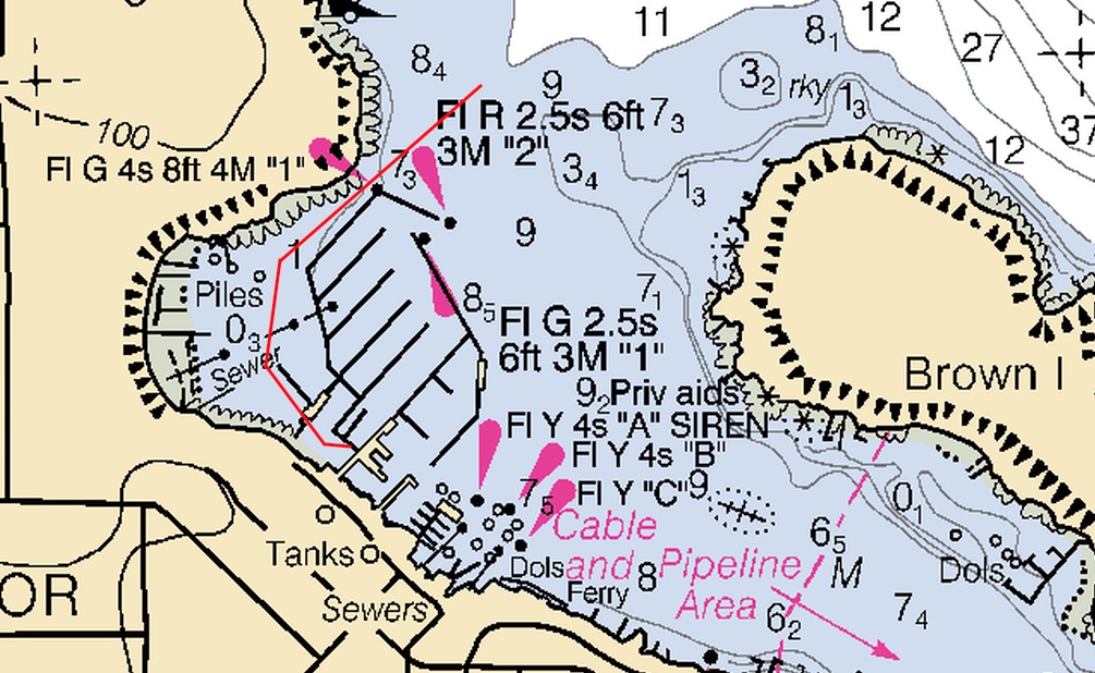
This is an ideal for sea kayak access to many of the San Juan Islands. After exiting the ferry ramp, carefully use the road and sidewalk system to proceed to the sea kayak launch dock at the harbor. Avoid other docks encountered first because launching from them is prohibited. Pass through a pocket park with covered picnic tables on the cliffside water edge just before reaching the pier. Check in with the harbormaster and pay the launch fee ($6 per kayak in 2020). When descending from pier to dock, the ramp is steep at low tide levels and a fully loaded sea kayak requires two people to prevent catastrophe. The “kayak dock” where you launch, just at the bottom-left of the ramp, is not numbered, but is next to slip number one.  “Kayak Dock” is a misnomer—it is there for kayak use but is still at traditional dock level rather than low to the water. Because a fully-loaded sea kayak can be damaged if it is slipped it over the edge, there are two alternatives. (1) Load the heavier materials into the floating kayak by reaching over and stuffing the hatches, or (2) leave most of the gear at a small beach under the Spring Street Landing building (passed on the way there from the ferry, see photo at right), then paddle over from the dock and load. Doing so also avoids a bottleneck at the kayak dock.
There may be an opportunity to store your kayak wheels with the harbormaster. In winter, there is an unstaffed kiosk at the top of the pier. In summer, you can bring your own locking cable and string it through the wheels and lock up to the bicycle rack behind their building. In either case, it is important to check with the Harbormaster at (360) 378-2688.
Restaurants and grocery stores are within walking distance. Water and restrooms available at the harbormaster’s building.
ORCAS ISLAND
This is a good location for access to Wasp Passage, Jones Island, and even the northern San Juan Islands.
After wheeling off the ferry, turn left to take your kayak down to the dock. This dock is high off the water making loading and launching difficult. There is no beach to load a floating kayak; you must do so from the dock. When considering a launch (for day or overnight paddling) from the Orcas boat dock please consider the following:
- The ramp down to the dock can be steep at times depending on the tide level.
- The ramp is narrow and has at least one 90 degree turn that cannot accommodate a sea kayak without lifting it over the height of the railings. Lifting a loaded kayak is difficult and potentially dangerous.
- The drop between the dock and kayak/water level is greater than 18-24”.
- A past incident report indicates that the docks are floating and subject to movement from wind, waves and ferry traffic, that pilings on one side of the dock present a hazard, and that the two docks can have potentially dangerous spaces between them with movement where someone could slip between them and injure themselves, and or damage equipment.
Potable water is available from a hose tap on the building corner by the ramp. A restaurant is adjacent to the terminal.
SHAW ISLAND
There is no beach access unless you are willing to wheel your boat 1.7 nm to the boat ramp near the county park.
LOPEZ ISLAND
There is no beach access.
DRIVING ONTO the FERRY TO REACH ISLAND LAUNCH POINTS
There are many places to launch—only a few are mentioned here.
SAN JUAN ISLAND
Friday Harbor has mostly 2-hour parking. Check with the Visitor Information Center or Police Department for longer terms. The same applies to Roche Harbor.
ORCAS ISLAND
This is a good location for access to Wasp Passage, Jones Island, and even the northern San Juan Islands.
After wheeling off the ferry, turn left to take your kayak down to the dock. This dock is high off the water making loading and launching difficult. There is no beach to load a floating kayak; you must do so from the dock. When considering a launch (for day or overnight paddling) from the Orcas boat dock please consider the following:
- The ramp down to the dock can be steep at times depending on the tide level.
- The ramp is narrow and has at least one 90 degree turn that cannot accommodate a sea kayak without lifting it over the height of the railings. Lifting a loaded kayak is difficult and potentially dangerous.
- The drop between the dock and kayak/water level is greater than 18-24”.
- A past incident report indicates that the docks are floating and subject to movement from wind, waves and ferry traffic, that pilings on one side of the dock present a hazard, and that the two docks can have potentially dangerous spaces between them with movement where someone could slip between them and injure themselves, and or damage equipment.
Potable water is available from a hose tap on the building corner by the ramp. A restaurant is adjacent to the terminal.
SHAW ISLAND
Shaw County Park offers reservation camping and a kayak can be launched from there. Also called “South Point."
LOPEZ ISLAND
Odlin County Park and Spencer Spit State Park have camping and sea kayak launching facilities. There is no launch from the ferry terminal area on Lopez Island.
SAN JUAN ISLANDS PADDLING DESTINATIONS
Jones Island
Difficulty: Sea Kayak III
From Friday Harbor, paddle 6 nm, crossing San Juan Channel and through the Wasp Islands to Jones Island for an overnight camp. Next day paddle back to Friday Harbor and catch the ferry back to Anacortes. There is potable water available in the summer. Jones Island is renowned for its “commando racoons," so secure your food tightly. The Water Trails site is in high demand but other sites are available. The grassy slope on the south end of the island offers nearly unlimited camping space.
YELLOW ISLAND
Difficulty: Sea Kayak III
A preserve owned by the Nature Conservancy. There are strict rules about group size and no eating is allowed on land. This island is best visited in April when the yellow and other wildflowers explode with color. It is often visited with trips to Jones Island.
POSEY ISLAND
Difficulty: Varies based on the starting point.
Posey Island is one of only two islands in the WWTA (Washington Water Trails Association) system that require reservations—it books quickly in summer. It is a Washington State Marine Park campsite, a good stopover while awaiting a current direction change, and is easily accessed from Roche Harbor.
SAN JUAN ISLAND CIRCUMNAVIGATION
Difficulty: Sea Kayak IV
A challenging, 37-nm sea kayaking trip, typically starting at Friday Harbor and lasting four days and three nights with travel to and from Anacortes included. There are two crux sections. The first crux is the 14-nm paddle between the Griffin Bay and San Juan Island County Park campsites, including 11 nm of exposed coastline. Plan for currents, especially in Cattle Pass. The coast is exposed and often rocky. There are some partially protected beaches but they are rocky and may have moderate breaking waves. There are landing sites but they require some skill. The second crux section is between Friday Harbor and Posey Island. Here a complication occurs between Spieden Channel and San Juan Channel. Currents in these two channels flow in the opposing direction so rounding the corner means one current or the other will be against you. Solve this by transiting at slack or adding a stop at Reuben Tarte Park. Overnight on Jones Island is also a god solution. For details see the this October 2020 trip report.
SUCIA ISLAND
Difficulty: Sea Kayak III/IV
An island that has mesmerizing geography along its southwest coast and an exploding abundance of sea life along its north coast walls. It can be a busy place in summer with hundreds of boats moored in the harbors and tourists filling the campsites. There is no Water Trails campsite that is reserved just for sea kayakers. Visit the Sucia Island Marine State Park web page for a map of the campsites. The ten miles of hiking trails offer a great supplemental activity and you may well see river otters waddling up the banks. A circumnavigation of the island is a good day trip. Parker Reef is a notable hazard on the crossing from Orcas—it is best to avoid this reef when current is flowing.
PATOS ISLAND
Difficulty: Sea Kayak III/IV
Normally accessed via sea kayak from Sucia Island, Patos Island is a wonderful respite from the crowds of Sucia Island. Currents can be chaotic between the two islands, so consider crossing when they are not strong. There is limited boat moorage which constrains the number of visitors at this state marine park. There is a reasonable amount of camping with spectacular views on the southwest corner of the island. The current can be strong in the channel with Little Patos so you may have to enter from the opposite channel end. A one-two hour hike takes you to the lighthouse and around the island. There is no potable water.
MATIA ISLAND
Difficulty: Sea Kayak III/IV
Matia Island Marine State Park is renowned for being buggy and somewhat dark, because of its heavy forested. Sea kayakers normally visit as a day trip, but camping is allowed. There is hiking on the island. No potable is water available. There is a good rest spot on the eastern shore of the island, facing Puffin Island.
CLARK ISLAND
Difficulty: Sea Kayak III/IV
Clark Island Marine State Park can be accessed by sea kayak from Gooseberry Point near Bellingham or from Washington Park with strong currents. Camping is along the eastern shore and spaces are often occupied by boats moored offshore. Camp along the shore, even on the beach gravel, to avoid bugs. Be sure to check out the intertidal areas along the southern end of the island or find one of the several benches along the bluffs to watch the sunset and enjoy views of Mount Baker and Lummi Island. No potable water is available.
Stuart Island
Difficulty: Sea Kayak III/IV
An easy sea kayak trip from Roche Harbor that can be linked in with many other trips within the San Juan Islands archipelago. The Washington Water Trails campsite in Stuart Island Marine State Park is at the end of Reid Harbor. On the way in pass many moored vessels that result in compromised water quality in the camping area at the end of the bay. Many boaters seem to stay on their boats and only frequent the campsite area to take fido for his morning constitution. Join them on a hike over gravel roads to the Turn Point Lighthouse where there are 360° stunning views of the Gulf and San Juan Islands. Potable water is available during the summer months.
San Juan Islands Archipelago Circumnavigation
80 nm loop, Difficulty: Sea Kayak IV
Paddle the outside edge of the San Juan Islands archipelago clockwise or counterclockwise. In a clockwise direction, the major islands encounters are Blakely, Orcas, Clark, Matia, Sucia, Patos, Waldron, Stuart, Spieden, Henry, San Juan and Lopez. This is a challenging, multi-day trip. Plan your trip to use the currents to your best advantage. Consider San Juan County Parks and Washington State Parks for camping.
Information for Leaders
scheduling
This route allows multiple bookings. Please check scheduled trips listed below in the "Activities" tab to see if there is another group already booked on the same day. If so, please coordinate with them to ensure you are carpooling and heading to different locations at different areas. Please keep groups to two per launch point.
permits
The Mountaineers has a commercial use permit with Washington State Parks for all free and fee-based outings at state parks. Leaders should carry a print or digital copy of our commercial use permit to show rangers they may encounter.
- Suitable Activities: Sea Kayaking
- Seasons: Year-round
- Weather: View weather forecast
- Difficulty: *Varies*
- Land Manager: Land Manager Varies
- Parking Permit Required: see "Launch Points" section (above)
- Recommended Party Size: 8
- Maximum Party Size: 16
- Maximum Route/Place Capacity: 16
- Rosario Strait & Bellingham WA001
- Sea Trails Lopez, Blakely, Decatur & Shaw Islands WA002
- NOAA Bellingham to Everett No. 18423
- NOAA Strait of Juan de Fuca to Strait of Georgia No. 18421
This is a list of titles that represent the variations of trips you can take at this route/place. This includes side trips, extensions and peak combinations. Not seeing a title that fits your trip? Log in and send us updates, images, or resources.
- Washington Park to James Island
- Washington Park to Cornet Bay
- Washington Park to Friday Harbor
- Allan Island
- Burrows Island
- Burrows & Allan Islands
- Cypress Island
- Strawberry Island
- Cypress & Strawberry Islands
- Doe Island
- Turn & Doe Islands
- Jones Island
- Yellow Island
- Jones & Yellow Islands
- Friday Harbor to Jones Island
- Spencer Spit to Jones Island
- Vendovi Island
- Clark, Patos, Sucia & Matia Islands
- San Juan Islands
- Northern San Juan Islands
- San Juan Island Circumnavigation
- San Juan Islands Archipelago
- San Juan Islands Archipelago Circumnavigation
| Name/Description |
|---|
| Friday harbor kayak approach How to approach the kayak dock in Friday Harbor |