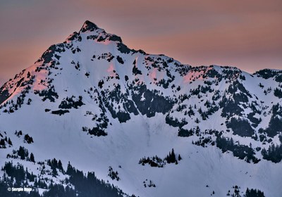
Ruth Mountain & Icy Peak Traverse
An easy snow/glacier climb to Ruth and then to camp, is followed by another glacier climb with a bit of 3rd class rock scrambling to reach Icy. Or plan this as a ski/snowboard trip to Ruth Mountain. Enjoy spectacular views of the northeast side of Shuksan and other North Cascades peaks. Black flies and mosquitoes can be bothersome on the hike to Hannegan Pass and there are some rockfall issues on Icy Peak. Times:5-6 hr trailhead to camp on Ruth Mountain, 3-5 hr camp to summit of Icy Peak.
Getting There
Drive I-5 to just north of Bellingham. Take SR 542 east to the town of Glacier. From Glacier drive 13 mi. Just before Nooksack River Bridge turn left on Nooksack River Road. In about 1.5 mi, take left fork, Ruth Creek Rd (Forest Road 32), and continue 4.5 mi to road end at Hannegan Campground (3,000 ft).
Approach
Hike trail 4 mi to Hannegan Pass (5,056 ft). From Hannegan Pass take climbers trail east and south to beyond a pond (the trail is on the south side of the pond and partially concealed by trees) and then upward bearing left around cliffs of a shoulder. A traverse south leads to a ridge ending at the base of Ruth Glacier on the north slope.
Climbing Route
Rope up and traverse glacier south to first notch right (northwest) of Ruth Mountain's summit. Camp on other side of notch on snow if possible, to minimize impact (6,600 ft). A shovel may be of some use.
Traverse west facing snow slope to south facing ridge leading down to the Ruth Mountain-Icy Peak saddle. Rather than descending the normal steep gully of loose scree and rock leading directly to the saddle area, stay left of the gully and descend a leftwards slanting slope to saddle area (5,800 ft).
Climb the glacier gradually on Icy's northwest slope roughly southeast, keeping the rock ridge on left and crevasses on right. At ~6,500 ft, head south and traverse top part of glacier at the west face of Icy Peak. Skirt Icy Peak's west notch and turn up the south side of Icy Peak through talus and snow.
Find the first prominent gully and climb to the top where rap slings are around a horn. A fixed line is recommended. The summit is a couple steps above and left. Watch for loose rock and wear helmets!
Ski/snowboard Route
Coming soon...
Trip Profile
Ruth Mountain & Icy Peak Traverse
| SEGMENT | TIME (HOURS) | ELEVATION GAIN (FEET) | ELEVATION Loss (Feet) |
|---|---|---|---|
| Trailhead to Camp | 5-6 | 3,600 | |
| Camp to Summit | 3-5 | 1,270 | 800 |
| Summit to Camp | 2-3 | 800 | 1,270 |
| Camp to Trailhead | 3-4 | 3,660 |
Ruth Mountain
| SEGMENT | TIME (HOURS) | ELEVATION GAIN (FEET) | ELEVATION Loss (Feet) |
|---|---|---|---|
| Trailhead to Camp | 5-6 | 3,600 | |
| Camp to Summit | 3-5 | 1,315 | |
| Summit to Camp | 2-3 | 1,315 | |
| Camp to Trailhead | 3-4 | 3,660 |
EQUIPMENT
Standard rock and glacier gear for the Icy Peak Traverse. Standard glacier gear for Ruth Mountain.
NOTES
- There are many way trails run from Ruth Glacier along ridge. If visibility is poor, pay attention to trail selection at this point, especially on descent. The grayish gully on left seems to be the best for final summit approach. Students can go up with a handline protecting themselves with a prussik.
- Helmets are required on the climbing route!
- It may be good to limit party size to six or nine, because of single file travel at the summit and in a gully or two, and some rockfall hazard.
Information for Leaders
Scheduling
This route allows multiple bookings. Please check scheduled trips listed below in the "Activities" tab to see if there is another group already booked on the same day. Leaders are expected to contact the leader(s) of existing trips to ensure there are no concerns or conflicts, according to The Mountaineers Outdoor Ethics Policy. Please review our Group Size & Multiple Bookings page for guidance.
Basic Climb Credit
Conditions change on these routes throughout the season. Ruth is typically a Basic Alpine climb, though it may be considered a Basic Glacier climb in late season. The Ruth-Icy Traverse is typically a Basic Glacier climb. Depending on conditions, it is the leader's discretion if the selected route should be a Basic Alpine or Basic Glacier climb.
- Suitable Activities: Backcountry Skiing, Climbing
- Climbing Category: Basic Alpine
- Seasons: June, July, August, September, October
- Weather: View weather forecast
- View avalanche forecast.
- Difficulty: Technical 2, Strenuous 3, Basic Glacier Climb, M2G Advanced Glacier Ski
- Length: 16.0 mi
- Elevation Gain: 6,500 ft
- 7,073 ft
-
Land Manager:
North Cascades National Park
Stephen Mather Wilderness
- Parking Permit Required: Northwest Forest Pass
- Recommended Party Size: 6
- Maximum Party Size: 12
- Maximum Route/Place Capacity: 12
- Green Trails Mt Shuksan No. 14
- Green Trails Mount Baker Wilderness Climbing No. 13SX
- Green Trails North Cascades Ross Lake No. 16SX
- USGS Mt Sefrit
- USGS Mt Shuksan
This is a list of titles that represent the variations of trips you can take at this route/place. This includes side trips, extensions and peak combinations. Not seeing a title that fits your trip? Log in and send us updates, images, or resources.
- Ruth Mountain
- Ruth Mountain & Hannegan Peak
| Name/Description |
|---|
| Mountaineers Beta & Brews: Basic Climbs 2021 A link to the YouTube video of The Mountaineers Beta & Brews: Basic Climbs 2021. The Ruth and Icy presentation by Craig Taylor and Kelli Taylor begins at ~35:15. |
