Iron Goat Trail
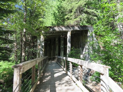
An easy hike that follows part of the Great Northern Railway. Three miles of the trail are ADA accessible and give a great history lesson about the area and the Great Northern Railway.
Getting there
iron goat interpretive center
Drive US 2 to 9 miles east of Skykomish (6 miles west of Stevens Pass) and turn north into the Iron Goat Interpretive Center parking lot and trailhead (2,100 ft).
martin creek
Drive US 2 to 6.3 miles east of Skykomish (8.7 miles west of Stevens Pass) and turn north onto Old Cascade Highway. Drive 2.3 miles, turn left onto Forest Road 6710, continue for 1.4 miles to the Martin Creek trailhead (2,450 ft).
on the trail
iron goat loop
6-mile loop with 700 feet of elevation gain, 2,800 ft high point
You can hike this 6-mile loop in either direction. If you hike it counterclockwise, you'll climb as very steep 700 feet in the first half mile. If you hike it clockwise, you'll climb the 700 feet gently over 5.5 miles. Along the lower leg is ADA accessible and there are lots of remnants of the Great Northern Railway with historical informational posted along the route. At the northeast corner of the loop consider heading east 0.25 mile to the Windy Pass overlook.
iron goat interpretative center to wellington
6 miles round trip with 1,000 feet of elevation gain, 3,100 ft high point
Climb the very steep switchbacks 700 feet and 0,5 mile from the Iron Goat Interpretive Center and turn right. Reach Windy Pass overlook in 0.25 mile. Continue 2 miles to Wellinginton, the site of one of the worst avalanches in our history.
iron goat trail: martin creek to wellington
12 miles round trip with 650 feet of elevation gain, 3,100 ft high point
Hike 0.2 miles and take the left fork uphill. Continue along the upper section of the Iron Goat Trail 5.8 miles to Wellington. This trip can be done as a one-way if you set of a car shuttle leaving a car at Wellington. You can include the lower section of the Iron Goat Trail on the way out or back.
INFORMATION for leaders
Scheduling & Permits
- If you are scheduling this as a non-stewardship activity, please limit your group size to the default party size. The maximum party size is only for use by stewardship trips run with the cooperation of the land manger.
- Suitable Activities: Day Hiking
- Seasons: May, June, July, August, September, October
- Weather: View weather forecast
- Difficulty: Easy
- Length: 5.7 mi
- Elevation Gain: 700 ft
- 2,800 ft
-
Land Manager:
Mount Baker-Snoqualmie National Forest
Skykomish Ranger District (MBSNF)
- Parking Permit Required: Northwest Forest Pass
- Recommended Party Size: 12
- Maximum Party Size: 30
- Maximum Route/Place Capacity: 12
- Green Trails Alpine Lakes West (Stevens Pass) No. 176S
- Green Trails Stevens Pass No. 176
This is a list of titles that represent the variations of trips you can take at this route/place. This includes side trips, extensions and peak combinations. Not seeing a title that fits your trip? Log in and send us updates, images, or resources.
- Iron Goat Loop
- Iron Goat Trail to Wellington
- Iron Goat Interpretive Center to Wellington
- Iron Goat Trail: Martin Creek to Wellington
There are no resources for this route/place. Log in and send us updates, images, or resources.
