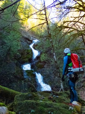
Fir Creek
A half-day intermediate canyon in the Skokomish River valley. This canyon features some technical whitewater that is easy to navigate at moderate flows. A rooster tail on the first rappel may indicate the chute sequence will contain advanced whitewater challenges. This canyon is rated v3a4II mid-season (early July) and v3a3II in mid to late summer.
GETTING THERE
From US-101, drive west on Skokomish Valley Road. Near the end of the road, bear right onto Govey Road, heading steeply uphill. The road becomes dirt and Forest Road 23 (aka Forest Road 2353). Drive it until just before it returns to pavement, and park at the pullout just before the road crosses Fir Creek at the hairpin turn.
APPROACH
From the pullout, it's a five min brush bash down to the creek. Stay just upstream of the tributary creek for the easiest terrain.
DESCENT
- Jump 1: Jump 15 feet DCR (Down Canyon Right) into a deep pool. Or rappel off a tree DCL (Down Canyon Left). Be sure to have someone check depth before jumping!
- Rappel 1: 12 feet DCR from webbing on a tree. If this rappel is dry, that is a good indicator that the technical aquatic section will be easily navigable.
- Rappel 2: 85 feet off of bolts canyon center. At higher flows, these unlinked bolts will be underwater. A high water option is webbing on a tree DCL.
- Rappel 3: 45 feet DCL webbing on a challenging-to-access tree. A human anchor for the rigger could be beneficial, because a slip could lead to a broken ankle. This rappel leads into the first pothole of the chute sequence. There is a challenging-to-navigate but interesting hidden pothole under a veil mid-rappel. Although the pothole at the bottom of this first drop is shallow, it is a good idea to connect it to the next anchors and treat it as a rebelay.
- Rappel 4: 95 feet DCL chain anchors. This is a two-tier rappel down a committing chute. The flow is crossed twice but can mostly be avoided. The hanging pothole is shallow canyon left, but deep canyon right, and can be pushy. Comfort in recirculating water is important, as this pothole is out of the line of sight of both the rigger and the bottom. Give yourself a lot of slack before crossing the pool. Once the edge of the pool is reached, it is easy to climb out of and continue to The Patio.
- Rappel 5: 75 feet DCL chain anchors from The Patio to the canyon floor. This rappel starts with a required fire-hose to navigate. This can be bridged or stemmed. Rappellers can also swing under it, but must back out of it once they are on the ledge. The remainder of the rappel can be done in or out of the flow, and the bottom 8 feet can be jumped into a deep pool.
EXIT
Follow the creek to the confluence of Vance Creek. Walk up Vance Creek ~500 feet, then turn into the woods, bushwhacking about 300 feet to find an old decommissioned forestry road. Follow this road until it connects with the active logging road up the hill. Turn right onto the active logging road and follow it to the gate. At the gate, turn right onto Forest Road 23, and walk around the hairpin back to the cars.
EQUIPMENT
Standard canyoning gear including webbing, a wrench, and replacement quick links.
TRIP PROFILE
- Rappels: 5
- Longest Rappel: 95 feet
- Approach: ~ 200 feet
- Exit: ~2 miles
- Time: 3-5 hours total
NOTES
- This canyon is rated v3a4II mid-season (early July) and v3a3II in mid to late summer.
- Fir Creek is on a section of Green Diamond Resource Company land that is open to public non-motorized access. No permit is required on this section of GDRC land.
- If flow is too high, Rock Creek provides a great nearby alternative.
Information for Leaders
Scheduling
This route allows multiple bookings. Please check scheduled trips listed below in the "Activities" tab to see if there is another group already booked on the same day. Leaders are expected to contact the leader(s) of existing trips to ensure there are no concerns or conflicts, according to The Mountaineers Outdoor Ethics Policy. Please review our Group Size & Multiple Bookings page for guidance.
- Suitable Activities: Canyoning
- Seasons: June, July, August
- Weather: View weather forecast
- Difficulty: Intermediate Canyon
- Length: 2.0 mi
- Land Manager: Green Diamond Resource Company
- Parking Permit Required: None
- Recommended Party Size: 6
- Maximum Party Size: 12
- Maximum Route/Place Capacity: 24
There are no resources for this route/place. Log in and send us updates, images, or resources.
