Trip
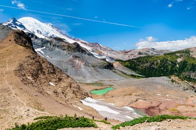
Day Hike - Summerland & Panhandle Gap
Enjoy a beautiful Rainier forest, Fryingpan Creek, flowers, and alpine wonders. Vaccination Badge is required.
- Tue, Aug 16, 2022
- Foothills Hiking Committee
- Day Hiking
- Adults
- Strenuous
- Challenging
- Mileage: 12.0 mi
- Elevation Gain: 3,000 ft
- High Point Elevation: 6,800 ft
- Pace: 1.75 MPH average moving speed
- 6 (11 capacity)
- Cancellation & Refund Policy
8:00 at what google maps calls 'Summerland Trail'. Use google maps and this link https://maps.app.goo.gl/2kwvg5RHMCJArpw76
One carpooling option is 7:00 at the National Forest Office in Enumclaw, 450 Roosevelt Ave E, Enumclaw, WA 98022
Route/Place
Summerland & Panhandle Gap
-
Green Trails Mt Rainier East No. 270
Green Trails Mount Rainier Wonderland No. 269SX - See full route/place details.
Roster
Required Equipment
Required Equipment
- Navigation
- Headlamp
- Sun protection
- First aid
- Knife
- Fire
- Shelter
- Extra food
- Extra water
- Extra clothes
Trip Reports
