Trip
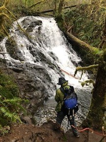
Day Hike - Mima Falls
Mima Falls Loop takes hikers through young plantings, lush forest, and quiet wetlands in Olympia's Capitol State Forest.
- Sat, Feb 24, 2024
- Olympia Hiking & Backpacking Committee
- Day Hiking
- Adults
- Easy
- Easy
- Mileage: 6.5 mi
- Elevation Gain: 400 ft
- High Point Elevation: 650 ft
- Pace: 1.5
- 4 (6 capacity)
- FULL (2 capacity)
- Cancellation & Refund Policy
Meet at the trail head at 8am. Full 6.5 mile loop trip option will be weather dependent (to be determined by the group).
Please bring: 10 Essentials
- Dress for the weather (it's February after all and even if Punxsutawney Phil did state that we should be having an early Spring it's just best to be prepared).
- Bring snacks, lunch, water
- And a great sense of humor
Required Equipment
- Navigation
- Headlamp
- Sun protection
- First aid
- Knife
- Fire
- Shelter
- Extra food
- Extra water
- Extra clothes
Getting There
From I-5 South: Take exit 95 and continue onto Maytown Road SW for 2.8 miles. Maytown Road becomes 128th Ave. Continue on it for 0.7 miles to a 'T' intersection. Turn left onto Mima Road SW and continue for 1.3 miles. Turn right onto Bordeaux Road SW for 0.6 miles. Turn right onto Marksman Street SW. After 1 mile keep straight at the bend in the road. Follow the gravel loop until you reach the parking lot and trailhead.
