Trip
Backpack - North Fork Sauk River
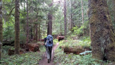
This beautiful trail threads its way through an old-growth forest along the North Fork Sauk River in the Glacier Peak Wilderness. It's an easy-going trip, a 10 to 13-mile backpack with 925 feet of elevation gain. It also counts as a field trip for B3 students, giving them the opportunity to try out gear and new skills on an easy overnight backpack with an experienced mentor.
- Sat, Jun 1, 2019 — Sun, Jun 2, 2019
- Foothills Backpacking Committee
- Backpacking
- Adults
- Easy
- Easy
- Mileage: 13.4 mi
- Elevation Gain: 1,000 ft
- High Point Elevation: 3,000 ft
- Pace: 1.5-2 mph
- 3 (11 capacity)
- Cancellation & Refund Policy
Meet at Sloan Creek Campground on Saturday, June 1, at 8:30 a.m. We will start hiking around 9:00 a.m.
Driving
It takes about 2.5 hours to drive to the trailhead. To get there, you have two choices.
1) Take I-5 up to exit 208 and take Highway #530 east to Arlington and then to Darrington. Turn right (south) on the Mountain Loop Highway and drive about 16 miles to just north of Bedal Campground. Turn left (east) on the North Fork Sauk River Road #49.
2) Take I-5 to US-2, and drive east. Where the road rises from the wetlands, take Highway 204 to Highway 9. Turn left (north) on Highway 9, then right on Highway 92. Take this to Granite Falls, and turn left (north) onto the Mountain Loop Highway. Continue past Verlot and Silverton, to Barlow Pass and continue north on the Mountain Loop Highway. Just north of Bedal Campground, turn left (east) on the North Fork Sauk River Road #49.
Once you are on Road #49, follow it for 6.4 miles to a junction for the Sloan Creek Trail. Turn left and in 0.1 mile reach Sloan Creek Campground (at coordinates 47.997921, -121.225312) and park there. The trailhead is popular on weekends. A National Forest pass is necessary.
The trail starts from the Sloan Creek Campground at 2075 feet, and passes through a beautiful old-growth forest in the first 2 miles. The trail rises gradually and is mostly soft dirt, a delight for feet. Pass the junction for the Pilot Ridge Trail at 1.8 miles. We’ll continue until we reach the Red Creek camp at 5.0 miles (2800 feet elevation, 725 feet elevation gain). Depending on conditions and the interests of the group, we can camp at the Red Creek camp, or cross Red Creek on a bridge and continue to the Mackinaw Shelter camp at 6.7 miles (3,000 feet elevation, 925 feet elevation gain).
On Sunday morning, we could day-hike somewhat further on the trail (it starts rising steeply a quarter-mile past Mackinaw Shelter), or head directly back to the trailhead.
North Fork Sauk River
-
Green Trails Sloan Peak No. 111
Green Trails Glacier Peak No. 112
Trails Illustrated Glacier Peak Wilderness
Green Trails Mountain Loop Highway No. 111SX - See full route/place details.
Required Equipment
The Ten Essentials, plus overnight gear as specified by the trip leader
