Trip
Backcountry Trail Run - Granite Lakes via Granite Creek
Happy hump day! Midweek run on a moderate grade and good company.
- Wed, Jul 13, 2022
- Foothills Trail Running Committee
- Trail Running
- Adults
- Moderate
- Moderate
- Mileage: 7.5 mi
- Elevation Gain: 2,500 ft
- High Point Elevation: 3,070 ft
- Pace: 3-4 mph
- FULL, 1 on waitlist (3 capacity)
- FULL (3 capacity)
- Cancellation & Refund Policy
Running at 6PM at the Granite Creek Trailhead (47.4920, -121.6399), so arrive several minutes early for any trailhead prep. Discover Pass required.
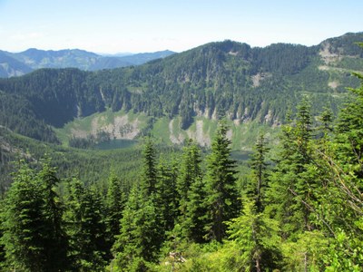
Mentored Backcountry Trail run to Granite Lakes via Granite Creek Trail, expected moderate (3-4 mph) pace. According to WTA:
"The trail starts southeast over a broad, graveled surface and quickly gets to work gaining the 880 feet of elevation between the trailhead and the first junction. ... Pass through a forest of second-growth hemlock, alder, Douglas fir, and cedar. Ground cover includes salmonberry, thimbleberry, Cascade Oregon grape, vine maple, and sword ferns. ... The trail continues to switchback steeply upward until reaching the junction with the Granite Creek Connector 1.3 miles into the journey, at 1680 feet of elevation. ... At 1.6 miles, there is a short spur to the left offering an overlook view of the creek, and at 1.8 miles, cross the new bridge over Granite Creek, placed by helicopter in April 2015. ... Views of the flank of Mailbox open to the right at 2.8 miles from the trailhead. Continue your upward progress until reaching a second junction and fork in the trail, 3.5 miles from your starting point. You have reached 3070 feet of elevation, and the trail to Granite Lakes descends to your right."
Bring a headlamp, water and a snack. Planning for 3 hrs roundtrip. Sunset is 9:04PM.
Granite Creek Trail
-
USGS Bandera
Green Trails Middle Fork Snoqualmie No. 174SX
Green Trails Bandera No. 206 - See full route/place details.
Required Equipment
- The Ten Essentials
- Sturdy running shoes
- Headlamp
- Water
- Snacks
