
Trip Report
Middle Sister, South Sister and Broken Top Traverse
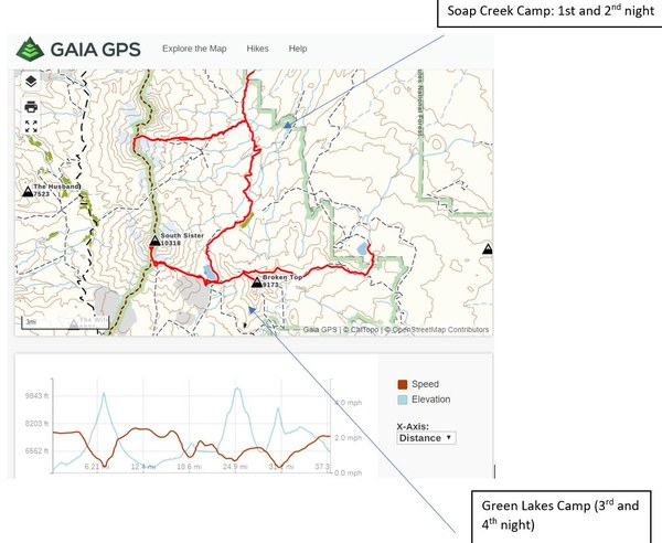
A 4-day (5 nights) 40 miles and 14,000 ft traverse from Pole Creek Trailhead to Three Creek Lake Trail head with ascents of Middle, South and Broken Top along the way. Two nights camping at the base of the Middle Sister by Soap Creek, then a day of backpacking to Green lakes and two nights there. One day climb of South Sister via the East Climber’s Route and then a carry-over climb of Broken Top followed by a long traverse on the north side of Broken Top to connect to the Tam McArthur Rim Trail and descend back to Three Creek lake.
- Thu, Jun 20, 2019 — Mon, Jun 24, 2019
- Climbing
- Successful
-

- Road suitable for all vehicles
-
This route is best done under good snow coverage (late spring-early summer) especially for the last day traverse from Broken Top NW Ridge to the Tam McArthur Rim Trail. Loose scree and rock fall could make this not attainable. Earlier attempts may have issues if the NW Ridge is corniced. No cornice remaining at this time.
The Middle Sister East Route was in fine shape. Snow starts around 6500 feet. The North Ridge of Middle Sister was mostly snow-covered and very steep and icy. We used pickets to protect two short steep pitches and running belays.
The Green Lakes trail was snow-covered above the junction with Golden Lake and all the way to Green Lakes. Green Lakes are completely snow-covered and so is the gully and slope on the East Climber's Route to the South Ridge of South Sister. South Ridge is snow-free till the summit crater.
Snow also from Green Lakes to the NW Ridge of Broken Top. Broken Top NW Ridge and Summit Block are snow free.
The traverse below the North and East side of Broken Top and to the east of Broken Hand to the Tam McArthur Rim trail is all snow covered. The trail was mostly snow-covered all the way down to less than 1 mile from the trail head.
I had been obsessively checking weather for weeks, hoping to give a go to our long-planned Ptarmigan Traverse trip, but in the end, it was clear we did not have a weather window for my week of break from teaching and I had to come up with an alternative plan quickly. Perusing my climbing list and searching for areas with better weather, the Three Sisters in Oregon materialized as an option. But I did not want to just do a long drive and a car-to-car experience, I really wanted a traverse! So, this is what I came up with.
A point to point traverse from Pole Creek Trail head to Three Creek Lake Trail head with ascents of Middle, South and Broken Top along the way. Two nights camping at the base of the Middle Sister by Soap Creek, then a day of backpacking to Green lakes and two nights there. One day climb of South Sister via the East Climber’s Route and then a carry-over climb of Broken Top followed by a long traverse on the north side of Broken Top to connect to the Tam MacArthur Rim Trail and descend back to Three Creek lake.
I initially considered climbing North Sister as well but realized it is a much more committing climb and felt it was best left for its own trip.
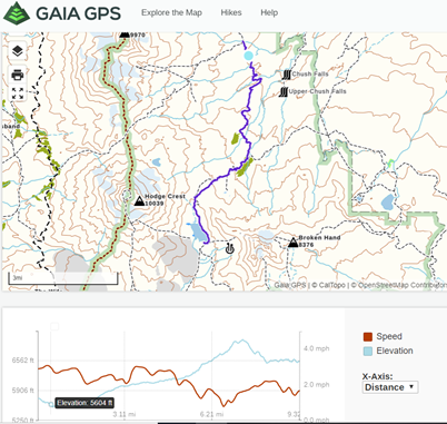
I am not sure if anyone has done this specific traverse before (there is nothing like it on the database and while I read of Three Sisters traverses online I did not find any tracks that did this particular itinerary only some partial tracks on Gaia. So I linked them together and came up with this itinerary.
By changing destination I lost a team member and it was too last minute late to find someone else. I was not 100% sure this route would go but Brian and Christine were up for the adventure and we had bail-out options (exit via Green Lake Trail to Cascade Lakes Highway) so we got into two cars on Thursday morning and head to Sisters, OR for the beginning day of our 4 days, 5 nights traverse.
Day 0: Pole Creek TH to Soap Creek Camp (2 miles, 500 feet gain)
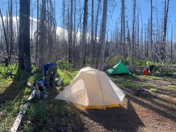
We drove to Sisters, OR and then to Three Creek Lake where we left one car. Then drove to the Pole Creek Trail head. Started hiking at 4:30 PM and hiked two easy miles to Soap Creek at the junction with the Green Lakes trail we would take for our traverse south two days later. This was a great base camp for the next two nights. A nice wide area is available right by the creek in the burnt forest from a major fire a few years back. There are peak-a-boo views of Broken Top and the Three Sisters from there but if someone just wanted to tag the Middle (or North) Sister they may want to go higher to closer and prettier camp sites right at timberline. Since we did not want to carry our heavy packs up and down this was the best site for us. It was also a very windy evening and the mountains were shrouded in clouds. We did not get any precipitation that evening but we discovered fresh snow at higher elevations on our route the next day.
Wind eventually abated after sunset and we retreated to our tents for a good night sleep.
Day 1: Middle Sister Climb
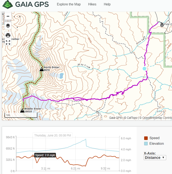
We woke up to a clear sunny day and views of all the Sisters and Broken Top. Had a leisurely start and start hiking up the climber’s trail at 7 am. The trail is easy to follow until we hit snow around 6500 feet. We had a good track and finding the route was easy. Some great camp sites can be found at around 7000 feet near timberline with great views. Some running water can be found not far from the camps in creeks running under snow. The route to Middle Sister is very straightforward on the north edge of the Hayden Glacier. At this time, it was mostly snow-covered with some sections of rock on prominent moraines that caused us to transition on and off crampons. Snow was consolidated and firm but a 2 inch-layers of fresh snow had fallen the day before. We followed the prominent snow-covered moraine up to 8800 feet and then traversed below Prouty Point (Point 9312- which straddles the saddle between North and Middle Sister) to the saddle at 9160 at the base of the North Ridge.
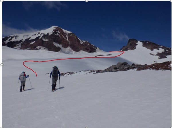
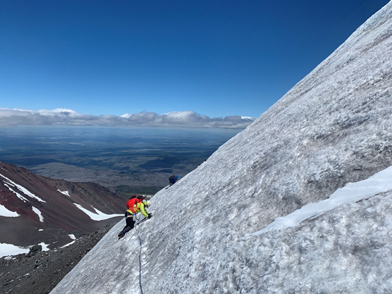
From the saddle, the route to the summit includes some easy scrambling on the ridge followed by a couple of steep (one 50 degrees, one 45) pitches of snow to the summit. The snow was very icy and given the lack of ice-climbing experience of one of the participants and the very bad run-out, we decided to protect it with pickets and do one running belay on each of the steeper sections. Pickets went in very well and this was a great introductory experience to alpine ice for Christine.
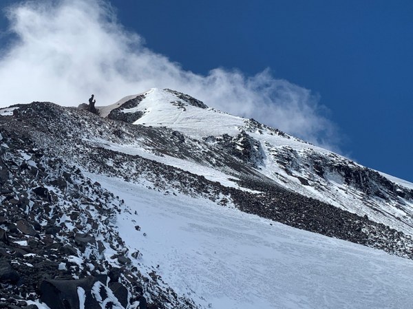
Other climbers did this section with no protection and a series of boot steps are visible in the picture above on the most direct and steepest section of the north face which we avoided due to traffic at the moment. Photo below show another climber soloing that section.
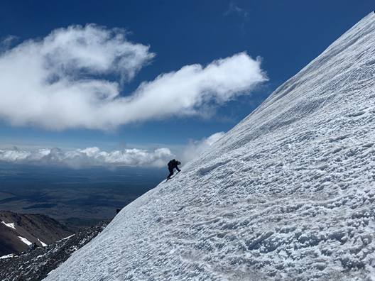
After the first steep pitch, the slope mellows out and a second shorter and less steep section is encountered before the final more gentle push to the summit.
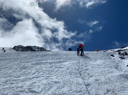
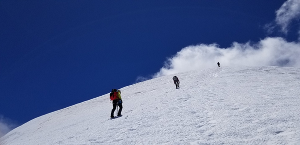
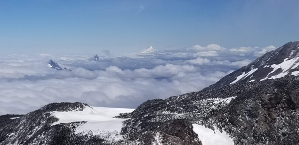
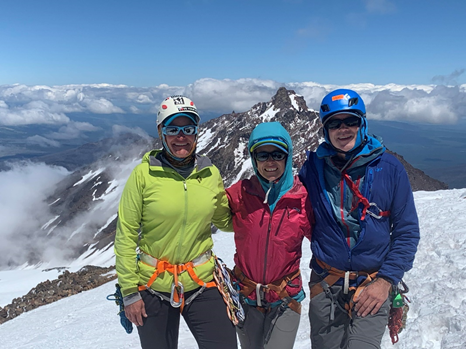
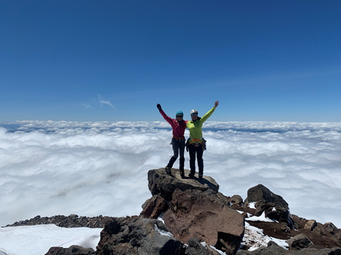
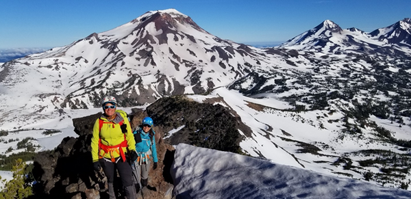
We reached the summit at 12:45 and we took a nice long break, ate, gawk at the views and snapped lots of pictures of our next two objectives. It was a beautiful clear day on the East side of the Cascades but clouds were enveloping the entire west side of Oregon. Only the very tippy top of the nearby Cascade peaks to the West were visible.
We descended back the North Ridge protecting again the two steeper pitches and traversing back to the rocky part of the ridge to the saddle.
After the saddle, it was a quick descent back on the moraine and then to the climber’s trail back to camp.
Day 1 stats: Total climb day (including all stops): 9 hours, 11.5 RT, 4700 ft gain.
Day 2: Soap Creek Camp to Green Lakes Camp
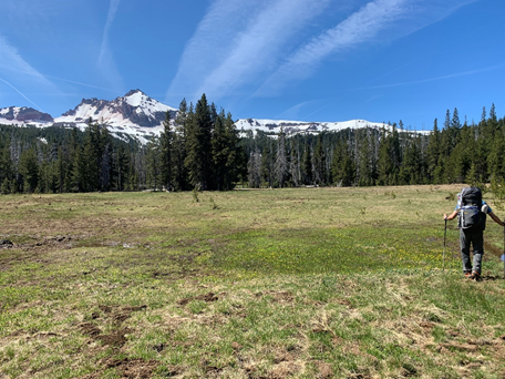
After a very restful night and a very slow morning start we left camp at 8 am. This was a supposed to be an easy day of hiking on the Green Lake Trail. We thought it would be a partial rest of day. But snow level was lower than we expected and a fair amount of this day was a cross-country traverse on snow that required solid navigation skills (can’t go wrong with the Seattle Navigation Chair!) and trudging though snow. It was a hot but beautiful day though. After a couple of interesting but uneventful stream crossings in the lower part of the trail (snow-free), we ascended a bit and found snow shortly after the intersection with the Golden Lake Trail (photo below).
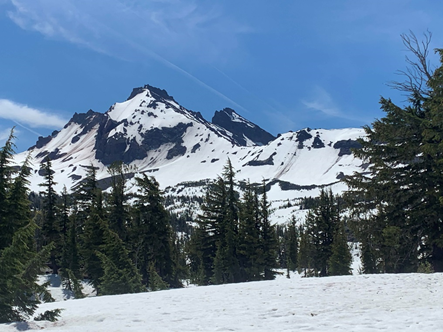
We climbed over a saddle that separates the Golden Lakes Basin from the Green Lakes Basins and then descended to still snow-covered Green Lakes, our camp for the next two nights. The lakes are still mostly covered in snow but there are several snow-free islands that had beautiful dry camps with views of South Sister and Broken Top, our two next objectives. Camp sites are designated only in this area and are supposed to become open for reservations 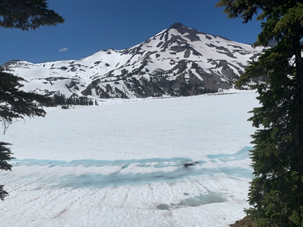 next year. Due to the high snow this year, there was not much competition for us and only a handful were occupied on Saturday. No one else was around the lake on Sunday night. There was plenty of running water from many creeks surfacing from the snow near their outlets into the lake. We found one just a couple hundred feet west from our luxurious campsite (site 1- space for 3-4 tents).
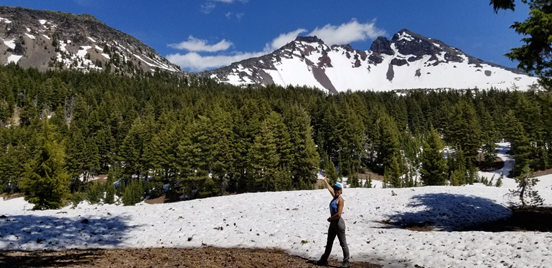
Day 2 Stats: 6.5 hours, 9.3 miles and 1600 ft of gain.
Day 3: South Sister Climb
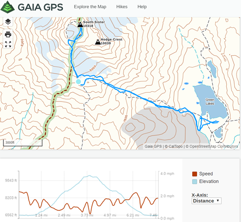
We started earlier today (6 am) with the idea of getting done earlier to give ourselves more rest for the long final day. Our route was the East Climber’s Route, which begins with a small gully and then ascends a broader valley to meet the South Ridge Route at 9000 feet. It was completely snow-covered at the time we climbed it but I could see some sections of a primitive climber’s trail on the north side of the valley once more snow melts.
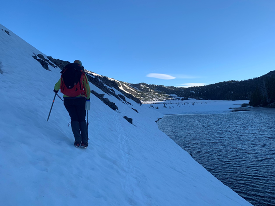
The first challenge was to find a way to cross the outlet of the Green Lake (Fall Creek). We initially headed directly in the direction of the gully (WNW) where the climber’s route starts but what looked like the remains of a log bridge had been swept away almost entirely so we traversed south a bit on one of the rock islands and found a snow bridge about a 1000 feet further south. After that crossing, we had to backtrack north and traverse a steep snow bank above a small lake. This causes a little trepidation but crampons on foot, and ice ax in hand made this delicate traverse pretty safe on the firm morning snow.
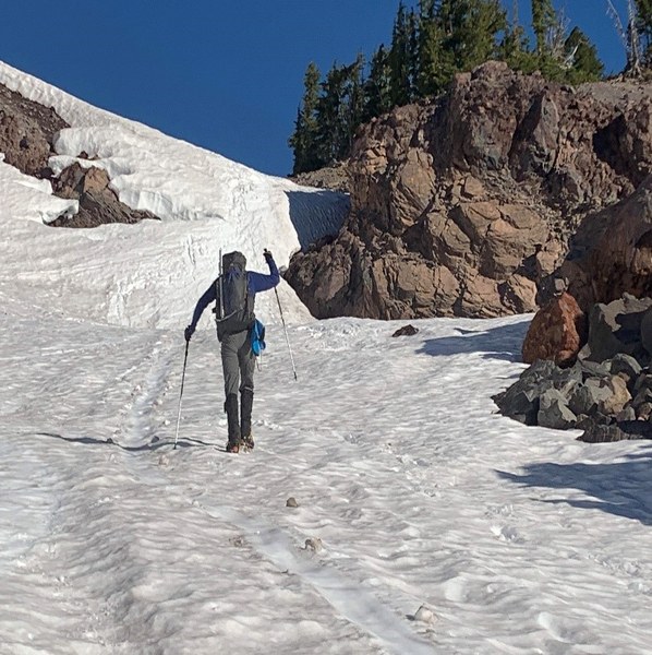
The next (and really only other mildly challenging part of this route) was a steep pitch of snow in the hour-glass shaped gully. A waterfall must run here later in the season but the water was covered by a thick layer of snow. This section looked much steeper and sketchy from camp. We jokingly had dubbed it “the Hillary Step” and were nervous approaching it. It turned out to be maybe a 40 degree short pitch of snow. Nice and solid in the morning with boot steps left from other parties the day before. Christine attacked it with gusto and felt great heading up first.
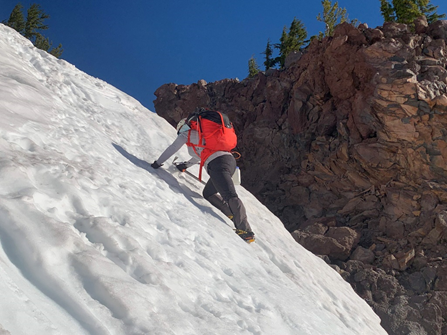
After the step in the gully it was smooth sailing the rest of the long but not too steep slope up to the saddle. There are some lovely bivies at about 8500 feet next to running water.
Once at the edge of the Lewis glacier and near the saddle that connects to the South Route there is a lovely tarn, the highest lake in Oregon that made us pause to marvel for a while. Views also open up here to the south side, Bachelor, Devil’s Lake, Sparks Lakes and Cascades Lakes Highway.

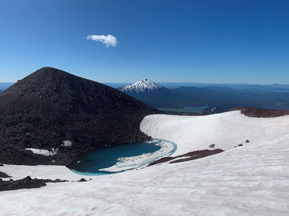
Skirting the edge of the Lewis Glacier we climbed over the South Ridge and joined the South Route for the last 1300 feet of the climb to the summit. This is a very straightforward climber’s trail that zig-zags up the ridge on loose scree. On the way up we took the most direct way up to the East rim of the crater. On the way back we traversed the crater and descended a little more to the west. Either way is fine but most people take the more western trail and traverse the crater.
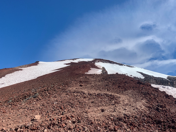
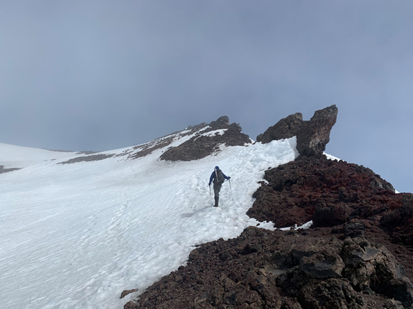
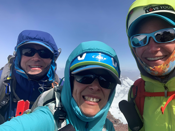
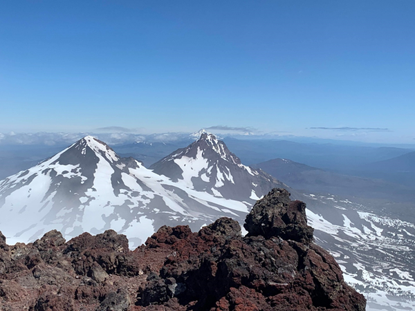

We reached the summit a little before 11 am. It was very windy and cold but we found a ledge on the east side that was more protected by the wind and we had a snack there. We got some cell reception, so we downloaded the weather forecast and sent some messages to family before descending the way we came with a little detour around that beautiful lake near the junction between the two routes. We descended back to camp quickly and were back at out tents at 2:30 PM.
Day 3 Stats: 8.5 hours total time, 7.6 mi RT and 3800 feet of gain
Day 4: Green Lakes camp to Broken Top Summit to Three Creek Lakes Trail head.
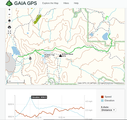
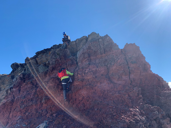
We knew this would be a very long day and we had our first alpine start of the trip. The prospect of a burger, beer and a real bed motivated us to get up before 4 and leave camp by 5 am. Along our long traverse back we also planned to climb Broken Top which is described in various sources either as a scramble or a low-class 5 very exposed climb. We did not know what to expect exactly but felt pretty confident we could handle it and protect the worst parts if needed (we did have a rope and several slings). The approach to the saddle was steep but uneventful. In 1.5 hours we were at the saddle at 7900 feet where the NW ridge starts. We lightened up our overnight packs and stashed our extra gear and followed a series of climber’s paths up the ridge up to the summit block. There are some on each side of the crest and every once on a while one on the crest itself. Views are magnificent and we thoroughly enjoyed this ridge run in the early morning light.
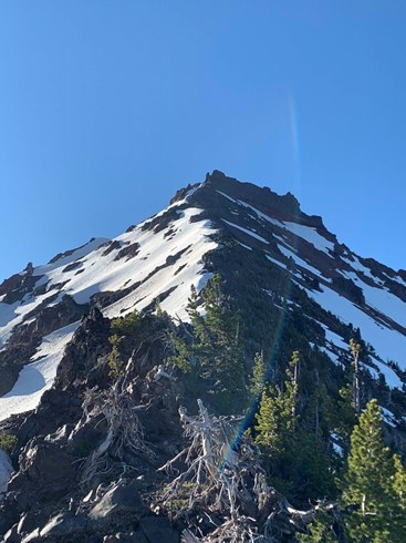
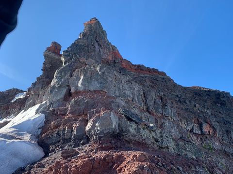
We reached the base of the summit block at 8:30 am and we discussed the best route. There is an obvious 10-foot rock band that leads to a system of ledges to the summit. It looked like a low fifth class section with one awkward move right off the deck. Given the extreme exposure we though it would be best to protect it. Luckily there is a beautiful chock-stone that can be slung from the bottom. Brian led that super-short pitch and belayed us from a well-placed and securely tied rappel anchor on the ledge above it. Fun little gateway to the ledges above.
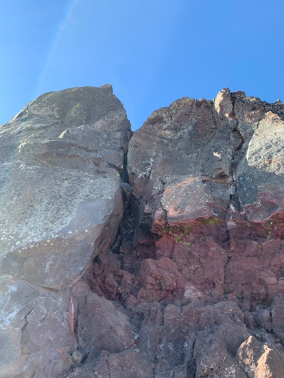
The ledges above are very exposed and have loose scree on them and are un-protectable so we carefully step along them to reach a platform that jets out of the real summit block towards the false summit of Broken Top. This has a very thin catwalk (less than 1 foot wide) and then the final block is a class 3 scramble to the tippy top of Broken Top. Exposure is real but this part if not very hard at all.
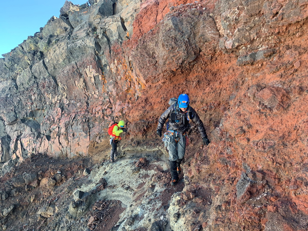
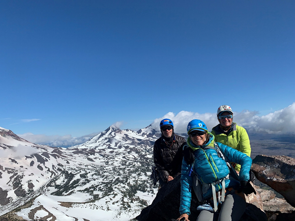
We reached the summit at 9 am and stayed for a while to enjoy some incredible views of all Three Sisters to the west, Bachelor, Thielsen, Mt Scott (Crater Lake) (and hundreds of other small volcanic cones as the eye can see) to South and Three Finger Jack, Washington, Jefferson, Hood and even as far as Adams to the North and Northwest. We wish we could have stayed there forever but we still had a lot ahead of us.
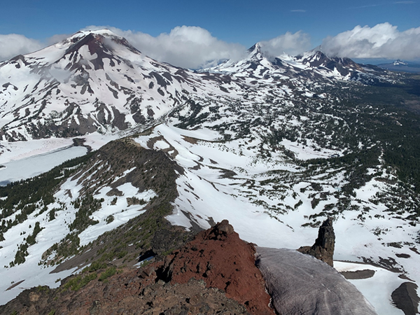
After carefully re-descending the ledges, the rappelled the rock band and retraced our route back to our stashed gear. Then wearing crampons and ice axes we descended a steep but short snow slope to the north of the ridge to begin our long traverse below and around Broken Top to join the caldera rim and eventually the Tam McArthur Rim Trail.
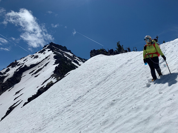
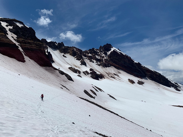
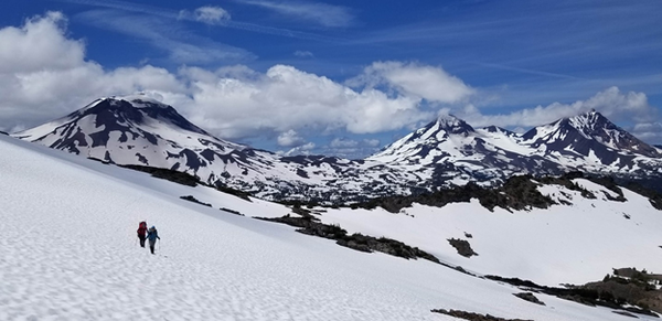
We wanted to stay as high as possible (about 7700 feet) below Broken Top to avoid too much climbing back up at various cols we had to cross over but the rock fall hazard was high so we descended a bit lower in the early part of the traverse and climbed up a prominent moraine instead or traversing higher and more directly. I assume this section would be horrible without snow. I only found one single GPS track of this route on Gaia so it looks like it is not done often. This was the best time of the year to do this.
As we traveled around the base the Broken Top we approached and skirted a little peak called Broken Hand (no interest in climbing this one) and finally connected with the Tam McArthur rim trail. What a relief it was to find an actual trail!
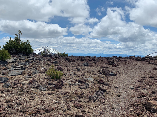
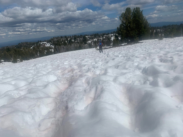
The relief did not last long as the lost the trail to snow soon after and we begun the LONG traverse of the rim plateau in “sun cap hell”. The actual trail winds over the plateau and peaks over the edge of the rim of this ancient caldera (Broken Top is the remain or a very large volcano that collapsed in a manner very similar to Crater Lake). But we did not bother trying to stay on top of the snow-covered trail and took the most direct path in the direction the trail takes to descend to the trail head. Even so, it was a lot of soft mushy snow traversing, some post-holing and finally a dry(ish) trail all the way down to the car.
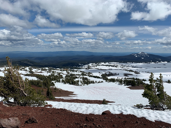
Day 4 Stats: 11.5 hours total, 9.2 miles, 3000 ft gain.
All in all this was an amazing route which took us through some wild and remote terrain seldom traveled with non-stopping views of one of the most amazing volcanic landscapes of our planet. As a Volcanologist by training, this was a feast to the eye with so many rock formations and landforms in front of me at all times. I was lucky to have a small but amazing team of enthusiastic and competent climbers that made this trip an unforgettable experience. If you are yearning for solitude, big volcanoes, views and a technically moderate alpine adventure, consider this route!
Thanks to Brian for double checking my route for viability and researching more details on the climb's beta and for supporting me as always as an ultra-competent and safe-conscious climber, navigator and co-leader.
Thanks to Christine for being flexible, fun, enthusiastic, open to learn and willing to push her limits and grow and for all the laughs along the way.
The photos in this report are a collection from all three members. Thank you for sharing and capturing these amazing trip with me!
GPS track at https://www.gaiagps.com/datasummary/folder/fd8d793e-3521-489c-859f-74908f608dfc/?layer=GaiaTopoRasterFeet
 Emma Agosta