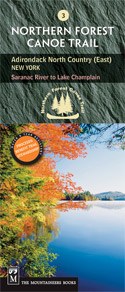
Northern Forest Canoe Trail #3 - Adirondack North Country, East: New York
Saranac River to Lake Champlain

Mountaineers Members Discount
Log in to access the promo code and receive 20% off your order.
Description
* The official Northern Forest Canoe Trail maps, produced by the organization that conceived, coordinated and developed it
* NFCT flows through New York, Vermont, Quebec, New Hampshire, and Maine
* Maps include put-in points, portages, campsites, local contact information, and permit guidelines
* Water- and tear-resistent color contour maps offer detailed route descriptions
Saranac River: From Adirondack highlands to Lake Champlain (Trail Section 3).
This section of the Northern Forest Canoe Trail follows the Saranac River northeast out of the Adirondack highlands into the lowlands around Lake Champlain, the 6th largest lake in America. Using this map paddlers will enjoy 61 miles of varied river travel (often challenging), passing through some ponds on the upper stretch and dropping through rapids to the lake. As the elevation of the river drops, the forests and animals change from more boreal, colder-weather species (moose, gray jay, black-backed woodpecker, conifer forests of spruce, fir, tamarack) to lower-elevation, warmer-weather species (scarlet tanager, northern cardinal, hardwood forests with red oak). The remains of dams, a sawmill, an iron forge, and a glass factory show the previous industrial life of the river, which is now primarily used for recreation and power generation.


