Trip Report
Winter Scramble - Moolock Mountain
Successful winter scramble of Moolock mountain in middlefork on apr 13 with bicycle approach and snow shoe to the saddle and summit
- Sat, Apr 13, 2024
- Winter Scramble - Moolock Mountain
- Bessemer & Moolock Mountains
- Scrambling
- Successful
-

- Road suitable for all vehicles
-
This was a low snow year, with conditions that might be seen in late April or early May in other years.
NWAC showed moderate avalanche danger, but we saw no signs of instability. I would not recommend this trip with considerable or higher danger on south facing slopes.The road grade is 15% much of the time. Strong cyclists may be able to bike to 3100', but due to the extensive bike pushing required by some on our group, there was probably no net time savings from bringing bikes. However, this was offset by the thrill of descending at 4000'/hour at the end of a tiring day, safely hitting 20 mph at times. The trip would be ideal for an all e-bike group.With the route snow-covered, the best route travels on the road north of the Borrow mine pit, eventually leading to the south slopes of Moolock.Even with good snow conditions for kicking steps, this is a T4 snow scramble, and although there is no significant exposure, is not recommended as a first snow scramble, or for those not confident with moderately steep snow slopes.
We had an early start at 7 am from the middlefork road at the base of Bessemer road. Conditions were optimal. Sunny day. No recent precip; trail was dry. Earlier season attempt would have precluded a bike approach and later season would have more bushwacking.
David Judish led a team of 4. Gear checks included bikes:1 electric fat tire, one rigid, one front suspension (hard tail), and one full suspension.
The initial approach on bike was a steady uphill from the lot at 1000 Ft. There are at least 3 water crossings. Although the grade was variable, it was traversed entirely on electric bike to the 4x4 trail turn off, except for one water traverse with slippery algae on the rocks; easily traversed on foot. The roads are straightford on gaia maps. There is a bridge over big blowout creek, going to the left to CCC trail, newly built in the last 3 years. Turn right here. Pass 4 switch backs and you will see blowout falls at 2000 ft elevation with a 10 foot drop to your left.
At 2200 ft you get your first view of Moolock, southeast face.
At 2800 ft dixie and green mtn appear to your left.
There is a steep turn off at elevation 3100 ft. Straight ahead is a road leading below the southeast face of Moolock. Even if a bike ascent were attempted from here, the rock is loose and not safe for a bike descent. The bicycles and bike gear were locked at this junction and we proceeded on foot.
Continuous snow was encountered at 3500 ft. And we transitioned to snowshoes. The hike up to the saddle between Bessemer and moolock was straightforward. The ridge line is complicated by dense trees. We followed bootpack south around the moolock knolls. We explored both the north and south faces of the moolock ridge and we had gpx tracks from both sides. The most straightforward approach on snowshoe wrapped the south side of the first knoll at the Borrow Pit (on USGS map), then the north side of the second knoll and back to the south face of moolock. The trail then underscores avalanche terrain bare of trees with a rocky rim just above the road. Avalanche danger was moderate today, with rollers or rain drainage only in northeast faces. At this point we climbed vertically in slushy snow toward the tree lined ridge.

(Image shows south face on right photo on descent)
Then we hugged the south side of the ridge until we were about 50 feet below the summit and then snowshoed directly.
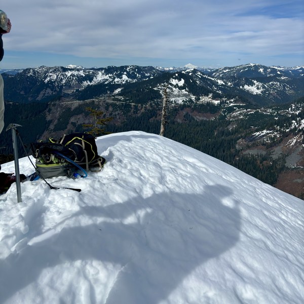
The summit at 47.54736, -121.64186 was snow covered at 4935 feet and showed unobstructed views of glacier peak, Mt Baker, Mt Rainier, lake Hancock, Russian butte, Mt Thompson. It stamped flat with enough space for our team of 4 to unpack and eat a late lunch

We snowshoed back via the same route although the heat prevented any steps from hardening. The bikes were retrieved at the Bessemer turn off and the return to car was an easy downhill on bike. Be cautious on the water crossings and stay on the boards on the bridges.
Although we brought 4 sattellite communicators (Garmin InReach), there was ample cell signal for verizon theoughout the majority of the trail. We were able to send pictures and tap into peak bagger and summit post throughout the hike and at the peak.
Time
We took our time with numerous breaks. Car to car was 11-12 hours. I record moving time of 5 hrs up and less than 2 hrs down.
 John Dinh