Trip Report
Sea Kayak - Goat Island
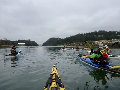
We followed the falling tide out, circled the island, with a break to hike around at Fort Whitman and a couple breaks to wait out the tide, then rode the rising water back to La Conner.
- Sat, Mar 27, 2021
- Sea Kayak - Goat Island
- Goat Island
- Sea Kayaking
- Successful
-

- Road suitable for all vehicles
-
Conditions were close to ideal for our paddle from La Conner to Goat Island and back. Winds forecast to be from the south, 5-8 kts in the morning and around 5kts in the afternoon with wind waves less than a foot. Pretty calm most of the way. Encountered strongest south winds and minor wind wave action at the west end of Goat Island, due to the long fetch over Skagit Bay.
A fun time with a great group after a long time between trips! We had a fun ride down the Swinomish Channel and out to Goat Island on the falling tide. As usual, I stopped at the fishway on the way out to make sure it was clear of snags. We landed at the remains of the Fort Whitman dock and had lunch on the beach before heading up the trail to hike around the fort. The start of the trail was in pretty rough condition due to winter storm activity. Extra care was taken to get over that part and from there on it was an easy 5 minute walk up to the remains of Fort Whitman. We got back on the water about half an hour earlier than I had originally planned. Saw lots of native currant bushes above the shore as we skirted the island counterclockwise. Spotted no sea stars, however, and the shoreline seemed rather devoid of sea life, other than brown algae and barnacles on the rocks. As we rounded the west end of the island we could see waves ahead, resulting from south winds acting on the long fetch of Skagit Bay. This part of the trip is usually the roughest due to the fetch but this day the waves were small and easily managed. Conditions calmed down again as we came around the south side of the island and we stopped on a beach there to wait for the tide to rise enough to clear the mudflats. After that, we continued east along the jetty toward the fishway and found the tide still had a foot or so to go before it was passable. While we waited for the tide, we checked out the river waters further east for half an hour or so then returned to find the fishway open. Passage through was a breeze and we rode on the rising tide back to La Conner with no further delays. We arrived at the take out just a few minutes before the predicted 3pm completion time. Typically I do this trip on a rising tide and plan to be at the fishway when the water level is at 7 feet. That means not always getting a fast ride out the channel at the start but it minimizes encounters with mudflats and allows for quick transit of the fishway. This time I decided to leave before the 3.75 foot low of the day to get more of a boost at the start of the trip. While that was fun, it meant risking that we’d have to wait for the tide to rise high enough to get through the rocky fishway; and that’s what happened.
 Doug Palm