Trip Report
Reynolds Peak
Early season day trip of Reynolds, Eastern Cirque route.
- Sat, May 12, 2018
- Reynolds Peak
- Scrambling
- Successful
-

- Road suitable for all vehicles
-
The last mile of road to the trailhead is brushy and will surely scratch your car, but any vehicle can make it. The Reynolds Creek trail is overgrown and a borderline bushwhack at times. We encountered snow patches beginning at 4,400 feet and solid snow shortly after. We brought snowshoes and began using them around 4,800 after post-holing a bit.
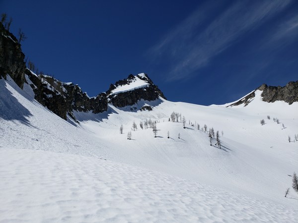
 Crossed Reynolds Creek just shy of 5,000 on solid snow bridges before following some skin tracks steeply into the eastern cirque. It was very warm, and the snow was soft and shallow on the steepest slopes. The going was easier higher up.
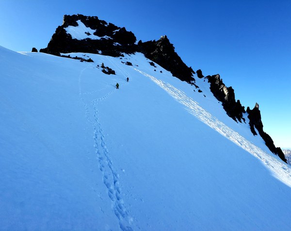
 We mounted the eastern ridge via a notch just past point 7038. Our beta said the ridge would go all the way to the summit block, but we encountered an impassable section at 7,480. Perhaps this is doable without the 4-5 feet of snow along the ridge. After descending into the South Reynolds basin, we ascended steep snow and negotiated minor rock bands all the way to the eastern face. Some amount of class 4 rock scrambling, or ridiculously steep snow climbing got us to the ridge of the summit block where we followed mostly snow-free, class 3 rock to the summit.
We descended via South Reynolds Creek, making fast time on this boring route by plunge stepping down to 5,700 and then putting on snow shoes. Snow still covers any awful brush and is several feet deep and solid down to 5,000 feet. Between 5,000 and 4,800 (the stream crossing) where it is steeper, the snow is very thin and will surely be gone within the week.
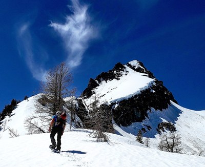
The usual crew, minus our token female, rolled into Mystery Campground at 11pm Friday night and made camp there. We started hiking at 8am the next morning after deliberating about snowshoes and caking on sunblock. The trail is an easy grade, but the lack of maintenance over the years is showing. Constant blowdowns and brush hampered progress. You come into an opening where there was a fire and both of Reynold's peaks come into view. It's a beautiful mountain from that perspective.
We were following some skin tracks and some snowshoe tracks. The snowshoer veered south toward the easy, long route. We followed the skin tracks up into the eastern cirque. The day was warm and without clouds. When we came into the upper basin, we met a group of four skiers from Twisp who seemed overly concerned about the snow conditions.
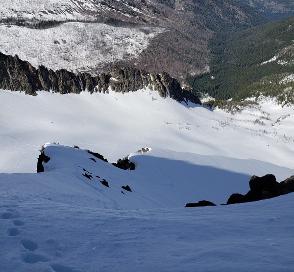
After mounting the eastern ridge and ascending easily along it for 500 vertical feet, we came to a section that we couldn't safely pass. Two in our party downclimbed steep snow and rock gullies into the edge of the South Reynolds basin. I doubled back toward where we gained the ridge, wanting an easier way down, and wasted a bit of time exploring some gullies that turned out to be cliffs.
 By the time I had located the other two in my party, I was over 1,000 feet below them and had to kick my own steps to catch up. I only caught up to them when they were struggling in unsupportive, junk snow on the eastern face. We should have reread the standard route and known to circle around to the south side of the peak at 8,000 feet. That would have saved us from some heart-pounding excitement.
After gaining the ridge and seeing that there was snow-free, easy scrambling on the other side, I was relieved to know we didn't have to descend what we just came up. Some simple rock scrambling leads a nice flat summit with a register. We peeked around at the northwest ridge, wondering if we could just down-climb that to the col between the north and south peaks. The skiers had tracks from the col, and glissading the eastern cirque would have made the descent very fast. Perhaps that would be the shortest, simplest route to summit Reynolds. Maybe even rappelling down for safety. But not having come up that ridge, and not being able to see the entire down-climb, we opted for the safety and simplicity of South Reynolds Creek.
We made it back to the trailhead at 9:15pm just as daylight was fading, and cracked somewhat cold beers to celebrate. We were happy to be driving just one mile back to our campground for the night. The day took just two hours more than our rough estimate, despite the challenges we had. (13 hours)
GPS track here.

 Brian Hill