Trip Report
Ouray - Dexter Creek Slabs (Right Side)
A popular and solid option for climbing outside of the ice park if you're already in Ouray.
- Tue, Jan 16, 2024
- Ouray
- Climbing
- Successful
-

- Road suitable for all vehicles
-
I've only climbed this route this one time, but it had been reported to me that there are numerous rocks at the top out of this climb. I can confirm that if you are using the walk-off option for this route that there are more rocks towards that side of the final pitch.
Note: Any loose rocks and/or ice, or other debris will likely find its way to the bottom of the climb. This basin is like a funnel.
We started our day from downtown Ouray and left the house around 6am. We were not able to drive to the "upper" parking lot as there was too much snow on the ground. We instead needed to park "lower" and walk to the where the trail leaves the road. This didn't add much time, only about 1/2 mile of extra walking.
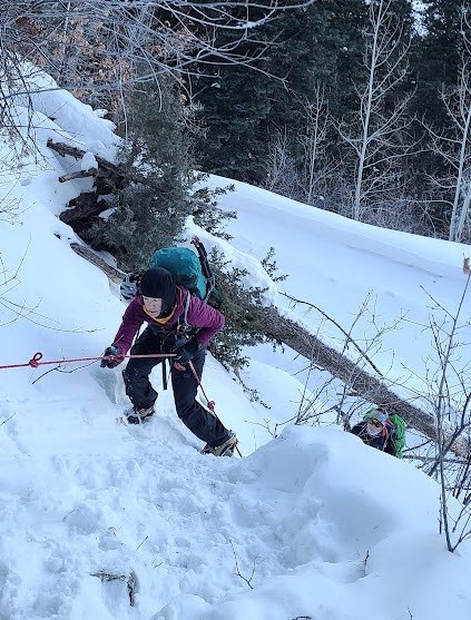
Locating where to turn left off the road was easy, as there's a handline hanging down into the roadside ditch marking where to start going uphill. (BELOW)
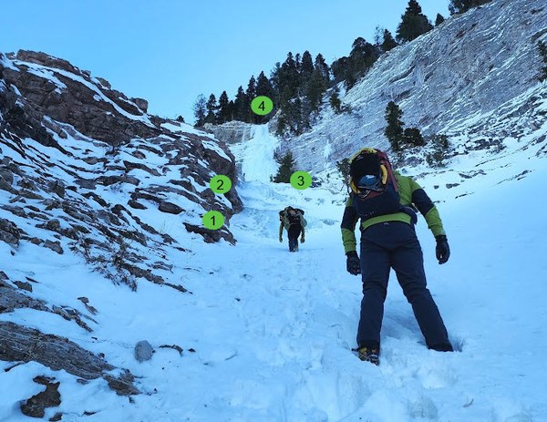
One then will enjoy a stroll through pine trees and then ultimately end up coming to some small icy "headwalls" only about 8-10ft tall, the first (#1) can be avoided by going up and to climbers right of it, if you so choose. The second (#2) of "headwall" is a little bit taller and cannot be bypass (that I could tell). Once beyond this you will pass a tree in the middle of the drainage (#3) with some rap tat on it. We opted to "scramble" over the two little "headwalls" until moving beyond the tree (#3) and getting to the base of the waterfalls. #4 seen below is the top out area. (BELOW)
Once roped up we were able to do the whole thing in 2 pitches with a 70M rope. The the final pitch to the top was a little wet and had some running water on it, but that made from some nice and sticky hero ice. There were two guides on the route that day that opted to climb the left side and noted some of it was brittle. Note: There are two clear paths up this route the right side and the left side. The left side did look more difficult than the right from what I could see.
Descent: We did not walk off and instead chose to do a mixture of V-threads and anchors on our way down. Four rappels total. From the top was one full length rap off of a tree to a V-thread, down to another V-thread at the base of the roped climbing, then to the tree with tat (#3). This will get you down below both little "headwalls". Note: We tied two 70M ropes together to descend; this is not necessary and just one way to do this.
Once down at the bottom of the "headwalls" we took harnesses off and coiled ropes and headed back to the car :-) I think we were back at the car by about 3pm.
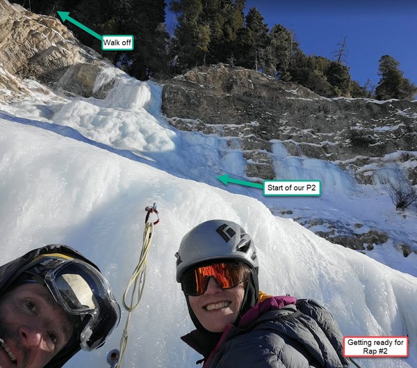
More detailed photo of P2 (BELOW)
Dexter Creek Slabs from afar just above my finger. This is taken right near Lake Lenore for reference HERE
 Douglas Hansen