Trip Report
Olympus in a Day
Single-push, 18 hour effort on Mt. Olympus
- Fri, Jun 21, 2019
- Mount Olympus/Blue Glacier
- Trail Running & Scrambling
- Successful
-

- Road suitable for all vehicles
-
Normal for the route. Bergschrund was still bridged over.
https://engineeredforadventure.com/2019/06/21/olympus/
|| BY THE NUMBERS ||
Trip Duration: 18 hours car-to-car
Stats: 45.13 miles; 8,135′ elevation gain
Caltopo/GPX: https://caltopo.com/m/RLNP
The Team: Justin Sackett, myself

|| PRE-TRIP ||
This trip was part of a month-long stint I spent in Seattle climbing mountains in the Cascades. I began the trip with Hans in Portland, and we road-tripped up to Seattle to meet up with Justin (a schoolmate at Georgia Tech), Adam (a mutual friend of Justin’s at Boeing), and Tyler (a mutual friend of Justin’s). Once Hans left, I stayed with Justin until the end of the trip.
Hans had just left to return to Colorado after we climbed Hood, Adams, Rainier, and Shuksan together, and now I was bumming on Justin’s couch, with his roommates very gracious permission. Justin was interning at Boeing, which left me at home with plenty of time to dream up adventure ideas. Summertime in the Cascades typically means long days and clear skies, perfect for big objectives. Justin’s house had a perfect view of the Olympic peninsula; each night, we would watch the sun set, leaving an orange haze draped over the majestic range not far from Seattle. For some reason, I had NEVER been to the Olympics?!?!? That had to change.
Wednesday night, Justin and I sat down on his couch and began brainstorming. Justin was working 4x10s that week, so he had Friday off, and the weather forecast looked great for Friday…not so much for Saturday and Sunday. We started bouncing ideas off of one another for the weekend…The Brothers? Enchantments run? Bonanza Peak? We kept coming back to the same objective though, time after time: Mt. Olympus…in a DAY.
Mt. Olympus is the crowned jewel of the Olympic mountain range, even its namesake. It is remote, though, hidden behind miles of rainforest and trails. The Hoh River valley extends over 15 miles from Olympus towards the Pacific coast. Most trip reports from Olympus were 3 days, some 2 days, with climbers packing in overnight gear and staying at camps along the Hoh River on their way towards the Blue Glacier and Snow Dome.

Justin and I were fit…Justin more so than me (especially since I had been bouncing from mountaineering trip to mountaineering trip that summer, with no real rest or recovery), and we felt that a single-push on Olympus would be a good test of our physical stamina.
|| GEAR CONSIDERATIONS ||
For a trail-run on Olympus, we would have to go fast and light, minimizing pack weight and focusing on keeping our bodies fueled with energy. We both chose 15-25L packs, small enough to fit extra clothes and food, but small enough that we could run with them on.

In terms of gear, I packed:
- Ice Axe
- Microspikes
- Trail Runners
- Down Puffy
- Headphones
- Garmin inReach Explorer+
- Beanie
- 8mm, 30 m rope (Justin carried)
- ATC belay device
- Harness

I wore running tights, a thin baselayer top, and wool socks. In terms of food and water, I packed a mixture of Rx bars, a few SNEAKZ Meal2Go shakes, and some nut butters. Our plan was to be consuming at least 100 calories every hour, keeping our fuel stores steady to avoid overtaxing our bodies.
We headed out for the Hoh River trailhead on Thursday night…our plan was to begin running at 2 AM. Justin got home from work, packed a sandwich, and off we went!
|| HOH RIVER RUN ||
We were up and running by 2 AM by moonlight on the Hoh River Trail. For 13 miles, this trail follows the Hoh River, passing by campsites and ranger stations along the way. We had landmarks to mark our progress:
- Happy Four Shelter (mile 6)
- Guard Station (mile 9)
- Footbridge across Hoh River (mile 13)
We kept a smooth pace along the Hoh River trail, jogging most of the time, only walking for steep or tricky portions. The sun began to rise by 5 AM or so, and we could see a slight glow from the high mountains above, Olympus somewhere among them.
We reached the 13 mile footbridge by 4:30 AM or so, around 2.5 hours after starting out. From the footbridge, the trail begins to gain elevation up towards Glacier Basin and the Blue Glacier beneath Mt. Olympus. From this point onward, we mostly hiked, only jogging on occasional downhills to keep our legs fresh. We would have to gain over 8,000′ in the next 10 or so miles to reach the peak.
We passed campsite after campsite on our trek upwards, sleepy climbers still in their sleeping bags and tents. Early birds get the worms!
By 5:30 AM, we were at the outlet of Elk Lake (~2,400′), continuing to climb up towards Olympus.
Around 1/2 mile before Glacier Meadows is the INFAMOUS ladder and huge wash-out…every trip report you read about Olympus mentions it. A large landslide has left loose dirt and rock along a steep slope. Fortunately, the National Park has strung a step ladder helping climbers manage their way down the slide path. Justin took it first as I snapped a quick picture.
|| BLUE GLACIER + SUMMIT ||
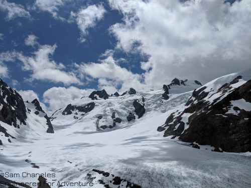
Finally, we got a view of the Blue Glacier and the alpine realm…WOW was it magnificent!
From Glacier Meadows, the trail climbs along a gradual ridge to an overlook of the Blue Glacier. From the ridge, one must downclimb on loose rock and choss to gain the Blue Glacier. There is a faintly marked cairn trail that leads to a handline; this handline is very useful for managing the loose rock and dirt down towards the Blue Glacier. Our GPX track shows the rough location of this downclimb.

Once on the Blue Glacier, I strapped on my microspikes, appreciating some traction on the bare glacier. Looking up towards the Snow Dome, I could sight our path, winding to climber’s right of the icefall before swinging back left below the Olympus massif.
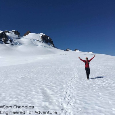
It was a BEAUTIFULLY clear day…barely a cloud or two in the sky. Justin and I cruised across the firm snow of the Blue Glacier and began to climb up towards the Snow Dome. There was a brief rock scramble transitioning from the Blue Glacier up to the Snow Dome, but with trail runners it was a breeze.
On the Snow Dome, we hooted and hollered! This was AMAZING! We passed a group from the Mazamas and chatted with them briefly.
The Snow Dome gradually climbs up towards the southern base of the Olympus massif. From the slopes of the Snow Dome, it is best to find a crossing of the bergschrund and cross over to the SE through a col, then to gain the summit block of Olympus from the SE.


It is possible in the early season to climb the Olympus massif directly from the north, without passing through the col, but it is steep, exposed, and has run-out directly into a bergschrund below.

Justin and I crossed over through the col and continued on up towards the summit block. The summit block is crumbly choss, and by many is rated at Class 4/low-grade Class 5. We brought harnesses and a rope for security, and I was personally very glad with that decision. Climbing and scrambling on tired rocks in trail runners would have been dicey…
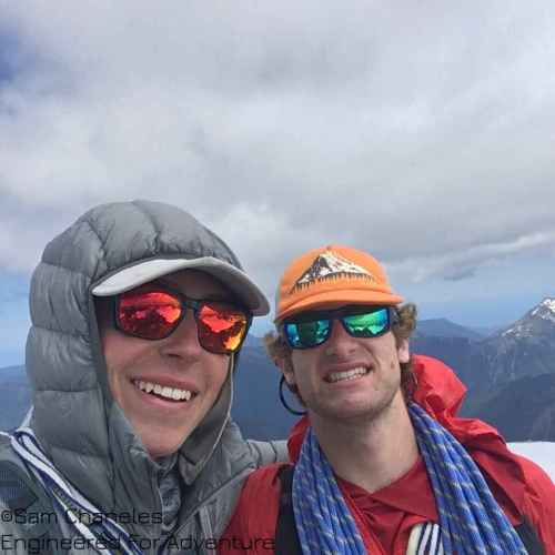
FINALLY! At 11:45 AM, around 9.5 hours after starting, we were on top. WOOHOO!


|| MARCHING BACK DOWN ||
Now for the rough part…22 miles and over 8,000′ back down to the car. Can my knees yell OUCH?!? The jog back down the Snow Dome and along the Blue Glacier was soft and pleasant. Justin and I even got some butt sliding in on the Snow Dome. But I won’t lie, I began to BONK once hitting the trail again, especially once we were back down to the footbridge. My mistake? I didn’t bring the right types of nutrition. I brought WAY too much fat and protein and not enough carbohydrates. I initially laughed at Justin as he brought candy bars…but on mile 40, when all I had in my pack was peanut butter and Rx bars, I wanted to puke. My stomach couldn’t handle the complex food sources I was giving it. I lagged around an hour behind Justin, as he cruised the final 13 mile stretch back along the Hoh River…meanwhile I marched in pain and agony, mostly at my stomach. My legs had nothing left to give, not because of muscular fatigue, but rather, because of a lack of fuel.
Back at the car, I looked at my watch. 18 hours round-trip. I can do better than that! Have to come back again…
 Sam Chaneles


