Trip Report
Mount Garibaldi/Brohm Ridge
Successful climb of Mt Garibaldi via Brohm Ridge/NE face
- Sat, May 27, 2017 — Mon, May 29, 2017
- Mount Garibaldi/Brohm Ridge
- Climbing
- Successful
-

- Road recommended for high clearance only
-
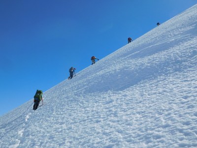
The Warren Glacier was generally in good condition. We had to skirt several crevasses and cross one on a good snow bridge. Made a descending traverse to approximately 6800ft where we climbed the shoulder of ridge leading to the NE face. Climbed NE face mostly climbers left to avoid crevasses on the right side. At the bergschrund there was a significant moat, dropping probably 20 feet, with upper portion 6-10 feet above the break. The standard route to climbers left up onto a snow ramp looked good from below but from the moat one could observe severe melting from the backside such that the snow bridge to the ramp was not safe and not protectable as the top section of the slope was cracked and likely would not have accepted a picket. A group of skiers was probing the climber’s right side of the moat for a way up but that proved to be unsuccessful. Instead, the team focused on the center portion of the upper slope. The moat was only about 1-1/2 feet across but the opposite snow wall was about 6 feet high. We cut some steps into the snow wall and shoveled out the top of the wall to form a small platform. A skier donated a pair of skis to use as a bridge across the moat. Leader belayed the team across. The rest of the way to the summit was straightforward. On descent the team made a short rappel across the moat. We avoided the steep descent down the ridge by descending more to skiers right but still had to negotiate several crevasses lower on the ridge line. At the edge of the glacier we stopped at a rock island to make water for the team. Time: camp to camp 15 hours.
General Activity Notes:
Much of this approach follows an abandoned road to an abandoned ski area (4900ft). Multiple groups of skiers and snow-mobiles. We were the only party on snowshoes/foot. Most of the approach followed a well-established snowmobile/ski track to Brohm Ridge. Camped just below ridgeline at 5560ft. Followed the ridgeline over Brohm Peak to the edge of the Warren Glacier at 6860ft. We were actually a little high on our approach – would have been better to gain the Warren Glacier at 6700ft. Terrain features forced us lower anyway.
Permits required?
None. We camped outside of Garibaldi Provincial Park so no permits necessary. Passports required for entrance into Canada.
Driving / parking notes:
We used the Cheekeye Forest Service Road (Cat Lake road), as described in Alpine Select. This road was described as requiring high clearance vehicles. I would add that 4WD/off-road vehicles would be preferable. One vehicle was stopped by high rocks about a quarter mile from the eventual hiking point. Second vehicle was stopped by snow at 3340ft. This added about 2.25 miles to our expected approach hike.
According to snowmobilers, there is a different branch road that they use with their rigs. They told us that the first left after exiting Hwy 99 would lead to a serviceable parking area (distance unknown). We met a group of snowmobiles joining our section of the road at a branch located at 3720ft.
Equipment notes:
Carried and used ice axe, crampons, ropes, picket. Carried but did not use snowshoes.
 Curtis Stock