Trip Report
Microwave Hill (Keechelus Ridge)
Interesting route for snowshoers, with great views on top. Snowmobilers like the top of Microwave Hill too!
- Sun, Mar 11, 2018
- Microwave Hill (Keechelus Ridge)
- Snowshoeing
- Successful
-

- Snow and ice on road
-
We attempted to park at the junction of Kachess Lake Road and Road 4832, the standard beginning for this route, now that the Price Creek Sno-Park has been closed. This junction is one mile north of I-90 from exit 62. However, a snow berm from snowplows clearing the road blocked access to the parking area so our vehicle wasn't able to park there. (There is space about 6 to 8 cars there.) Instead, we parked near exit 62 in a plowed pullout approximately .7 miles away, and fortunately this seemed to be okay as we were not ticketed or towed.
Keechelus Ridge/Microwave Hill snowshoe March 11, 2018
Conservation Northwest is currently asking their volunteers who have animal tracking expertise to record GPS coordinates of tracks in snow of certain species on Keechelus Ridge, which is the ridge between Lake Keechelus and Lake Kachess, north of the interstate. So on March 11, I joined an animal tracker in snowshoeing around Keechelus Ridge in search of animal tracks. This was a fascinating trip! I looked at my surroundings with new eyes, searching for traces of wildlife. Every dimple and contour in the snow promised to reveal the forest's secrets. Did I see simply a mark left by a tree shedding snow or was that a pawprint?
Road 4832 is closed to wheeled traffic and groomed for snowmobiles west of the posted sign. We had intended to go cross-country and break trail; however, given the adverse avalanche conditions, we instead opted for a route on the roads and across low-angle slopes.

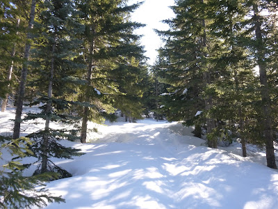
We snowshoed 1.5 miles along Road 4832, which was perfectly groomed and firm corduroy to Road 124, on our right. We then followed this unplowed road up to the false summit with the former tower which gives this hill the name "Microwave Hill" - this route is 6.5 miles one way to the top with nearly 3000 feet of elevation gain. During our snowshoe trek we kept an eye out for animal tracks. Snowshoe hare tracks - in the shape of a Y -were extremely abundant and in some spots, criss-crossed extensively. Busy bunnies!
I observed frozen crusty snow in the morning and drier, powdery snow at higher elevations, especially in the shade. Trees had dripped and shed snow, pocking the snow in wide circles beneath them.
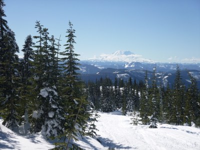
On top of Microwave Hill we had a leisurely break in the sun plus spectacular views, including Mount Rainier in all its majesty! We skipped the further half-mile hike to the actual summit, which was slightly higher than the radio tower station. Many snowmobilers were out enjoying the beautiful day. As we descended, given the warmth of the day and the bright sun, the snow became softer and wetter. By the time we returned to Road 4832, the snow was very soft and mushy.
We covered about 12 miles.
 Gabrielle Orsi