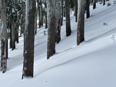
Trip Report
Kendall Trees (and More Trees)
Great day out in excellent early season conditions to explore the Kendall Trees/Knob/Stump area.
- Mon, Dec 12, 2022
- Kendall: Knobs, Lakes & Loops
- Backcountry Skiing
- Successful
-

- Road suitable for all vehicles
-
We were lucky to catch the area at the tail end of a colder period with soft, low-density snow and good coverage for early season. The PCT was well-trod by skiers and snowshoers, and an adequate but non-optimal skin track up to Kendal Knob was easy to follow. Creeks were still open or thinly covered in some areas, and a few crossings on the PCT required careful choice of location and then some sidestepping (on skis) to get up the opposite bank.
The snow condition deteriorated through the day as temperatures warmed, growing heavier at lower altitudes by the end of the day. Evidence of the warm-up showed on our descent — upside-down snow (high-density over low-density) visible on ski cuts, rollerballs/pinwheels, and large tree bombs.
Our plan for the day was to check out the Kendall Trees line (a conservative ATES L1 choice for the day) and see what else we liked in the area once we got a sense for the snow and terrain.
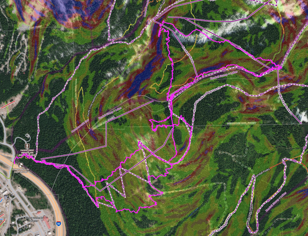
We parked across the road from Summit West around 7:45AM, and our party of two geared up and walked over to the PCT summer TH. From there we skinned up to Kendall Knob via the Kendall Stump approach (follows the PCT South and then heads uphill at the first switchback) along a well-established skin track. The track was somehow set to pass through lots of slide alder, had a somewhat uneven ascending pitch, and contained more kick and A-V turns than necessary versus just following the forest road, but complainers can set their own track if the existing one is really that awful… We enjoyed some great views from the ridge.
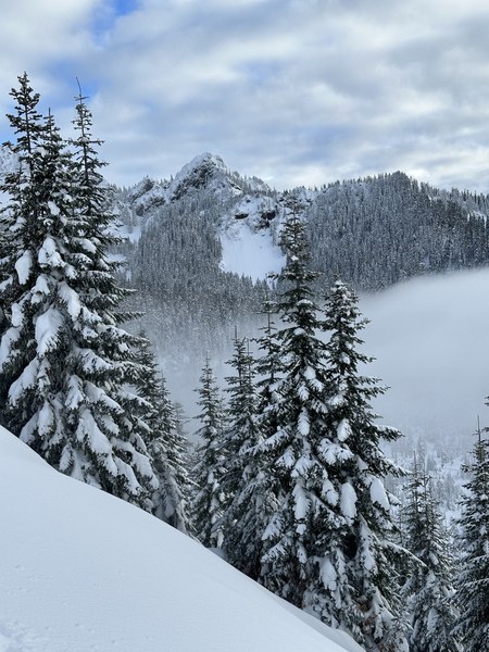
From there, we skinned rolling terrain WNW along the ridge to a high point at about 5050’ that is NW of where the Kendall Trees line is marked on maps, and we transitioned at a convenient spot. The snow along our ascent route was soft, dry, and fluffy all the way up with limited evidence of slightly higher density snow over lower density snow in some more open areas. There was evidence of light wind action but no evidence of strong wind action.
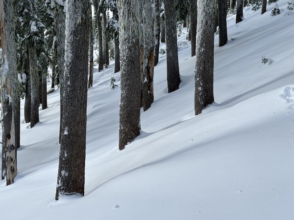
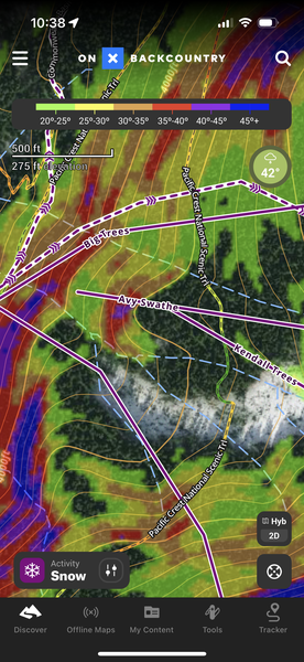
Our descent line had a relatively steep initial pitch with some small trees to avoid at the rollover from the ridge. There was some slough as we skied (to be expected given the pitch) and additional visual evidence of upside-down snow, but it didn’t run or propagate. We approximately followed the drainage through large trees and then through some small clearings down to about 4000’ where we cliffed out. (The cliff band shows obviously in higher-resolution slope-angle shading but not in lower-resolution views.) We traversed skiers left across what was marked on maps as the Kendall Knob line but didn’t see an obvious way to continue our descent to all the way down to Commonwealth Basin. (Our goal had been to ski down to the Commonwealth Approach track.) Staying well right (trending to the bottom of the Big Trees line) would have been preferable.

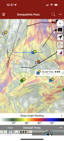
There is an interesting difference here between sources of data/beta for the ski lines in the area. The Rakkup version of the Matt Schonwald/Beacon Snoqualmie guidebook marks the Kendall Trees line as extending from ~4700' to ~4300' — well short of the cliff band we encountered — while the OnX version marks the line as running from ~5000' to ~4200' with the nearby Avy Swathe line continuing all the way to 4025'. The lower resolution slope-angle shading in the Rakkup data does not show the cliff band, while the higher resolution slope-angle shading in the OnX data does. (Rakkup is on the left, and OnX is on the right below.)
 |
 |
After searching briefly for a way past the cliff band, we put skins back on and took turns breaking trail in deep snow back up to what is marked on maps as "Kendall Knob #2". (There is supposedly a path through the cliff band that is passable in later season.) Our plan was to ski either the Kendall Stump West line or the Kendall Stump East line and then pick up the PCT back to our start point as needed. With a little more warmth and some sun peeking through, the trees started dropping big bombs, and we left helmets on for our ascent. We ripped skins at the expected high point, but navigational challenges brought us to a line about halfway between the two that was completely clogged with 20’ trees at an impenetrable spacing. We begrudgingly put our skins back on and skinned up to our ascent track. (Apparently, the West line does "go" as marked later in the season but is still somewhat sporty and schwacky as the smaller trees have gotten bigger over the years.)
We ripped skins again at around 4660’ and skied fall line along the toe of the ridge until we met the road at 4380’. We followed the road, dropping fall line at the hairpin at 4250’ and working through tightening trees between the two drainages. The snow here was noticeably different, with large rollerballs (verging on pinwheels) from our slough and pronounced evidence of 4-8" of higher density snow over lower density snow below from our ski cuts. The line was narrow and sporty with a few spicy spots (e.g., rollable 4’ drop off of snow-covered old growth log down across the slope), but it did “go”. The snow got even heavier as we got closer to the PCT (making the tight terrain more challenging), and the air grew foggier as we descended.
We hit the PCT at about 3200’ and skied out to the TH with a modicum of shenanigans at some creek crossings.
 Paul Brown