Trip Report
Junggeselle Peak and Swallow Tail
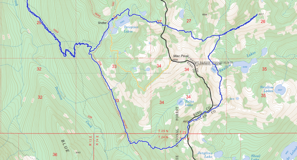
Circumnavigation of Mac Peak to tag two seldom scrambled summits.
- Sat, Sep 14, 2019
- Surprise Lake & Mountain
- Scrambling
- Successful
-

- Road suitable for all vehicles
-
The road to Tonga Ridge gets an A+. Tonga Ridge trail is great except the last mile to Deception Creek Cut-Off TH gets a bit brushy. Cross Deception Creek on a footlog; there's a sign leading you to it.
Another wet front due to arrive Sunday had me cancelling yet another overnight scramble trip. Such is the story of the Summer of 2019. This one would have been great to split up over a couple of days, but I set my alarm for 3:45, not wanting anything to do with what was forecast for Sunday. As it turned out, everything was wet anyway. Not a dry leaf in the forest. I would have to put up with waterlogged shoes and rain pants for the entire day.
I started on the Tonga Ridge trail at 5:50am. An hour and a half later I crashed out of the brush at the other end of the trail... at another trail head! A true face-palm moment. But it is a nice hike over Tonga. Now from where I should have begun the day, down into Deception Creek where I crossed on a very low "footlog." Up the other side of the valley is one of the finest trails I have ever hiked. Not brushy, clear of all downed trees, no rocks, and cushy.
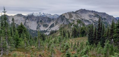
After a mile southbound on the PCT, and only passing one thru-hiker, I started eastbound up the wet, steep, brushy side of Junggeselle Peak. Using trees to pull myself up the steepest parts, crampons would have been sweet here. Everything was so wet and slippery! But only 2,000 feet up, and once close to the ridge it opens up granting views like this one south, toward Granite Mountain and French Ridge.
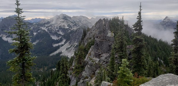
It is important to stay west of the gendarme on the ridge when coming this way. There's a steep, but open slope that leads to a saddle, granting easy access to the summit. This also grants easy access down the other side of the peak, and I had another peak to visit; Swallow Tail. I have left my home three times already this year with plans to get to Swallow Tail's summit. It was always too far, or too brushy, or running out of daylight, or whatever. Today, I would not be deterred.
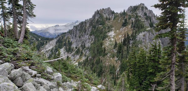
Pictured above is Junggeselle from the east. Summit on the right, gendarme on the left. Two saddles over is a fine valley leading to Swallow Lakes. I found granite boulders solidly set in-between grasses. No moss on these rocks! Fun and fast. It started to rain as I passed the uppermost Swallow Lake. Once on the ridge of Swallow Trail, there's an impressive gash in the earth that creates an impressive wall. This is where the scrambling begins. I followed a few ledges and scrambled a bit of rock, but was quickly through the cliffy section and on to the broad, easy summit at long last! Pictured below is Swallow Tail. Behind it on the left are Thor and Thunder.

The summit register showed a serious lack of visitation. I was only the seventh entry in 15 years. After making my way back to the saddle on the western side of the peak, it was back uphill and then across the steep north face of Mac Peak. I stayed a little lower and found it easy. There was a large, hardy snow patch hanging on so late in the summer. I crossed another easy boulder field and up the ridge guarding Deception Lakes. The lakes were strangely quiet this Saturday evening. Still and beautiful.
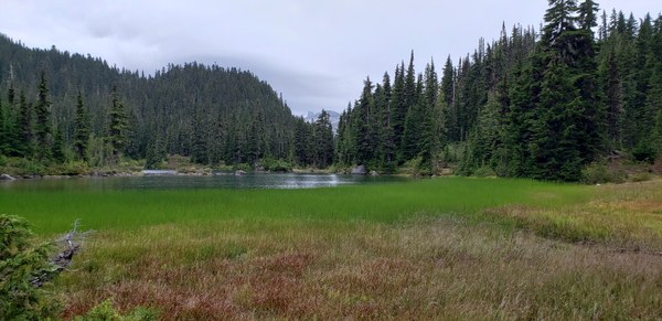
Now, I had a long way yet to go. After passing half-a-dozen thru-hikers in a quarter mile, I jogged down the good trail to Deception Creek. My legs screamed while hiking up to the Deception Cut-Off trailhead where I found a couple who shared their story of picking mushrooms and getting stung by bees. They had beers and snacks and looked to be having a great time. My legs weren't having a great time. I still had 4.5 more miles to go up and over Tonga Ridge to the car. With much determination, I made it just as the last light was gone from the sky.
GAIA GPS track here. 26 miles, 7500 gain
 Brian Hill