
Trip Report
Intermediate Ice Climb - Mount Hood/Devil's Kitchen Headwall (variation 2)
A pretty tough 16-hour day with non-stop strong winds virtually all the way through, spindrift in the eyes, and an occasional apple- to grapefruit-sized cannonball to dodge. Practiced placing sketchy pro in rime ice and not-so-well consolidated snow. Miraculously managed not to get blown off the ridge, and finished up DKH V2 with a version of the Wy'East crux traverse that ended up being a tad more sketchy than it needed to be.
- Sat, Feb 22, 2020
- Intermediate Alpine Climb - Mount Hood/Devil's Kitchen Headwall
- Mount Hood/South Side
- Climbing
- Successful
-

- Road suitable for all vehicles
-
Ice on the approach, but could boot it all the way up (some parties did). Cold and windy. Snow on the route not very well consolidated, no alpine or water ice, just brittle rime. Route not currently protectable, but low angle enough that you can solo.
After seemingly endless storm cycles and cancellations, finally we got the much-awaited weekend weather window following several days of clear weather. The avy danger level was "low" (to the extent that it ever is, given that the summit of Hood is blowing all the time and officially outside of the NWAC forecasting zone). No precip for days leading up, ~18F temps at the summit down to single digits with wind chill, really about as good as one can hope for at this time of the year. All the major technical routes on the South side (DKH v1, v2, v3, Steel Cliffs) had been climbed in the weeks leading to the climb. Not exactly "in", with concerns about being unprotectable (which was our experience as well), and some deep snow wallowing, but evidently all doable at the moment.
Friday was definitely looking better, but we lost the third climber in the last minute, so we had to go with Saturday as the only remaining option.
The forecast for Saturday was not perfect, with storm rolling later at night and some uncertainty in the forecast, showing up to anywhere between 20mph to 35mph winds, on and off, and up to an inch of precip depending on which source of forecast you choose to trust (mountain-forecast.com was looking good, but I've had questions in my mind about it for a while). The inconsistency across various sources, and the fluctuations in the forecast, were raising concerns about weather being somewhat unstable. The primary concern here was a possibility of encountering windy conditions, which turned out to be spot-on, as that's exactly what we found.
But, it did not look too terrible overall, and the worst of the forecasts (one from NOAA) had been steadily improving over the 48 hours leading to the climb, a reassuring trend. We had a team of 4 signed up for Saturday, the team was solid and confident, and the stoke was high, so we decided to give this one a shot.
Two of us left 5:30pm from Seattle. We merged into one car at 7pm in Tacoma. Little traffic down from Tacoma. With a couple of stops switching drivers along the way, we made it to Gresham by around 9:30pm, and started looking for a place to get the one-day parking permit, which was said to be available at pretty much every gas station (or according to locals, at Safeway, but as we found that is not really true past 9pm in the evening, as the customer service desk is closed for the day).
We swung by a few gas stations, looking for the permit. We noticed an interesting pattern. All gas stations in Oregon are guarded by a chill bearded dude, smoking and drinking a lager by the entrance. Eventually, we found luck at a Kane Drive Plaid Pantry, which is open 24/7, and on the way to the mountain, so that might be my favorite place to get it from now on. Huckleberry Inn also allegedly has permits, but on the off chance they may just happen to run out, I think it's best to get one ahead of the time in Gresham, where multiple backup options are available.
After getting a permit in Gresham, we drove to the Huckleberry Inn in Govt Camp to get some nice giant omelett breakfast before the climb. We made it there in the ballpark of 11pm, which was just about the right timing, leaving enough to eat, rest, and go through several coffee refills. I hadn't gotten much sleep the night before, so the coffee was very much appreciated. I left my hash browns behind, and that was a mistake. I burned through all the calories in my omelett in under 2 hours, and by the time we topped out Palmer, I was already hungry as hell.
The lot at Timberline is only 15 minutes from the Inn, we made it there at midnight, as planned.
Now, this may seem super early, but it really isn't. Don't make plans for a February climb of a technical route noone in the party had climbed based on trip reports of the Basic route in summer conditions. As it turned out, given the conditions we experienced, the timing was spot-on. Shortly after we had arrived at the lot, a couple of other parties also started rolled in.
As it was late, and after a long drive, everyone was hitting a low point, so getting geared up and prepped took us longer than anticipated. We hit the start of the snow cat track at 1am sharp.
After pondering for a bit, we decided to use snowshoes. One could've gone either way, as the snow along the cat track was quite consolidated, and based on the trip reports, we wouldn't expect to be post-holing more than an ankle-deep. But, snowshoes with their heel raisers made it more comfortable to walk, and their crampons definitely helped on the icy patches, which extend almost all the way down to the Silcox Hut, so in retrospect, this was the right call.
We gained the 1000 feet to Silcox in about an hour, by around 2am. One the way to Silcox, one of our climbers wasn't feeling well. He pressed on to Silcox with team encouragement, but it wasn't getting better, so the climber decided to turn around, and has generously offered to wait for the rest of the party to complete the climb (thank you).
We contemplated going up with only one rope, but decided to keep both to have options. This was a good call, as having only one rope for a party of 3 really doesn't make sense on this route. More on this below.
As we moved past Silcox, the wind started to get more severe. Strong enough to blow bursts of lateral spindrift into our eyes, and occasionally strongly enough to get tipped off balance while walking. Made for pretty slow progress, and to the point where later on the approach, I had thoughts of turning the party around if it got any worse, but decided to press on for now. It was supposed to get a little better later in the day, but with the exception of the short stretch in the coulour in DKH, it never really got better (and the summit was definitely blowing hard).
With the wind slowing us down, and the past couple of months of madness at work getting in the way of conditioning, we were moving slow. It took us ~1.5 hours to negotiate the 1600 feet from Silcox to the top of Palmer. We arrived there at 3:30am, and took a 20-minute break while I had another breakfast, and finally decided to put on a hard shell for the upper part of the approach, as the wind had been blowing through all my soft layers. The doors to the inside of the structure were protected by an unlocked shackle. You're not really supposed to go in, but it was comforting to know that if the weather were to get really severe, the structure could possibly offer an option for an emergency shelter some 2500 feet above the parking lot.
We arrived at the beginning of the traverse at 9500 feet at around 5am (so again roughly traveling at approximately 1000 feet/hour). As it was windy as hell, any extended stop risked freezing solid and there wasn't really any good stop sheltered from the wind, we decided not to gear up just yet, and keep pushing to a flat spot in the Devil's Kitchen, hoping for some relief from the Crater Rock as the wind at that time was mostly Westerly (although it varied throughout the day, and it was later inconveniently blowing from the East by the time we made it to the Wy'East traverse).
A bit of fatigue was setting in, wind was hauling, and the going from there got slower, so it took over an hour to negotiate the traverse to a flat spot in the Devil's Kitchen. We arived at the flat spot at somewhere in the ballpark of 6:10am, ditched snowshoes and hiking poles, and put on harnesses, all the gear, crampons and all the layers everyone brought, but decided not to rope up just yet mostly because by the 30 minutes of time it passed as we were doing all the above in the cold, with clumsy fingers and clouded mental status, we were freezing freaking cold solid, and we badly needed to start moving as soon as possible to avoid getting hypothermic. We started moving again at 6:45am, only about 15 minutes before the sunrise.
Here is the overview of the route we climbed, with the flat spot in the Devil's Kitchen area at the bottom of the picture:
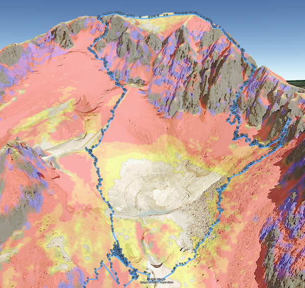
As shown above, we made a decision to go around the Devil's Kitchen counter-clockwise, in part because the high clockwise traverse I've done 3 months ago seemed a bit of a PITA, and in part because it seemed shorter this way, and certainly in large part because a party heading for DKH V4 just ahead of us had conveniently started making a bootpack through the fumaroles, which we thought was a pretty sweet deal at the moment (and spoiler alert, that was a wrong call).
First, as we started making our way up towards the East rim, the snow was pretty solid to walk on and we thought of cutting through directly to V2 in a straight line of sight. After 15 minutes of moving, at 7am with the sun coming out and lighting up our route, the incredible awesomeness of the place totally compensated for all the hardships we experienced getting to that point.
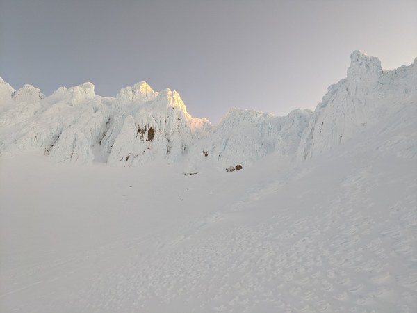
It's worth pointing out that this picture was taken at 7am, around 6 hours after we hit the start of the snowcat track. With our 12am meet up time, we were expecting to make it to the base of the couloir 30-60 minutes before the sunrise as it just starts to get bright, and we ended up getting there a good couple of hours behind the schedule. The idea one can make it up in 3 hours in these conditions is a pure fantasy firmly disconnected from the reality we experienced, so beware, and make sure to plan conservatively. Time margin is your friend.
Continuing our story, the draw of the route lit by the sunshine was strong, and so we decided to split from the boot path made by the party heading for V4, and tried a lower traverse that more directly led towards V2 after roping up.
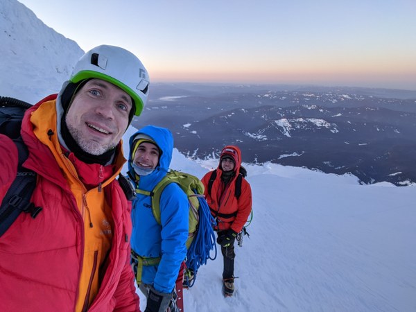
After a brief walk, we were warming up again, and we were totally pumped to crush this climb:
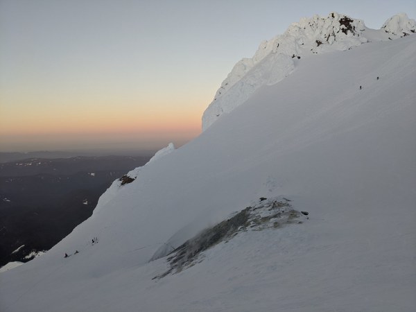
A quick look back at the folks making their way up Hogsback:
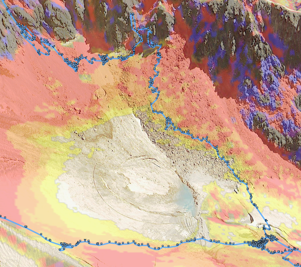
The lower traverse soon turned out to be a mistake, as the hard surface turned out to be thin and treacherous crust covering fumaroles, with holes running radially through towards the center. I have almost fallen into a fumarole, and was just lucky enough that I was walking tentatively, and managed to stabilize myself and pull away from the sketchy area with ice tools hooked on the harder snow while lying down, trying to spread pressure over a larger area so it doesn't break any further. That beautiful uniform white snow surface covering the middle of DKH is treacherous as hell, and indeed, quite aptly named.
From that point on, I had to probe most of the way for every step with the shaft of my tool except for scattered patches of snow that clearly looked solid. That, and zigzagging around fumaroles, took a long time, and in retrospect, unless you're going for V4, going clockwise and doing the high traverse from the Hogsback is definitely the way to go, so this is what I'll be doing consistently from now on.
Here's our circuitous and slow path around DKH to the base of V2:
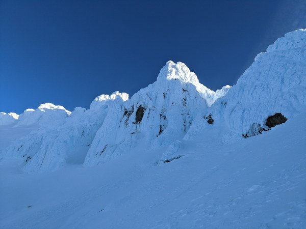
As circuitous as it was, it was great to have the base of the route in sight:
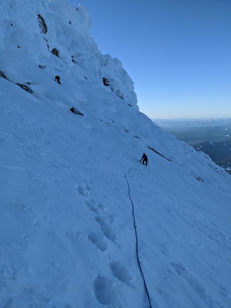
Downclimbing from a high traverse near V3 to avoid the fumaroles lower down:
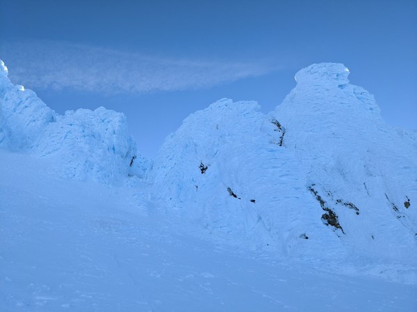
A final stretch, approaching the base of the route:
Finally, by sometime around 8:15-8:30am, a pair of short screws was going into a smear of what looked like just marginally less sketchy patch of ice at the base of the V2 couloir. Obligatory selfie to celebrate this important milestone:
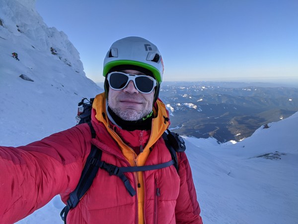
Shortly thereafter, about 2 hours after gearing up (yup, no kidding, it took this long), the 3 of us were standing at the belay anchor, stoked to finally get on the route.
Sadly, I was in for a nasty surprise, as my sunscreen had frozen solid and wouldn't come out from the tube. A dumb rookie mistake. I was in for a bit of a sunburn, a well deserved punishment. Note to self to carry the damned thing in the jacket pocket to keep it warm.
Now, as far as pitching out we had a bit of a conundrum. Normally, having 3 climbers in the party would not be much of an issue, as one can always tie mid-point and break into smaller pitches. But, from what we have read in the trip reports, and what we could see looking at the route, doing short pitches was going to be problematic, as the protection opportunities looked scarce to nonexistent, and thinking you can choose the place to place pro where you want it was clearly not thinking straight.
We've spent a bit of time discussing a range of complicated options, including cowtails and other exotic ideas. As the rat's nest on the belay anchor started to emerge, eventually common sense kicked in, we decided to cut this short, and eventually converged on what should've been the only sensible option from the start, which is to use both of the ropes we had been carrying, with the middle climber tied to both of them. The only excuse we have is the cold numbing our brains.
Finally, by 9:15am we started moving. Here's the route we climbed.
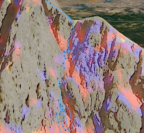
It's just about 2 rope lengths overall, but then again, it's not clear that having rope on this climb was actually a benefit. Honestly, it seemed like more of a liability, as the dubious pro we placed was going to maybe hold a mild slide, but almost for sure it would not hold an actual fall. One climber soloing the route bypassed us as we climbed, and this is probably what we should've done as well to keep the pace.
Anyhow, the first half of the route contains a small step over barely covered rocks that requires an easy mixed move. Much of the second half is poorly consolidated snow with an occasional chunk of rime that you can hook with a tool. Pounding into it tends to shatter it.
A look down on the first step:
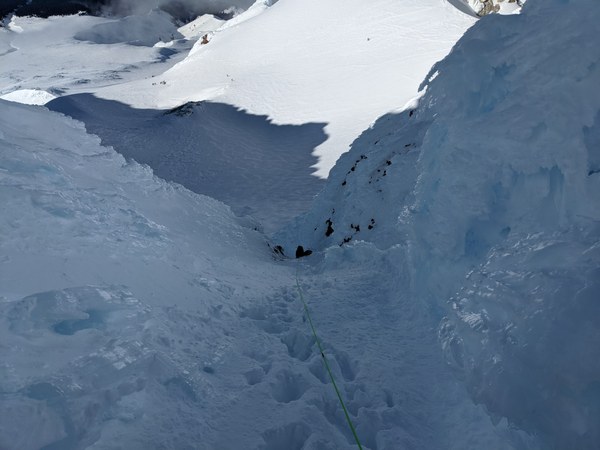
There wasn't really anything in the way of a proper alpine or water ice on the route. It was all sketchy at best, and not really protectable, but low angle enough that soloing it (which is effectively what we were doing while dragging rope along and poking holes in the rime) seemed reasonably safe:
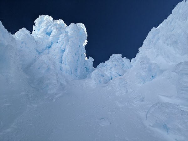
Finally, the knife edge ridge. We momentarily forgot about the wind while in the couloir as it was sheltered, only to be reminded of it after topping out. Now, it was blowing hard again, and having stopped, it was quickly getting chilly (although sunshine was helping a bit).
Nothing but unconsolidated powder at the ridge, but for what it's worth, a semi-legit anchor out of a pair of deadman pickets buried as deep as they go went in, and soon after, everyone was up.
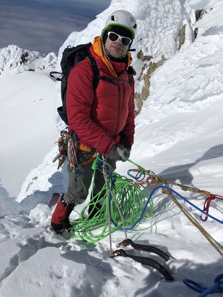
We have been moving slow, and it took almost 2 hours for all of us to top out. It was approaching 11am at that point. Behind the schedule, but still with several options ahead.
The first and the default option was to continue along the Wy'East route to the summit. Despite having previously been keen on tagging the summit, I was not in love with that option anymore in the present conditions. Fatigue was setting in, and I felt my legs were getting a bit wobbly. The wind at the knife edge ridge was blowing hard, which combined with the fatigue setting in seemed concerning because what lied ahead of us was a sketchy, unprotectable traverse along a no-fall zone, where you can't afford to make any mistakes. Furthermore, as we got behind the schedule, at 11am on the Eastern aspect, the sun had been cooking the snow for 4 hours, softening it up. Not good.
The backup option was to move a bit down the ridge and down-climb the V3 variation, which we knew was easy, as Portland Mountain Rescue reportedly downclimbed it no fewer than 4 times just about a week before while scoping out the technical routes. Having studied the topo of all the routes and all trip reports extensively, I felt it was the safest choice given the circumstances, but as we didn't see any boot pack going South, the group was concerned about missing the top of V3, going down the wrong couloir, and getting ourselves into a pickle.
I realized at that time that I had made a mistake of not covering this option extensively beforehand with the group. For posterity, this is what it looks like from bird's eye view. It's the first wide couloir you run into while going South (from the top towards the bottom of the picture), it's very large and distinctive, it's right at the sharp turn on the ridge, and you can't really miss it:
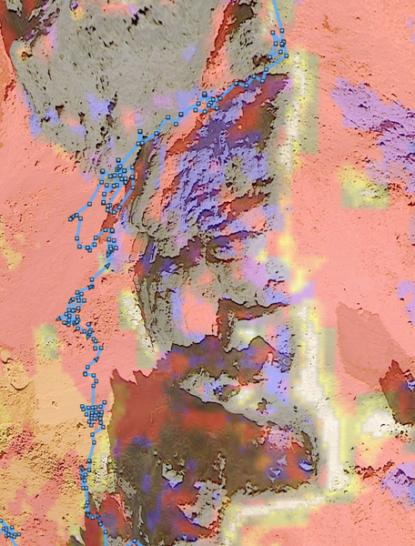
The third option was to go all the way down the entire length of the Wy'East route towards the base of Steel Cliffs, which after dropping down the ridge is mostly a broad 40-45 degree slope, not very exposed. That said, again, the mistake I made not extensively discussing all of the available retreat options with the group bit me in the butt. A note to self, the breakfast at the Inn is a great place and time to do this.
Now, a few folks ahead of us just followed the Wy'East crux traverse towards the summit, so there was an established booth path to guide us through it. The presence of the bootpath made it seem like the least risky option, so after some discussion, we made a group decision to go for it and tag the summit as originally planned.
Placing pro wasn't really an option, as the route followed a steep snow slope, snow was not really well consolidated, and the occasional chunks of rime were too fragile to be of much use whether for screws, or placing slings around (mostly just broke off and shattered when hit by a tool).
We decided to stay tied to the ropes, and use counterbalance and terrain as a way of protection. Opinions varied on whether this was actually helpful or not (trending on "not").
The beginning of the traverse is probably the sketchiest mandatory part. It goes over a section of snow that sits over cliffs. The snow was steep, loose, and sketchy, and the wind was blowing hard. Blew one of the footholds getting over the hump. So good to have had 3 remaining attachments points to keep myself attached to the mountain. Not feeling super in a hurry to do this one again.
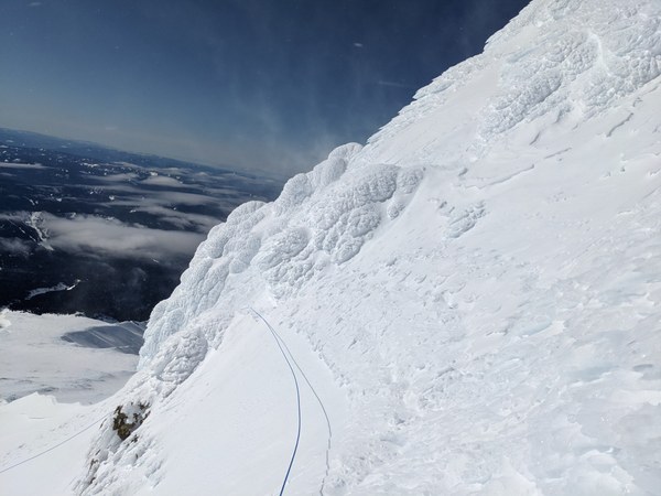
Beyond that lies quite a bit more, but it can be potentially less exposed if you read the beta and actually follow it.
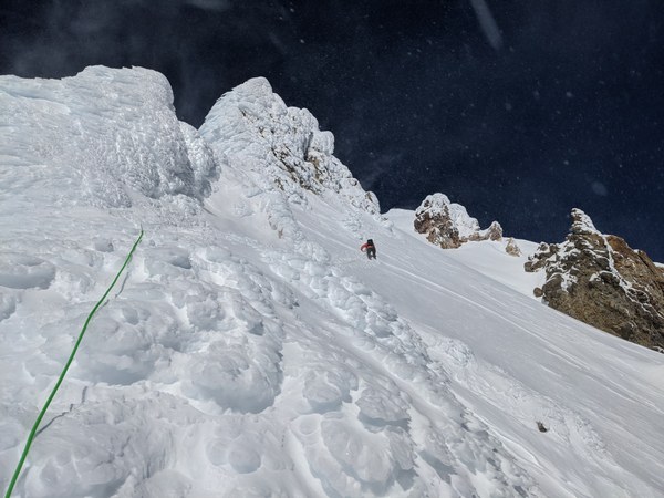
I remembered from reading all the trip reports that it's key to stay low on this traverse, and one should expect to move across a couple of shallower dead end colours before finally getting into the obvious wide summit couloir that tops out on the ridge. That's what I was expecting...
Unfortunately, the parties ahead of us that made the bootpack haven't read that advice, and did a high traverse on higher-angled terrain. Here's the version of the traverse we ended up doing by following the bootpath; missed the summit couloir entirely:
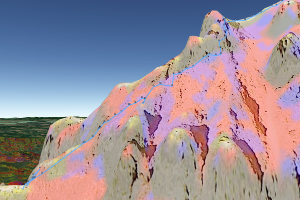
Here's the same from the bird's eye view, going left to right:
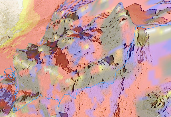
Anyhow, we made it. The entire crux traverse took us about 1.5 hours, we were at the summit at around 12:30pm. Quite a bit behind the schedule, but still quite reasonable and with a wide time margin for a safe descent.
After doing the Wy'East route, the catwalk was easy peasy. The conditions going down Old Chute were quite luxurious. No plunge steppable, but one can go down facing out, which is pretty good deal compared to 3 months ago when we had to downclimb 600 vertical feet facing-in on a hard-packed surface.
A little over an hour later, 1:45pm we took a break at the Hogsback. Going down was slow after all the effort we had gone through getting to that point. Haven't had the time to eat, and was running really low on fuel. Ate everything that was edible in my pack to get an energy boost for the rest of it.
Back to the snowshoe stash by 2pm, another break to degear, decrampon, unlayer, and repack for descent. Getting the crampons off my boots was a relief. Switched to snowshoes to help negotiate the icy surfaces. More comfortable to wear.
Back to cars 5pm, back home later in the evening.
Here's the entire route we climbed:
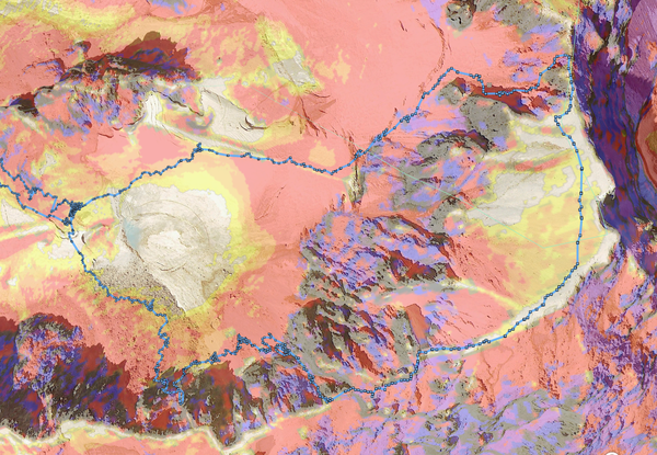
Overall, it was a long, over 16-hour day, and a tough one, but well worth it. Glad to have made it out, and would definitely do this again!
 Krzysztof Ostrowski