Trip Report
Intermediate Alpine Climb - Mount Triumph/Northeast Ridge
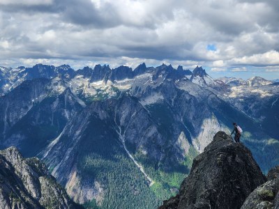
A full value climb of Mount Triumph's Northeast Ridge. The snow levels on the approach were significantly lower for this time of year and required navigating around a quickly growing moat.
- Fri, Jul 21, 2023 — Sun, Jul 23, 2023
- Intermediate Alpine Climb - Mount Triumph/Northeast Ridge
- Mount Triumph/Northeast Ridge
- Climbing
- Successful
-

- Road rough but passable
-
Thornton Lakes Road was steep and had lots of bumps/washboarding. A 4WD vehicle is highly recommended.
The snow levels on the glacier/snowfield were significantly lower for this time of year. Approximately halfway across the approach from camp to the notch there is a moat forming that requires a short jump and will likely be more difficult in the near future. The climbing route itself was in good condition, but did have its share of loose rocks and hollow flakes. There were lots of rap stations with rings/links and decent looking webbing/cord.
Distance: 17.3 miles
Elevation Gain: ~7,975 feet
Map: https://caltopo.com/m/1LLQP
Alex and I met at his place in Sedro Woolley early Friday and drove straight to the trailhead. Thankfully through North Cascades National Park's new Good Stewards Program I was able to print our permit in advance and did not need to wait in line at the WIC. The Thornton Lakes Road was quite steep at times and very bouncy even in Alex's truck. We were very thankful to have 4WD.
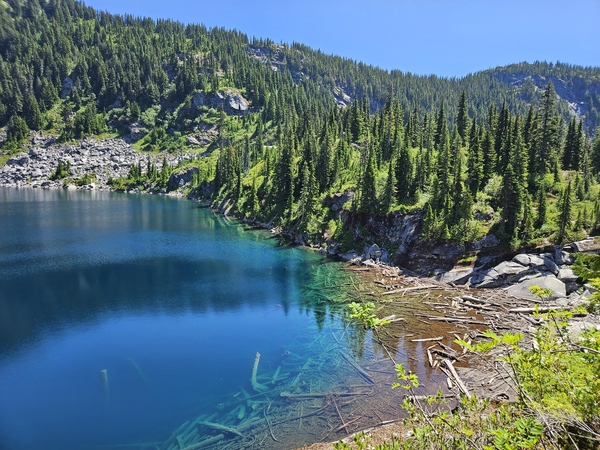
Once at the trailhead we distributed a few pieces of group gear and headed out around 9 AM. The first few miles of the trail went pretty quick and had several water sources interspersed. We were thankful to be in the shade until the Pass. Once we started heading down to the lower lake it started to get quite hot out.
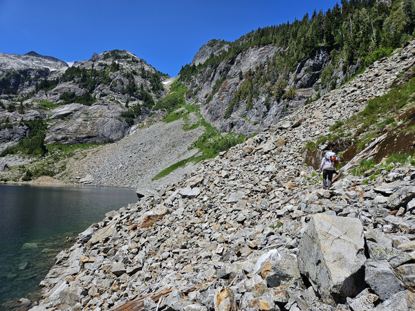
We took a quick break for lunch at the log jam crossing at the start of Thornton Creek around noon. Shortly after the crossing the trail became more of an overgrown climbers trail. It was relatively easy to navigate though there were a few side trails to avoid. After about an hour we reached the middle lake and took a quick water break. We began to work our way through the talus up towards Thornton Col. We found a small, hard to see cairn and started following the faint climbers trail nearby. At times the trail navigated through sections of long grass which made it easy to get off route, but after a grueling, hot 1.5 hours we reached the top of the col. Since there was plenty of water from a nearby block of snow and a nice breeze we decided to make camp. Our tent wouldn't perfectly fit in any of the dry tent pads so we ended up camping on a smaller snow patch right at the top of the col. Using bivys or a very small tent would be recommended if planning to camp here. We scoped out the route for a bit, made dinner, and went to bed to prepare for an early start.
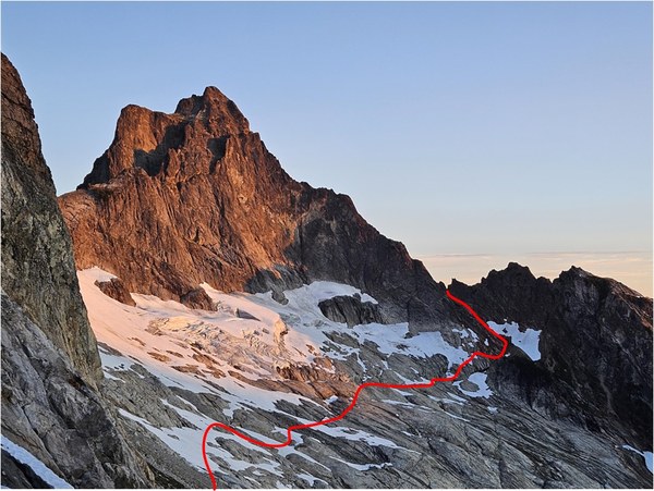
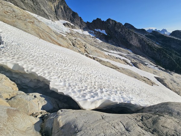
Saturday we woke up, had breakfast, and got moving around 6 AM. Right out of camp the snow was steep and firm so we decided to rope up and wear crampons. After ~250 of descent we reached talus and decided to remove our crampons and unroped. We slowly made progress towards the start of the climb having to navigate around a fairly undercut moat forming approximately 0.5 miles in. Due to the conditions we ended up doing a belayed jump across which thankfully was not too difficult. I would guess this will become more problematic in the next week or two. After this we followed a seam in the slabs up towards the notch, followed some snow, and traversed into the class 3 scramble up. Finally near the notch we ditched our snow gear and mountaineering boots and got racked up to start climbing the ridge. Another party of two from Portland showed up right after us as well.

Alex took the first lead and quickly got us off the ground around 9:30 AM. We led the route in blocks and ended up simul climbing a major chunk of it. The climbing was fun but you definitely had to look out for loose rocks and routinely had lackluster protection placements. I included a few good resources with pictures of the route below since I didn't have a chance to take many photos.
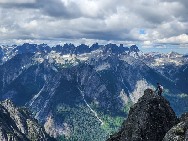
We reached the summit around 1:00 PM and celebrated by eating a quick lunch. Soon after the other party of two reached the summit and we discussed/decided it would be smart to descend together to ensure good communication between parties and allow for double length rappels. It also ensured that if one rope got stuck we would have another to continue down the route. We started down at around 1:30 PM. It was easy to lose count but I believe we ended up doing 11 rappels in total, 3 of which were double length. Thankfully we were able to scramble most of the interconnecting ledges which helped with time. One thing to note is that it was easy to get the rope stuck on several of the rappels when pulling the rope. We had a few times where it was fairly difficult to get the rope down due to it getting stuck on flakes and other features. Most of the rap stations appeared to be in good condition though we did add a new sling to one and backed a few others up with a temporary piece as a precaution. We reached the start of the route at around 7:15 PM and did one more, optional rappel to get back to our gear a little lower down the 3rd class ramp.
We changed into our mountaineering boots and began to retrace our steps back to camp. The walk back was pretty uneventful except we did have to find a way back across the moat. Since the gap was within a short jumping distance we again did a belayed hop across which definitely got the adrenaline going! We continued back up to the col reaching camp at 9:00 PM. It was definitely a full value climb taking us around 15 hours to navigate the snowfields/slabs (3.5 hours), summit (4.5 hours), descend (5.5 hours), and get back to camp (1.5 hours). We had some dinner and quickly went to bed.
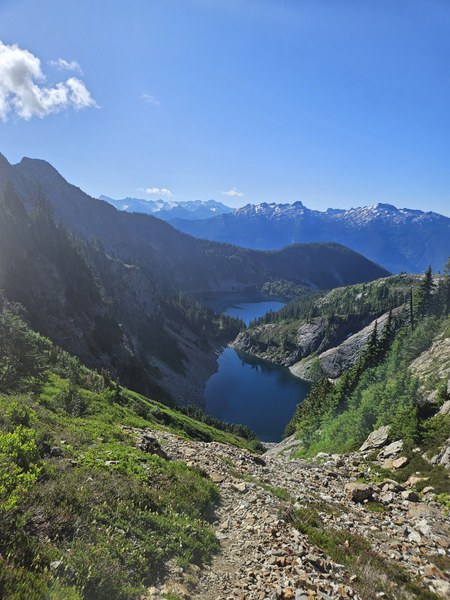
Sunday we ate breakfast, packed up, and headed out around 9:00 AM. We made good time back to the lower lake and had a quick break in the shade at where we had lunch the first day. We slowly ascended the 500 feet back out from the lakes and then trudged down the 5 miles back to the car. We ended up finishing the hike nearly at the same time as the party of two, so we traded info and celebrated with snacks together before heading home. We took the drive down the forest road very slowly on the steep sections and then grabbed a late lunch in Marblemount before heading home. All in all it was a fun, but very tiring weekend.
Rock Gear:
- 1 x 70m single rope
- Stoppers
- Singles BD #0.3 to 4 cams
- Singles Metolius offset cams
- Large number of slings (mix of singles and doubles)
Resources:
Some great beta on the route can be found on these two sites:
 Tim Schafermeyer