
Trip Report
Intermediate Alpine Climb - Mount Rainier/Kautz Glacier
A strenuous 2-day carryover with a 3-day worth of ballast.
- Sat, Jul 27, 2019 — Sun, Jul 28, 2019
- Intermediate Alpine Climb - Mount Rainier/Kautz Glacier
- Mount Rainier/Kautz Glacier
- Climbing
- Successful
-

- Road suitable for all vehicles
-
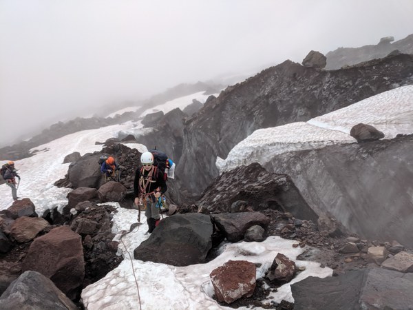
As noted in earlier reports, the Fan is melted out, so crossing Nisqually requires traversing at around 6800 to access the snow ramp higher up the glacier that connects Nisqually and Wilson. As we were crossing Nisqually in the fog, there were some route finding challenges involved, and we did encounter deep choco crevasses along the way, but overall it did not seem too bad, and I would expect it to remain crossable. Much of the crossing is on the rocks (PC: Craig Taylor).
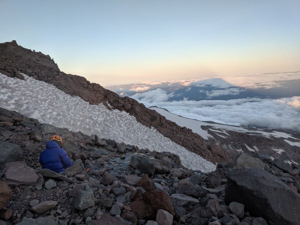
The camp at 10,800, where we spent the night, did have running water, but we did not find water at either Camp Hazard, or at the 13,000 camp at Wapowety Cleaver (PC: Craig).
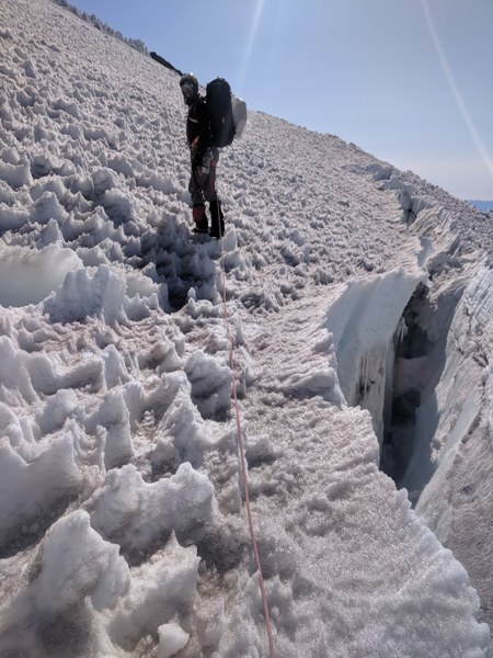
Higher up the mountain, getting from the top of the ice steps at 12,000 to the Wapowety Cleaver camp at 13,000 again involved some zigzagging around crevasses that added some mileage, but we weren't forced to cross any sketchy snow bridges on the brink of melting out - there were ways around with an ample margin. Here too, I would expect the glacier to remain crossable for quite a while (PC: Craig).
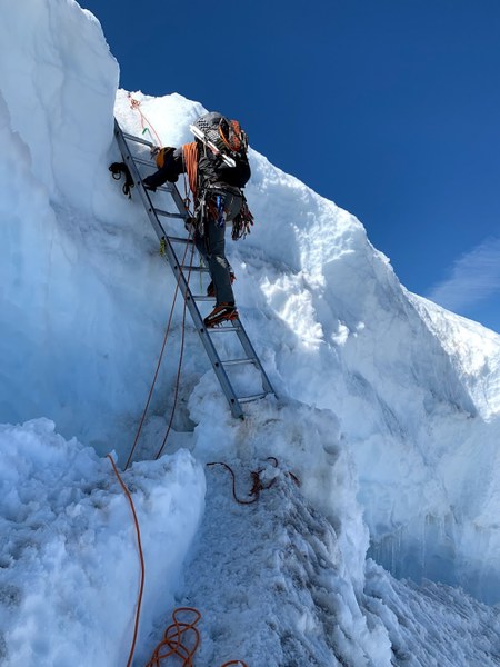
There is a handline and a ladder at 13,000 on the way down the DC to protect a small downstep, but nothing sketchy. Overall, a totally straightforward walk down a very well-established track, with fixed handlines in all places that could get spicier when iced up (PC: Annie Chen).
The original plan was for this to be a 3-day climb, starting at Comet Falls due to a concern about being able to cross Nisqually. We planned to get to the camps around 9,500 on the first day, rest and acclimatize there, and move the camp higher to 11,200 on the second day, and to do the ice pitches, summit, and get down on the third day.
First, we have switched to start at Paradise to save on elevation gain after seeing a couple of recent trip reports and GPX tracks that indicated Nisqually to be crossable. Then, we've decided to skip the rest day and just go for it on day 2, with the backup option to bivy at Wapovety, at the summit, at Ingraham flats, or at Muir in case we were to run out of steam. Along the way, we decided to just keep moving at each of the intermediate waypoints, and in the end, we arrived back at the cars one day early. It was a very strenuous trip, but well worth it.
Day 1.
We arrived at the Paradise ranger station around 10am. Doing paperwork took time. We set foot on the trail at 11am. Most of us decided to take the 1 lb hit and wear trail runners for the 4 miles or so that we were expecting to walk on the pavement (PC: Krystian Walec).
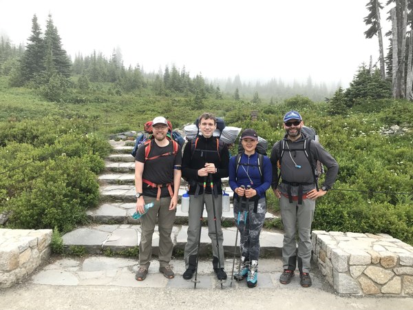
A day prior to the trip, I was content to get my pack down to a little over 30lbs. The morning of, I saw the number climb to infinity as I added more food, water, boots, and rope. There was food I did not eat, clothes I never wore, and comfort I could have done without. Live and learn.
From the trailhead, it took a little over 30 min. on the pavement to get to the spot where we begin to descend into the Nisqually basin and into a moist cloud of fog with somewhat limited visibility (PC: Craig).
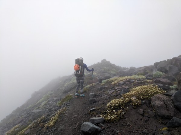
As the terrain became very slippery, we had to switch to boots at some point. In the end, I'm not sure I got as much mileage in trail runners as I had expected, but it was nice to have something to switch into in the camp while venting my boots.
It took another half an hour or so to get down to the stream crossing. We crossed the Pebble creek around 12pm (PC: Krystian).
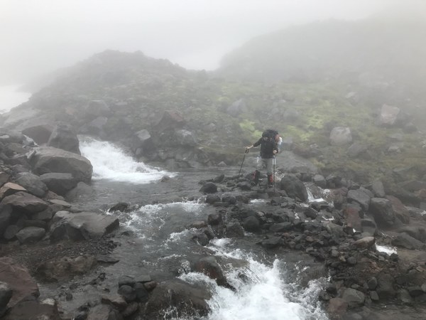
From there, we proceeded up along the mini-ridge structure at the lateral moraine on the east side of the basin. After another 30-40 min. of walking, right before the ridge turns, at around 6300 or so, we stepped down onto the snow and started veering left towards the glacier. We officially set foot on the ice at around 1pm (PC: Google).
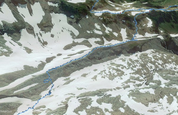
Having studied the route beforehand, we knew that we should be moving pretty much along the path of least resistance towards a snow ramp just north to a set of cliffs, but given the very low visibility in the fog, we could not see any of the landmarks, so we just kept a rising traverse veering climber's left while consulting the GPS along the way (PC: Krystian).
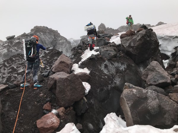
The terrain was a bit challenging and crevassed, so the route was a bit circuitous, and we had to backtrack in one or two places. After reaching 6800, we continued to move westward (PC: Google).
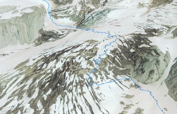
Eventually, we have seen the ice cliffs that clearly marked the northern boundary of our route, and a snow ramp to the left of the ice cliffs. We started ascending the ramp around 2pm (PC: Annie).
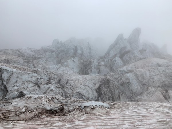
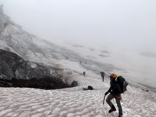
It took about 30 min. to get to the top of the shoulder at 7400. We took a short break there. Still very much in the fog. Another half an hour to cross Wilson, and around 3pm we were at 8000 on the rocks, on the ridge to the West of the glacier. Still in the fog.
From there, it was a slog in low-vis on mixed terrain for another 2 hours or so pretty much straight up North. We arrived at the first camps at 9200 shortly before 5pm, and this is when we finally emerged from the clouds, saw the sun and the broken-up glacier behind us.
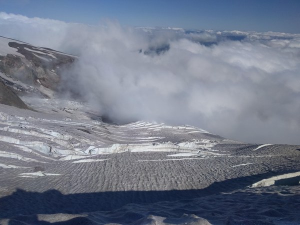
With the sunshine and a newfound energy it brought us, we continued on to the turtle snowfield towards the higher camps. The snow was getting a bit harder and easier to walk on, and the crevasses were easy to avoid.
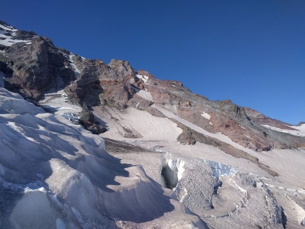
We have gained the ridge at 10,500 at around 7pm, and from there, it was only 15-minute walk to the camp at 10,800. As we found running water there, and we had no knowledge of water at Camp Hazard, we decided to stop and bivy there.
The camp consists of 3 narrow ledges next to a stream, one large enough for a tent, and two just barely large enough for a bivy bag. Since 2 of us shared a tent, and 2 of us slept in a bivy, that was actually just perfect. We found water trickling down the rocks just 20-30 feet from the camp spot (PC: Krystian).
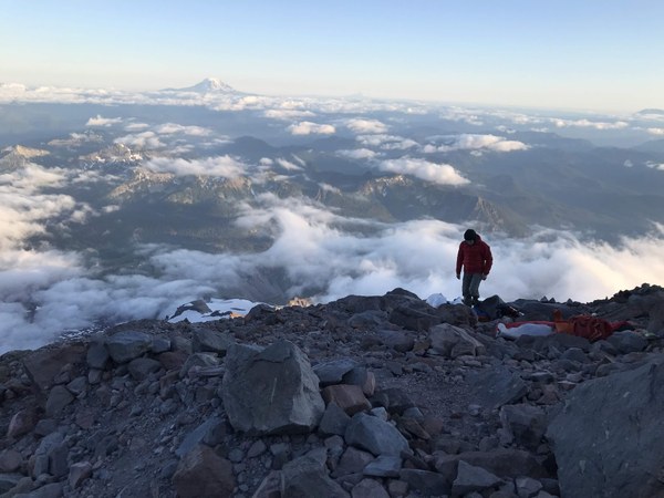
Our ascent so far was forecasted to be a leftover of a wet and windy period, with high winds that were expected to subside later in the afternoon, hopefully by the time we were expecting to get to the camp. Sadly, when we got there, the wind was still there, and continued for a few hours.
Setting up the bivy and sorting the contents of the pack in these conditions was a little bit challenging, and the camp offered very little protection. I had to secure my bivy bag with several draws around boulders, and even then, my bivy kept flipping arund like a spinnaker, requiring a bunch of heavy rocks on top to keep it in place. At some point, I almost lost of sleeping pad to the mountain. Not the greatest spot in this regard, but at least we had running water. In retrospect, all things considered, the way everything played out, I still think this was the best camp to spend the night at.
The water was icy cold, which posed a bit of a challenge. One of us brought a mini squeeze pump filter that was constantly freezing up and giving out little output. I had a Katadyn squeeze bottle, which would have been great, if not for having to duck my hand in the water to fill it up. Neither was ideal.
At dinner, we discussed plans for the next day. The original plan was to rest, but none of us really felt like spending the whole day at the camp. I had a moment of doubt, as I felt tired after the long approach, and we were leaving ourselves zero time to acclimatize. On the other hand, the weather forecast for the next day was great, and if need be, we had options, including a camp at 13,000 like the group a weekend before. After contemplating the pros and cons and a brief discussion, we all decided to go for it.
The wind had continued into the evening, and was still delivering gusts as we went to sleep around 8pm, which made things less than optimal. As I was zipping up in my bivy, aftre all the PITA of setting up the camp in windy conditions, the thought of having to get up at 3am in all this wind in the cold to break camp and move was a bit of a downer. The air temps were going up as predicted, though, and despite the wind, after a while I started to feel pretty warm and comfy in my 30F bag, wrapped in a light bivy, with a pair of Nalgenes with freshly boiled water strategically positioned near my large blood vessels, and on a double pad on the rocks. I managed to get a nap in.
Not long after, I woke up in the middle of the night to perfectly calm conditions, and a clear sky. The wind was gone, it was quiet and beautiful, and I was starting to feel pretty comfortable and confident about this climb.
Day 2.
We got up 3am as planned. No wind, quiet, and not even much of a chill. We quickly broke the camp, I managed to gulp 1.5 liters of water, swallow some food and strategically place protein bars in all the available pockets, and we started moving at around 4:20am. There was one party that passed by us just as we were packing to leave, and we run into them briefly again at the rock step and at the second ice ramp. Other than this, and a group we passed by at one of the earlier camps, we pretty much had the entire mountain to ourselves.
It took about 30 min. to reach the rock step at around 11300, we arrived shorlty before 5am. While passing by Camp Hazard, we confirmed there was no sound of water nearby.
At the rock step, we had to wait for and assist the party ahead of us, whose rappel rope has gotten jammed. The rappel station only has quicklinks, and the quicklinks are occupied by the static line. There's not enough space in these quick links to accommodate both the static line and the rappel rope. They will jam, as it just happened to the other party.
Given the stuck rappel, at first one of us tried to downclimb using a hand line, but it proved more spicy than expected, and we all agreed rappel will be faster. We rappelled off cordage, which was not entirely kosher, but fine for this short stretch (PC: Annie).
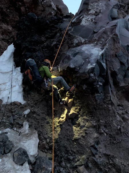
The whole procedure took a while. We've used this time to pull out the ice tools, apply sunscreen, eat and hydrate. We started moving again at around 5:30am. By that time, it was nearing the sunrise, and starting to get brighter, which was just about the perfect timing, as we did not want to climb in the dark (PC: Craig).
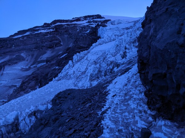
Getting to the ice ramp required walking in crampons on the rocks. Having previously spent over an hour sharpening all the 28 points in prepping for the trip, I was experiencing significant mental pain hearing my precision job getting all ruined. Fortunately, it was only a short stretch, and with the rising temps, the hope was that ice would not be too brittle (a weekend before, one of the climbers on this route lost their footing and fell due to what we speculated may have been blunt crampons).
We got to the basis of the climb, setup in a pinch, and started climbing at 5:45am (PC: Anni).
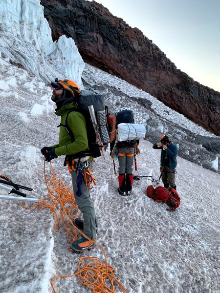
The first ice ramp was low-angle, so we simulclimbed it. Placing pro felt like overkill here, but having read enough stories about climbers falling on low-angle ice, I decided that saving the few extra minutes that it takes to put some pro in were not worth the risk, however small. A major annoyance was rope catching on the ice, adding drag and creating a dangerous amount of slack. We had to constantly whip the rope to keep in reasonably straight. Other than that, it was mostly a walk-up (PC: Craig).
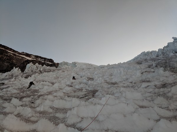
After placing 8 screws, pounding 1 vertical picket, and running a few rope lengths, I stopped just short of the base of the second ice step. Incidentally, this turned out to be a great place to wait, as the party ahead of us on the second step was raining dinner plates, and the gravitational lens was focusing them on the belayer. Waited for a while in the safe spot for them to get off the pitch while admiring the surreal scenery (PC: Craig).
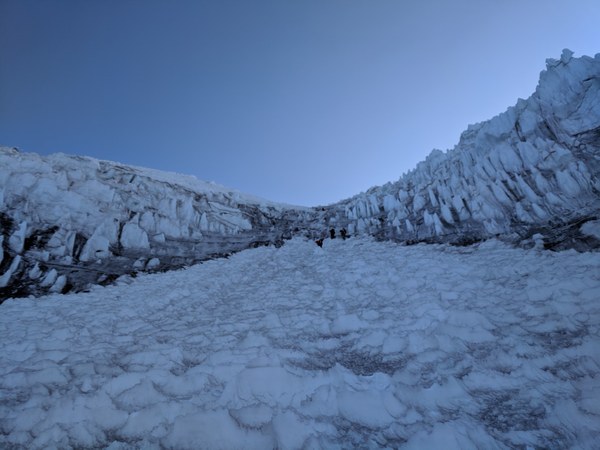
The second ice step was a little steeper, but not by much. Since we only had a 40m rope, we had to break it into 3 short pitches (with a longer rope, you can do it in 2 pitches). The first of these was more sustained, as it didn't have very good rest steps (except for those you chop yourself). The second had ledges. The third was a walk-up (but we agreed that at least meat belay was in order, because why risk for nothing). The ice here was more consistent and better. Used up all the 8 screws. To the left and right, we were surrounded by penitentes, but the ice pitch meandered in-between (PC: Craig).
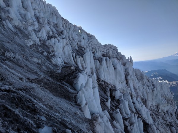
We topped out at 12,000 shortly before 9am and took a short 10-minute break to rest and to soak in the scenery. By that time, the sun was fully out, and with no clouds in sight, we could see all the way into Oregon (PC: Krystian).
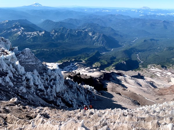
We did not want to linger, as we still had a very full day ahead of us. The next segment of the trip, getting to the top of the cleaver at 13,000, involved the most zigzagging, as the glacier was quite heavily crevassed here, and the crevasses were of gargantuous proportions. But, for the most part, it just required making some detours. There were quite a few snow bridges that didn't look too bad, but that we opted not to use just to be on the safe side (PC: Craig and Google).
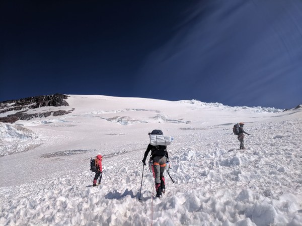
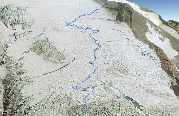
Above the ice pitches, we could feel the effects of altitude, and we were moving quite a bit slower. Overall, it took about 2 hours, or until about 11am, to make the 1000 foot gain to get to the camp at 13,000 on the top of the cleaver, where the last weekend's group had spent the night. The camp was not very sheltered, had no water, we felt good and still had the energy to go, so we rested only briefly at the camp, and then decided to keep going straight for the summit (PC: Krystian).
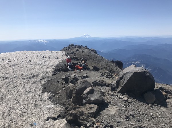
From the 13,000 camp to the summit, the route was very straightforward, only with occasional zigzagging around crevasses.
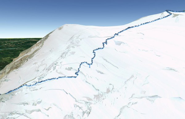
We were tired and affected by altitude at that point, however, sand it took us in about 3 hours to do the final 1,500 or so feet. We summited at 2pm. There was noone else there.
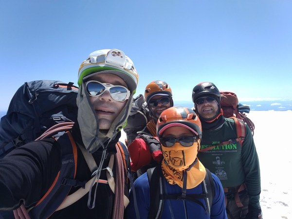
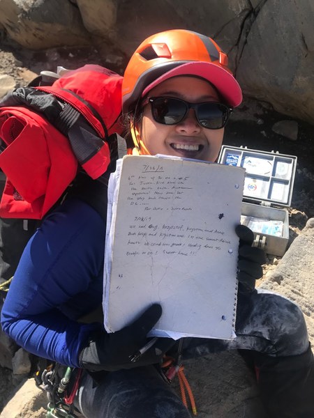
I must admit that the summit was a little anti-climactic. Between that, and a mild headache that was starting to cook up, I didn't want to stick around any more than necessary, and neither did anyone else. After about 5 minutes, we decided it's time, and we went into full-on free fall mode down the bobsled track, only pausing briefly to fill out the summit register (PC: Krystian).
We have reached Camp Muir shortly after 6:30pm, dropped packs and left no trace. The original plan was to spend the night there, and I felt quite exhausted by then, but between the heat and all the people walking around, did not exactly seem like a serene and magical place, and none of us really felt like to stick around any more than necessary.
We determined that we can make it down before dark, so we loaded all the gear into our packs, and started moving again shortly before 7pm. Reached Pebble Creek by around 8pm, took a 15 minute or so break to refill water, switch into dry socks and trail runners, and continued on. We made it back to the cars at around 9:20pm, just about when the park staff started blocking off the trail entrance.
GPS links: route on a map, GPX file.
 Krzysztof Ostrowski