
Trip Report
Intermediate Alpine Climb - Mount Adams/Adams Glacier
Clear skies, a full moon rising over the Adams glacier, and a few rope lengths of enjoyable ice. Can't complain.
- Sat, Jun 15, 2019 — Sun, Jun 16, 2019
- Intermediate Alpine Climb - Mount Adams/Adams Glacier
- Mount Adams Ice Climbing Routes
- Climbing
- Successful
-

- Road suitable for all vehicles
-
Snow on the ground for most of the approach to lake 7550. No flotation devices needed. Lake 7550 has water.
Most of the route is a mixture of well consolidated hard snow that takes vertical pickets, some not so good snow, and ice in the upper portion of the route.
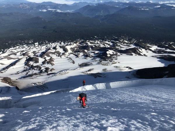
At least one snow bridge required to get to the upper part already disintegrating, as shown on the picture, with no alternatives in sight.
The trailhead was swarming with mosquitoes, which mobilized the entire party to kit up quickly. We geared up and hit the trail in something like, 10 minutes from arrival.
Start from trailhead around noon with ~5 miles, 2900 feet elevation gain, and 3 hours to reach the camp at lake 7550. No snowshoes. The lake has water and is located next to a snow-free island that's great for camping, if somewhat dusty.
It was warm and clear, most of us brought a bivy. It was a hot, clear day, and a clear night with a full moon. The orange light at the sunset shone on the Adams glacier, and soon thereafter, the full moon rose right over the top of Adams. A rare sight.
Roped up at the camp in 2 teams of 2 and started moving around 3:15am or so, reached the base of the climb at 9200 in about 2 hours.
The bottom portion of the route started mellow, then steepened up quite a bit, but it was on well consolidated snow, and we felt safe without placing pro. We stayed roped up, though, due to the danger of crevasses (and indeed, half of my right leg later got swallowed in the upper portion of a route).
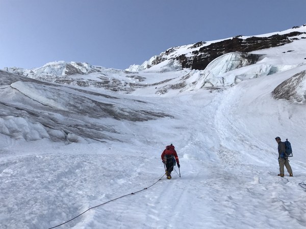
Started placing pro on the first crevasse crossing: some vertical pickets, some deadman, some screws. We had 1 picket plus 2-3 screws per person for the team of 4, and that was adequate.
Several snow bridges to cross on the upper portion of the route, and as noted above, at least one is already falling apart with no alternatives in sight.
At the seracs, we chose to go through rather than traversing all the way to the left (a day before, a different party apparently took the left variation and made it to the summit as well).
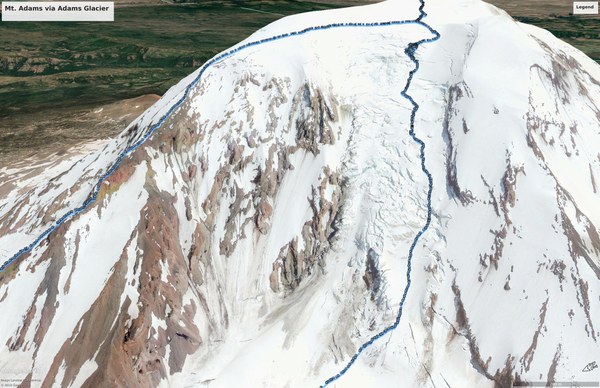
The path through the broken up seracs had a nice ledge system with a satisfying amount of AI2/AI2+ in not too steep, but inconsistent-quality ice and some not-so-well consolidated snow.
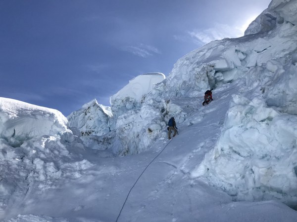
We were fortunate to have a party moving ahead of us exploring the route, so we had a fair confidence we were not heading towards a dead end. We might not have pursued it otherwise, as it wasn't at all obvious that there would have been a good path through without running into some steep overhangs.
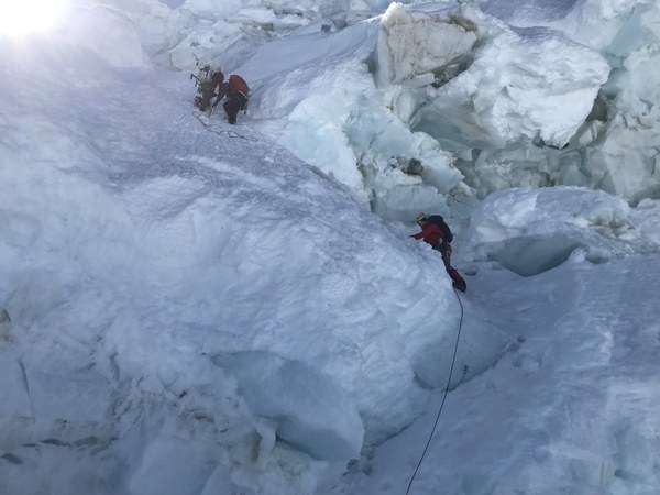
We were happy to have brought 60m ropes. Used almost all of it on the meandering ice pitches, and it was also helpful below when crossing the snow bridges.
Topped out shortly before noon, dropped packs, and went on to tag the summit.
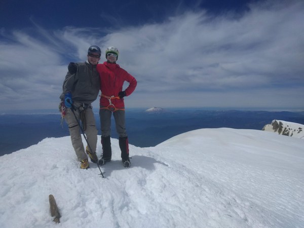
Started descent around 12:30pm. The path that led 5000 vertical feet down the chossy ridge proved to be incredibly arduous (the "some parties will go to great lengths to avoid it" does not quite give it justice). Much postholing in the melting afternoon snow.
Back to the parking lot shortly before 8pm.
PC: Jeff Wirtz and an anonymous bystander
 Krzysztof Ostrowski