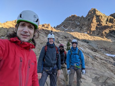
Trip Report
Intermediate Alpine Climb - Ingalls Peak/East Ridge
a bit long, but satisfying
- Sat, Jul 17, 2021 — Sun, Jul 18, 2021
- Intermediate Alpine Climb - Ingalls Peak/East Ridge
- Ingalls Peak/East Ridge
- Climbing
- Successful
-

- Road suitable for all vehicles
-
No snow on the trail to the lake. A few snow crossings before the gulley, but manageable in just approach shoes. No need for boots, crampons, or ice axes at this point.
We debated whether to do the trip in a day car-to-car or whether to hike in the day before, and opted for the latter to have a sufficient time margin to get back home at a reasonable hour and catch some sleep before getting back to work on Monday. A strong party that already knows the route and can avoid routefinding and other delays, or that is OK with late return and driving back the next day in the morning, might be able to do this car-to-car. We ended up needing the extra time, so we were really glad to have planned this as a two-day trip.
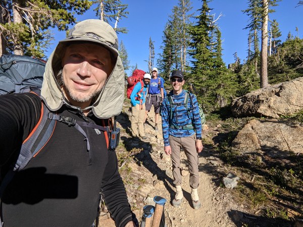
We drove in on Saturday afternoon, hit the trail around 4pm, and moved slowly at a relaxed pace in the afternoon heat, trying to keep it pleasant. Made it up to Ingalls Pass in about 2 hours, and another 1 hour or so to reach the Ingalls Lake by around 7pm, with plenty of time to set up camp , eat dinner, discuss the route, and enjoy the view. We did not need to cross any snow on approach.
One person had a tent, the rest of us brought bivy bags. Camped on dry rock near the lake on top of the slabs. Plenty of flat spots. There was no running water in the camp. We filled up on the way in from one of the several creeks. Great views of the lake and of the route.
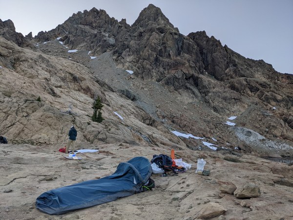
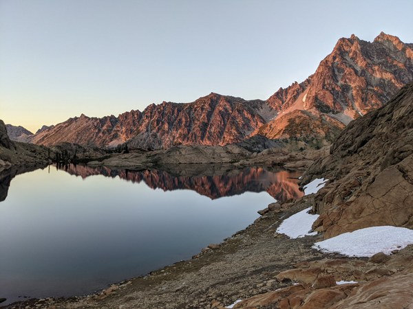
Got up on Sunday around sunrise, broke the camp, stashed the camp gear, and started moving at somewhere in the ballpark of 6:20am. Most of us opted to go more streamlined with only small summit packs, which worked well.
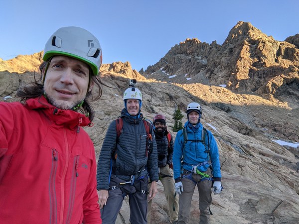
I have never been here with snow melted out this much, so the way to the gully was not obvious, but fortunately, one of us had beta from a trip just a few days ago. The way up is to first get down to the lake, where a climber's trail can be found, then up through the slabs into a third-class gulley, some more slabs, and finally up the chosspile, angling from the climber's left. You can see the route we took from the camp and back in the picture below.
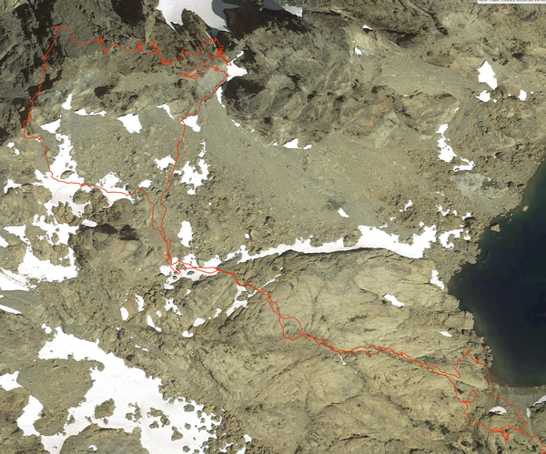
On the way up, we only had to cross snow twice, once for about 20 feet, and then again for maybe about 200, but it was low-angle, and the snow was soft. Walking in approach shoes required some care not to slip, but was manageable without traction, axes, or hiking poles.
The loose scree was somewhat unpleasant, but manageable as well. Right before the gulley, there was a moat between the snow and the adjacent wall on the left. We entered it in the hope to avoid losing elevation on the scree, but it ended just up being more awkward.
Once in the gulley, we spent a fair amount of time trying to locate the low-angle third-class ramp system that was supposed to get us to the base of the first pitch, and I'm not sure we have actually ever found it. We saw a white serpentine sidewalk leading to a rap station, but that was on the right side of the chockstone. There was some third and fourth-class terrain to the left, but it was not quite matching the description. We were probably there with snow level somewhat lower, and that likely threw us off track.
After eventually scrambling up on the climber's left on the path of least resistance and a little bit of searching, we did find slings around a boulder on some third/fourth class terrain not far from the gulley entrance, but the surroundings at that spot did not exactly match the beta, so just like the other slings, likely these were used by someone to bail from there.
After some more poking around further up and deeper into the gulley, we spotted another white serpentine sidewalk, closer to the ridge and higher up relative to the rap slings, and opted to take it. That has led to some fourth class terrain that seemed to go in what seemed like roughly the correct direction, and eventually started to steepen up in front of us. We busted up the rope and decided to start there.
I'm not sure exactly how long it took us to reach this point, but I think it was in the ballpark of two hours in total from leaving the camp, definitely more than what we had anticipated.
View down from where we roped up:
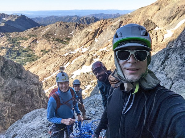
The rock in that spot was not great for climbing or pro, a lot of it had shallow cracks or grooves, serpentine and slippery. Building a borderline acceptable anchor from a couple small pieces took some effort.
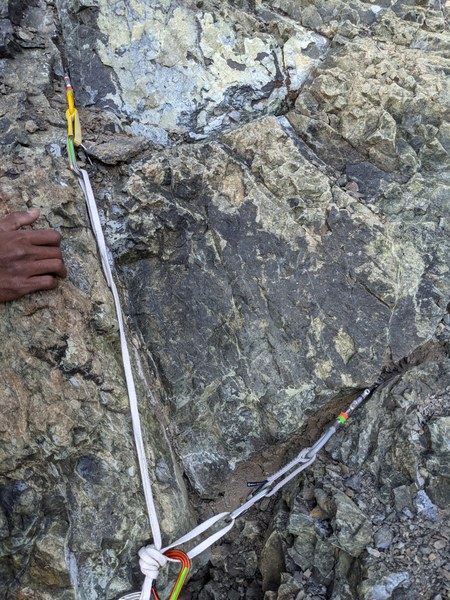
I took the first pitch to explore ways to reach the ridge on fourth and fifth class rock.
A view of the start of the pitch from the belay:
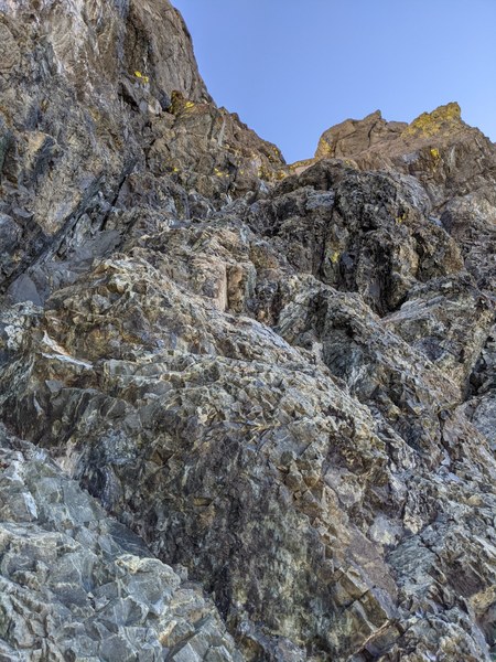
The slippery stuff felt sketchy to climb on, and options for pro were quite scarce. One of the trip reports warned of the first pitch being stiffer than you'd expect at maybe 5.5. I don't know if what I climbed was the first pitch as it was meant to be experienced, but I'd agree with this general assessment.
I had to explore and backtrack a bit, and at some point I ended up in a place, from which I could easily get down to right at the chockstone or climb back from the chockstone to where I was. This made me suspect that I was not on the route proper, since the beta did specifically warn against ending up at the chockstone. Anyhow, after backtracking, I took a route in the middle that went straight up, and that eventually deposited me just above and to climber's left of the chockstone on top of the ridge, right in front of and maybe 15-20 feet from the first gendarme. There was supposed to be a great boulder to sling there. I didn't see a boulder that would inspire confidence, so I built a gear anchor and belayed Steve from there.
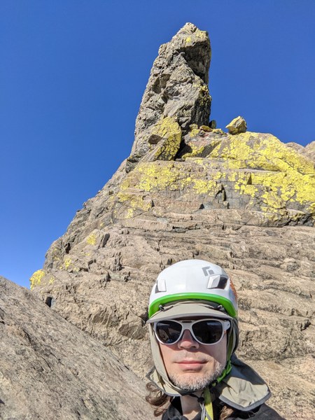
Steve took the gendarme pitch. We looked for the piton, but could not see any. Maybe there was one on the left. We knew that the past parties mostly took the route on the right along the crack, so that's what we did. It was really only one tentative move on the slippery stuff before getting more secure footing on broken up serpentine features inside, but I was glad to have switched from approach shoes to TC pros for the gendarme for better purchase.
Once at the top, you walk the flats across to the other side, and end up right at the first knife edge traverse. Steve was belaying me from a gear anchor he built right after clearing the traverse.
As mentioned in other reports, the traverse is done on small rock features on the left. Stay fairly low on this, with the knife ridge at maybe around your chest level. And the end, it's a few large steps down on small rock features, one step across to the other side and done. Steve kindly placed some pro for me at the end to protect it, which made it feel fairly secure.
After the knife edge, it was my turn again to lead the third ("money") pitch. There seemed to be two ways to go, straight up or along the right side. We were supposed to be getting back onto the ridge, and straight up was fifth-class climbing, so I explored that first, but I ended up cliffed out, so I came back down and went around the right side on some fourth class rock that didn't provide much in the way of pro options, but felt fairly secure to walk on.
Right after a short traverse, came back up left onto the ridge and ended up at some kind of a flat area at some kind of a notch, with nice boulders to sling. This looked promising, but it was not even half of the rope out, so clearly the "money" pitch had not happened yet. I decided to throw in one piece there and continue.
Left was again a no-go. I considered the right, which looked like fourth class terrain, but the beta was asking to climb up, so I went straight up mid fifth class with reasonable options for pro.
Ended up right in front of what looked like a second knife edge traverse, but a few things about it didn't quite seem to add up. For once, it did not "veer to the right". It didn't have a horn in the middle. Left side was featureless and then steep dropoff, no way to downclimb. It was impossible to tell what was on the right. Looked like it would be steep nothing as well. It differed from beta enough to make me question whether I was in the right place, so I asked Steve and the second rope team to look around to see whether there are any alternatives to going where I went. After a bit of poking around, we concluded that this indeed would have to be the only way. Built a gear anchor again, and brought Steve up.
As it turns out, what looked like a sharp knife edge from the end of the third pitch was indeed a somewhat walkable traverse on the blind right side that we could not see, with a short down-step to third class terrain on the right. Steve belayed me on this short pitch from a gear anchor right after the traverse.
My turn again to do the long "unremarkable" traversing pitch towards the crux. Once again, there seemed to be an option to go more up towards the right (as beta suggested), or more forward along the third and fourth class terrain. Explored a bit of both, and ended up going forward. Did not quite find anything that qualifies as a distinctive notch or good belay. Stopped where rope drag started to be annoying and put in belay for Steve, in what we later concluded must have been somewhere part of the way through the fifth pitch, and from where we could clearly see the crux.
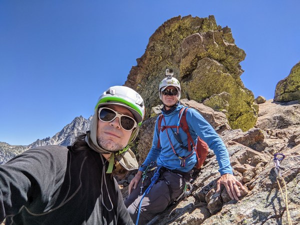
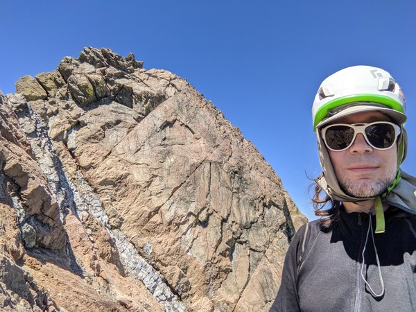
Steve took it from there and brought us up the white serpentine rock third-class gulley shown in the picture above to a belay just about 15 feet from the crux.
My turn again to lead the crux. There were more than 2 cracks there, I counted 4. Past beta made it a bit ambiguous which the right one was, but the right-most one was definitely stiffer than 5.7, and the left-most one was very wide, so that left two left-leaning cracks in the middle. The right of these is definitely what I saw pictures of some people climbing, and it looked like it might offer better features to step on, but it was narrower than what the beta sounded like, and definitely did not accept a #4, so I went for the left one. The left did accept #4, which offered a sense of security.
The beta suggested to put the right foot in the crack and jam fists in it. I found it hard to execute this, given that entering the crack was pushing me off balance. Ended up instead smearing both feet on the sloping face on the left, which looked very slippery, but had some small imperfections to step on. It was indeed 2 moves and over, but it felt harder to me than the supposed 5.7 rating.
After the crux, around and to the right was a low-angle area at yet another notch. I was supposed to go the remaining less than a rope length up to the summit, but there was another traverse to clear, and the rope drag seemed like it would be too much, so just built a belay there, and brought Steve up to finish it off.
Pro options were not that great, and I really wanted to be able to catch a potential fall, so ended up with a bit of a franken-anchor from 6 pieces:

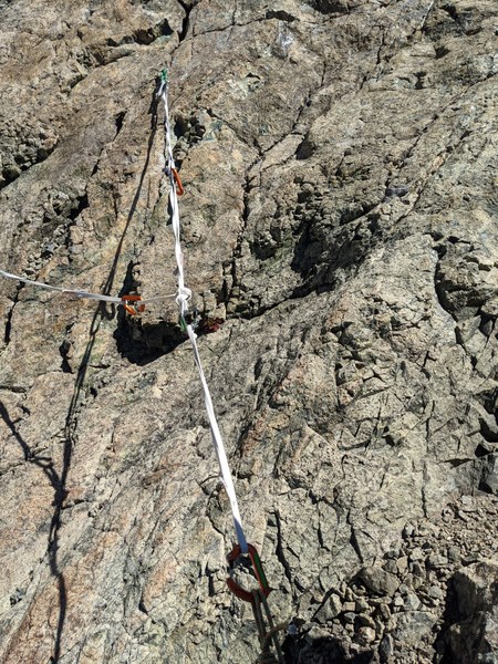
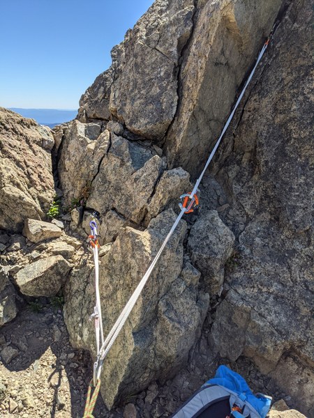
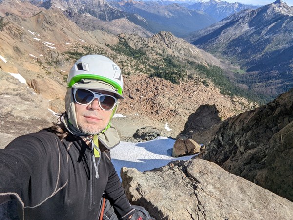
Celebratory picture after clearing the crux:
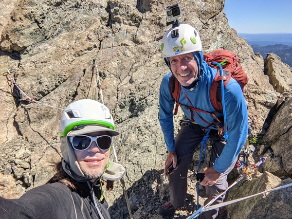
We ended up on the summit somewhere in the ballpark of 3:20pm, so in total about 9 hours from leaving the camp, with about 2 hours spent on approach and looking for the starting point, and 7 hours spent climbing. A bit on the slow side, but still with plenty of a time margin.
While at the summit, the other rope team radioed in that they experienced a lead fall, fortunately ended up with nothing more than a cut finger. It took a little over an hour for the second team to join us.
At the rappels, there was a party of 4 that came up the Basic route and ended up rappelling ahead of us, so we had to wait until a little after 5pm to begin ours.
We did the regular single-rope rappel to the bolts, then double-rope to the ledge, again a single-rope to the top of the first pitch, and finally, a double-rope down to the trail. I'm really glad to have opted for the double-rope on the last rappel. The snow melted so much that we really did need the full length of a double rope to reach a good spot. Cleared rappels by around 7pm or so.
Descent to camp from the end of rappels required a longish descent along a snow finger, which felt a bit sketchy in approach shoes, but it was low-angle enough that fortunately noone slipped.
As we were walking down to the camp, we kept hearing a party bailing from the middle of the ridge screaming "rock" over and over and over, at least a few dozen times if not more. Looking at it and listening to it all was somewhat unsettling. I hope they made back down safely.
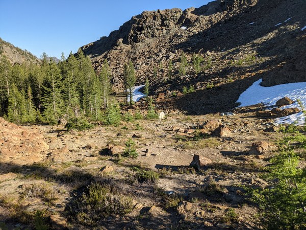
Back to camp by 7:45pm. In the camp, we took maybe half and hour or so to degear and repack for descent, and headed out. As we were about to head out, we were approached by goats, and watched one grown goat chase away another grown goat, just about some 20 feet away from where we were standing. The goats had babies, but fortunately, took no interest in us.
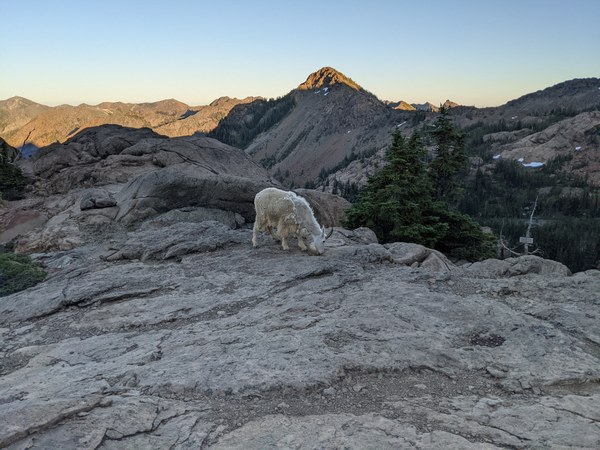
Filtered some water on the way down, reached the pass by 9pm, and the parking lot by 10:30pm, with the last 45 minutes or so walking with headlamps on.
Overall, it was a longer and somewhat harder day than expected, but we had a great time and a solid team. Definitely would recommend.
 Krzysztof Ostrowski