
Trip Report
Glacier Climb - Snowfield Peak/Neve Glacier
A strenuous, yet fun, North Cascades outing! Great conditions.
- Sat, Jul 14, 2018 — Sun, Jul 15, 2018
- Basic Glacier Climb - Snowfield Peak/Neve Glacier
- Snowfield Peak/Neve Glacier
- Climbing
- Successful
-

- Road suitable for all vehicles
-
Parking- side of the road, small lot.
Trail to Pyramid Lake- steep and rooted, easy to follow.
Climber's trail to low camp- easy to follow if you have "a nose" for climber's trail. Very steep, little 'shwacky, downed trees/branches to cross, mossy boulders to scramble. Snow free. The SW trail that begins from Pyramid Lake is much more apparent and easier to follow than the SE trail that heads off from the lake. Both eventually meet up.
Route from low camp to high camp- patchy snow began around 5,600' ish. Traverse above waterfall was mostly soft snow with a firmer boot pack trail beaten in already. A few bands of loose boulders/talus to cross. Be careful of rock fall from above late in the day, I would suggest moving quickly and not taking breaks along the traverse above the waterfall. We heard and saw rock fall coming down ~2p both days.
High camp- had a tarn to filter water from, snow free on the ridge. Nice dirt/rock camp spots with wind walls built up. ~4 next to the tarn big enough for tents but you could also find more bivy spots nearby. If those are all full when you go you can find 2 or so more by traveling farther down the ridge.
Colonial Glacier- the glacial lake is beginning to melt out, path was easy to skirt around it up to the Colonial-Neve Col.
Colonial-Neve Col camp- had running water, 2 windwall melted out rock/dirt camp spots that I noticed (but one of them is smack dab in the middle of the col and would be annoying to sleep there while climbers trudged past early in the morning IMO).
Neve Glacier- some crevasses opening up but easy to navigate through the glacier.
Summit ridge, gully, summit block- all snow free. Ridge had a bootpack trail leading to the gully, gully had a cairn on the left where you pop out over the arete. Summit Block also had a cairn or two and was obvious where ascent route was.
I will start out by saying that this is a very difficult basic climb for first year students. I was very particular with team selection and filtered interested participants by their comfort/experience with similar terrain to this route. I recommend this climb as a 2 day for basic students who really have their conditioning, & food/water systems dialed in. Otherwise it may be better as a 3 day for first year basic students. Summit/descent day 2 is very long. Leaders should take additional caution on the steep descent and be prepared to move slowly to ensure team safety. There have been several incidents/injuries on the descent reported within this season and in previous years on this route- I really can see why, after having done this climb.
It was a very hot and sunny weekend (70-80 degrees in lower elevations and 45-55 in upper elevations).
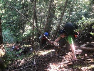 We took the SW climbers trail that left Pyramid Lake and it was pretty straightforward all the way up to low camp.
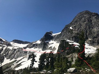 It sounds like there are variations on how you get to the start of the traverse above the waterfall, some drop below the knob of tree/rock formation directly in front of Pyramid and some go up and around it. We went up and around- it looked like the more doable option with our route conditions. See our approximated route in red.
Most snow we encountered was soft, the boot tracks that were beaten in above the waterfall traverse were a bit more firm so we opted for crampons for additional security while traversing with heavy packs. Crossed some short sections of loose talus/boulders that had begun to melt out.
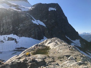 Scrambled up a ridge to high camp and snagged some tent spots. Filtered at the tarn. That camp has some of the most beautiful views!
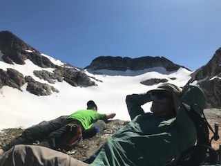 Correct col is the one on the left, directly above the bright green shirted napper's hat :). I scoped the route and identified the correct col the night prior to our summit day, and yet still went to the incorrect col (left in the dark the next morning during a sliver of a crescent moon). My recommendation would be wait until you have just enough light to see the cols when you depart in the morning or check gps/map frequently. Going to the incorrect col is a very common mistake on this route. If you do happen to go to the incorrect col, I recommend dropping elevation and returning the way you came to attain the correct col. Do not maintain elevation and do a long and very steep snow traverse like we did. It was a lot of additional and unnecessary work.
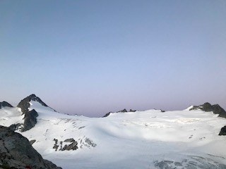 Roped up at the (correct) Colonial-Neve Col and traveled across the glacier as the sun was rising. Fantastic views of the cascades and beyond.
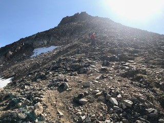 Summit ridge has a dirt/rock boot track that leads to the gully and is easy to follow. The gully is loose so stick together and test holds. I traveled about halfway up the gully and saw a cairn to my left, popped out of the gully over an arete, did some exposed scrambling for a bit, got to a slabby/rampy section and then headed upwards.
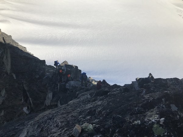
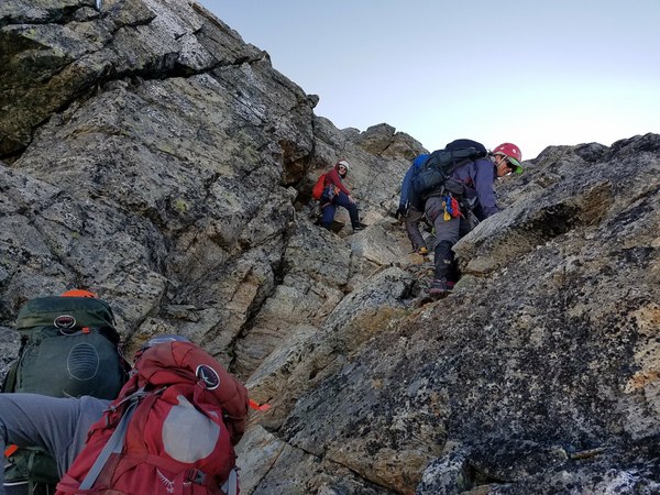
I set up a handline for students after this little notch (note this is not the notch in the gully that is also a route you can take, this particular route we took is to the left of the gully. There is a previous Mountie TR that has great beta for the several options that exist to attain the summit). I went up about 20 or so feet, and I saw an obvious ledge with a cairn that traversed climbers right. Anchored in the other end of the handline, and the team followed up. From here the final scramble to the summit is straight forward, just go up the path of least resistance. I left in the handline to save time because we could see that incoming parties were far away enough that it would not be in their way by the time they got up to the summit pyramid.
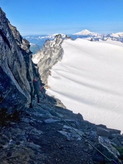
Descended that handline, and built an additional handline through the notch over the slabby/rampy section. It had bad runout and could be easier to slip on on descent than ascent, although I think a student would have appreciated a hand line on the ascent as well. Ask lots of questions about your team's comfort. If you are comfortable and experienced with scrambling 3/4 class then you won't need a handline. If you are new to it, a handline is in order.
Descended route back to camp, ate, rested, packed up and headed out. At about 3100' after a break, we accidentally took the SE climbers trail back to Pyramid Lake instead of the SW climbers trail that we ascended. It went fine, but was much more faint than the SW climber's trail, I could foresee it being much easier to lose the SE trail. Just something to look out for on descent, we did not purposefully take the other trail back to the lake. Took it very slow on the descent as I was nervous about incidents due to the two that had happened on the descent of this route just this season. It was so hot out one party member got some likely heat induced cramps so I slowed the pace a bit more. Got to the parking lot at 7:20p, ate delicious food at Mondo's and headed home.
A great climb with great folks, everyone did fantastic and had wonderful attitudes! Most importantly, everyone got down safely AND had a lot of fun.
Times:
TH-Pyramid Lake: 1:10 (including a 20 min break prior to reaching the lake)
Lake to low camp: 3:30 (with a few 10 min breaks included)
Low camp to high camp: 2:00 (includes a 45 min lunch break)
High camp to wrong col to correct col: 2:20 (don't go to the wrong col and it'll be much faster! :) )
Col to summit: 3:10 (includes break at col to rope up and eat, and a few more short breaks in between)
We then stayed on the summit for about 45 mins or so.
Summit back to high camp: 3:30
(Spent an hour packing up/resting at camp)
Camp to knob in front of Pyramid Peak: 1:00
Knob to Pyramid Lake: 3:00 (took several breaks in between, one to filter water also)
Pyramid Lake back to cars: 1:35 (slowed pace and took a few breaks)
 Rikki-Rachelle Hinz