Trip Report
Glacier Climb - Ruth Mountain & Icy Peak Traverse
great trip despite limited views
- Sun, Jul 9, 2017 — Mon, Jul 10, 2017
- Basic Glacier Climb - Ruth Mountain & Icy Peak Traverse
- Ruth Mountain & Icy Peak Traverse
- Climbing
- Successful
-

- Road suitable for all vehicles
-
Route to both Ruth and Icy in excellent shape. Probably easier if you aren't in a whiteout.
The hike up the valley towards Hannegan Pass is especially scenic this time of year, everything is very green and the flowers are prime. Mt. Ruth can be seen at the head of the valley. Very hot and humid on the approach, so we kept a moderate pace. The trail itself has only one minor difficulty, a stream crossing where there was probably a snow bridge a few weeks ago, you just have to climb down and up out of it.
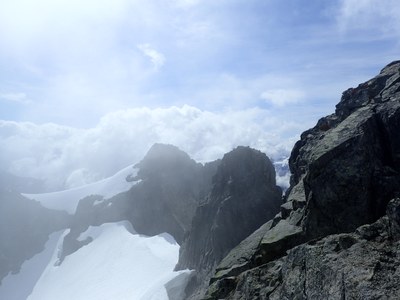
From the pass, we followed the ridge first up, then down, then up on the right on snow, until it opened up below the 5900' peak where we traversed on snow around the shoulder. From there we mostly followed the ridge towards Ruth, staying to the right of the ridge most of the way. Entered the clouds at 6000' and lost all the views for the rest of the day. From there we scrambled down to the camp spot above the gully, which again was hard to find since we couldn't see anything. Made camp and ate dinner in the clouds and went to bed at 8.
Woke up at 4am to a full moon, hurray! But also some clouds here and there. We started down to the Ruth/Icy saddle (staying left of the gully) at 4:50am. By the time we reached the saddle we were again in the clouds. We roped up here and crossed the glacier in the whiteout. When we reached the other side the clouds cleared enough so that we knew where we were going.
We found the first gully leading to the summit. It is light-colored, and a little slabby at the start. I led it on the 2 30m glacier ropes and placed one #7 bd nut. Make sure to start high enough if you are using 30m ropes, 40 would be better, especially for the rappel. 60 probably overkill.
Made the summit around 10am, and everyone prussiked up. Clouds lifted every now and then for wonderful views. Rapped down and began long hike back to camp and cars. 12 hours camp to summit to cars.
Note that the route description takes you to NW summit of Icy 7062' on the USGS map, not the actual summit of 7073'. Looks like you could follow the snow over to the ridge and ascend from there but we didn't explore that. Perhaps on a future trip.
 Tom Girard