Trip Report
Dragontail Peak/Backbone Ridge with Fin Direct
A one day push of an awesome classic route.
- Sun, Jul 20, 2014
- Dragontail Peak/Backbone Ridge with Fin Direct
- Climbing
- Successful
-

- Road suitable for all vehicles
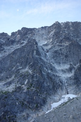
We climbed Backbone Ridge in 22 hours car-to-car since we didn’t have a camping permit. We started from the Stewart Lake trailhead at 2:30am, topped of water (2l each) at the top of the lake at 5:20, and reached the rock at base of the ridge at 7:00. The trail to Colchuck Lake, the boulder field above and the Colchuck Glacier moraine were free of snow. The small snowfield between the moraine and the base of the ridge was firm icy snow so recommend bringing ice axes and either boots with firm soles to kick steps and/or traction devices. The same applies to the snowfield on the back of Dragontail. After the scramble to the base of the 5.6 corner we roped up at 7:30am. The first pitch stretched the 60M rope all the way to the base of the 5.9 off-width crack. The off-width was led without a pack and the pack was hauled later; the follower climbed with the pack. We had both #5 and #6 BD cams for the off-width but we found that #5 can be walked almost to the top of the crack leaving maybe only 5 feet of difficult climbing for #6. The pitches 3 and 4 went left of the small roof and on the left side of the huge layback block (both 5.8). From there we went left of the ridge crest and started simulclimbing until we reached the fin by 1:30pm. We continued up next to the ‘dirty’ groove finishing on the first big ledge and set up a belay right there. The next pitch (5.9, 80’) went up to the ‘twin’ cracks and then up the cracks to the second big ledge. The following pitch (5.9, 200’) went up the left side of the fin and finished at a belay spot straddling the fin crest below a huge roof. The next pitch (5.8, 200’) started with a rising no hands foot shuffle traverse past the big roof, then up a crack and another rising traverse to the top of the fin with another belay on the crest. From there we simulclimbed the ramp on the back side of the fin and came back to the front side after about 100’, continued on a wide ledge and then scrambled to the summit by 6pm. We went down the back side of Dragontail on trail, snow and rock and reached Aasgard Pass by 8:15. Locating the trail there is important because of the cliffs below bit it proved a bit of a challenge so we kept going NE traversing the boulder field and crossed a few streams until we found cairns. We got down to the lake and filled some water by 10pm, and then hiked out reaching the car by 12:30am. Overall the route was in a great shape but beware of a lot of loose rock especially on the back side of the fin. Radios were very helpful.
Gear
60m rope, (2x rack BD .3 to 3), plus BD 5, 6, (for the offwidth), plus yellow & blue wildcourtry zero (small cams), 1/2 set nuts & nut tool, runners (8 single, 6 double).
 George Reynya
 admin
admin