Trip Report
Day Hike - West Tiger Mountain 1-2-3
A large loop hike visiting five of Tiger Mountain's summits: East, Middle, and West Tigers 1, 2, 3
- Thu, Feb 20, 2020
- Day Hike - West Tiger Mountain 1-2-3
- West Tiger Mountain 1-2-3
- Day Hiking
- Successful
-

- Road suitable for all vehicles
-
Large clearcut on the East Tiger Trail (between Bootleg Trail and Preston RR Grade). Requires leaving trail to follow logging road up through clearcut to regain the trail near the upper end.
We began at 7am and hiked up the High Point Trail and then the ups and downs of Dwight's Way, then up the Preston Trail. We hiked the Bootleg Trail and then then turned left on the East Tiger Trail. When we reached the logging road, we followed the road up through a big clearcut toward the top of the road, where we were able to cross through some of the clearcut to regain the trail. When we intersected the Preston RR Grade, and this is where we found the old unmarked path that climbs steeply up the north ridge of East Tiger. At first it was hard to find in the snow, but we found it to the left a little and it was fairly easy to follow up the steep hillside. We climbed up to meet the mountain bike trail, and went left to get to the summit road, which we followed to the top of East Tiger.
We went back down the road and then hiked all the way down the mountain bike trail to the main Tiger Mountain Road, and turned right. We walked until a junction with a gated road, and turned left onto the gated road to Middle Tiger. We followed the road up until is reached a trail that we hiked to the top of Middle Tiger.
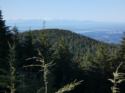
We backtracked down to the junction and continued straight on the main road toward Paw Print Rest Stop (the outhouse). From here we continued straight on the road a bit more and then turned right to climb the steep road up onto West Tiger 1. We walked up this road past the radio towers and had our lunch in the sun at the big viewpoint. We gazed out to the whole Cascade Range from Twin Sisters and Baker down to Mt. Si, and out to Bellevue, Seattle, and the Olympics. We then continued over the summit of WT1 down to Hiker's Hut viewpoint of Mt. Rainier, the South Sound, and Olympics. We then hiked down and up the road to West Tiger 2 and then along the slick and slushy trail to West Tiger 3.
From 3 we hiked down the main West Tiger 3 Trail, which was pretty icy for most of the way. Microspikes are strongly recommended. We turned right onto the West Tiger RR Grade and hiked this mostly-flat trail to the K-3 junction, and then hiked down K-3 Trail to the TMT. We went right )down) on the TMT and hiked to the grand Murat's Bridge, and then returned to the junction with High Point Trail, which we hiked back down.
16 miles, 4500' gain, 8.75 hours.
 Chris Pribbernow