Trip Report
Day Hike - Talapus & Olallie Lakes
We used the Pratt Lake trail head and so extra miles. Woodland flowers are blooming now and the stream crossings are very pretty.
- Wed, May 25, 2016
- Day Hike - Talapus Lake Trail
- Talapus Lake Trail
- Day Hiking
- Successful
- Road suitable for all vehicles
-
Blow down has been cleared in the first mile of trail - there was blow down to climb over and under further on. Some snow on trail still, but easy to cross. Stream crossings are easy for experienced hikers. The trail is a good trail with many improvements.
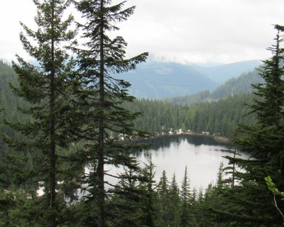
Parking is right off I 90 for the Pratt Lake trail. This does make for extra trail miles over the FS road 9030 trail head. It is good trail though, very soft and this made for a fast descent. We went to the Olallie Lake overlook (on a clear day Mt. Rainier is visible, but not last evening), the map miles added up to 6.5 mi RT and a hiker's GPS said 9.4. the trip took us 4 hours and we were moving at a good pace, so I would say the GPS is more likely correct. The Cal Topo map shows a trail going down from near the overlook and around the lake, this trail does not exist. Forest Service pass required.
 Barbara Folmer
 admin
admin