
Trip Report
Basic Glacier Climb - Sloan Peak/Corkscrew Route
The Alpine climb that has it all! Glacier, rock, "climbers trail", bush whacking, and some fun log crossings at the beginning, middle and end!
 sara ludeman
- Mon, Jul 8, 2019 — Tue, Jul 9, 2019
- Basic Glacier Climb - Sloan Peak/Corkscrew Route
- Sloan Peak/Corkscrew Route
- Climbing
- Successful
-

- Road suitable for all vehicles
-
- Log crossings were not straight forward to find or cross. Manageable yes, but tricky.
- Plenty of water on the trail so you can filter often
- Good water at first high camp
- Meadows are soggy, not suitable to pitch tents right now
- Crevasses are open, but easy to navigate
- Bugs were present at camp. Some put on bug spray at camp, some didn't.
- Ursacks!! There are mice and they will eat your summit blondies..
We met Monday morning at 7am at Marblemount ranger station ready to get our permits for Snowfield. Everyone was very excited. Squared away permits and checked out bear canisters and then as one last final check before taking off we checked the weather... Our 20% chance of .01 rain had turned to thunderstorms. Dismayed at the sudden shift to below suboptimal weather, we spent the next hour looking at weather reports and brainstorming alternatives. Half the group had taken time off work to join the climb and well wanted to at least try to climb something. After brainstorming a few different routes that would be possible with glacier gear we decided to settle for a shorter route we thought might be feasible in a day: Sloan Peak.
Our next stop, Red Top Tavern (literally the only thing open in Darrington at 11am)

We all received strange looks as all we ordered was coffee and then stared at our phones, down loading gps tracks and reading trip reports for the next hour while Sherrie moved her RV.
After some discussion we settled on hiking to the tree line and made the decision that if thunderstorms came we would at a lower elevation, if not then we would continue hiking to a higher base camp. We got to the trailhead and began hiking at 1:30pm. The trail is rather "bushy" this time of year and not as straight forward as expected. The trail markers for the first log crossing led us to a very deep section of the river with no logs. We continued up to the left and found the first crossing further down:
There is a fun little switch move in the middle of this log traverse.

We then followed the trail to the next log crossing, which was a little tricky to find once again:
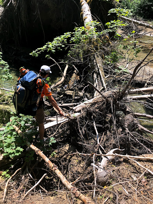
From there we went left and crossed an even larger log jam with more options for footing. This led us to the beach. We proceeded a few hundred feet to the left and found a small trail on our right leading off into the woods. The trail continues up into the woods to an old road. Go left a little ways to another trail on your right. Follow switchbacks up through the forest, under logs, over logs, around logs.. through more bushes.. cross even over more streams.. The first campsite we encountered was at 3572ft. A small one, and the only one we found below the tree line. Weather was still looking decent so we decided to continue. We took our first break at cougar falls:
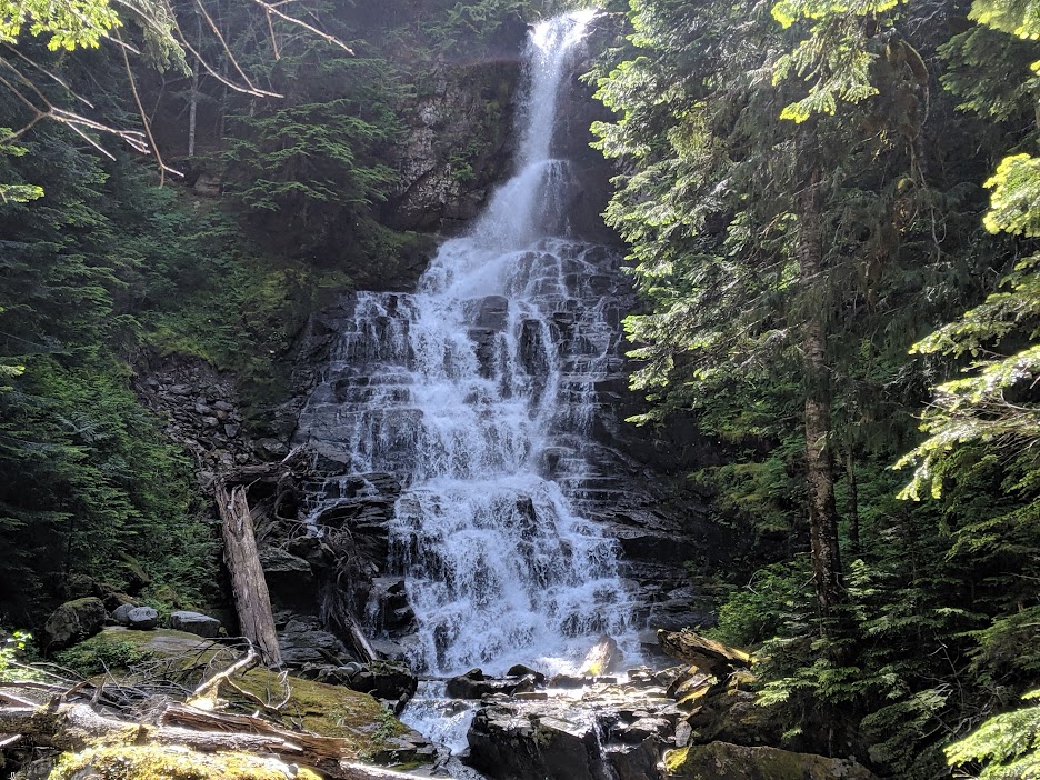
There is plenty of water options on the trail right now and we were able to filter often. From Couger we continued up. The trail continue to gain until you reach the first meadow at 4600ft. We tried to find camping, but everything was rather soggy..

One member of our party had been on the route before and recalled more camping options further up, so up we went! Here the trail has two steep sections you climb to gain the next plateau at 5000ft:
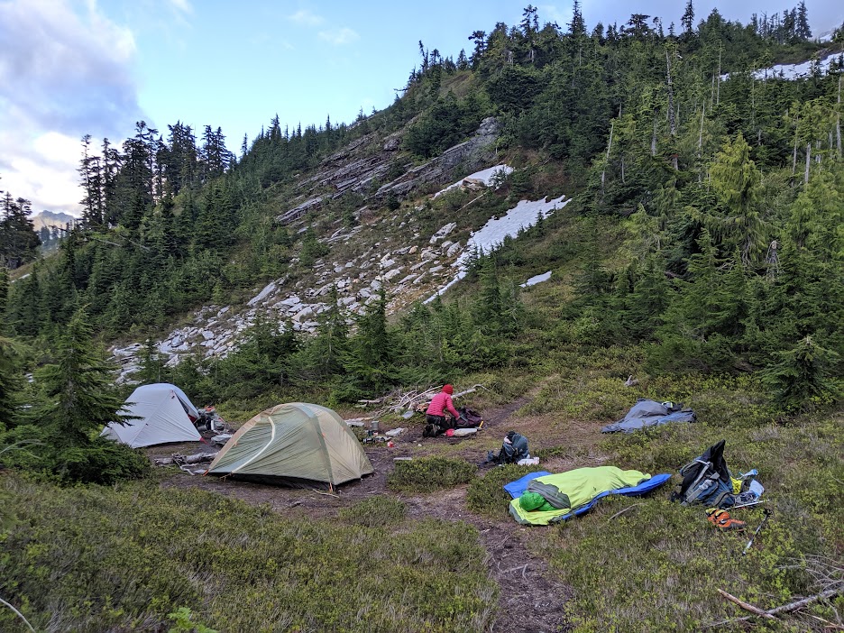
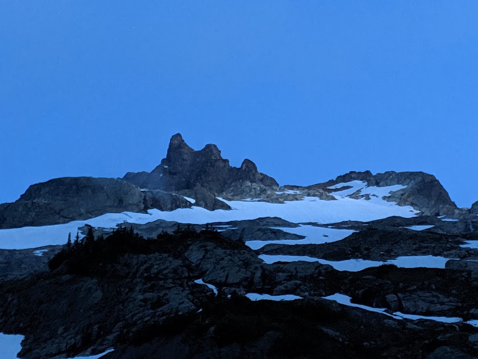
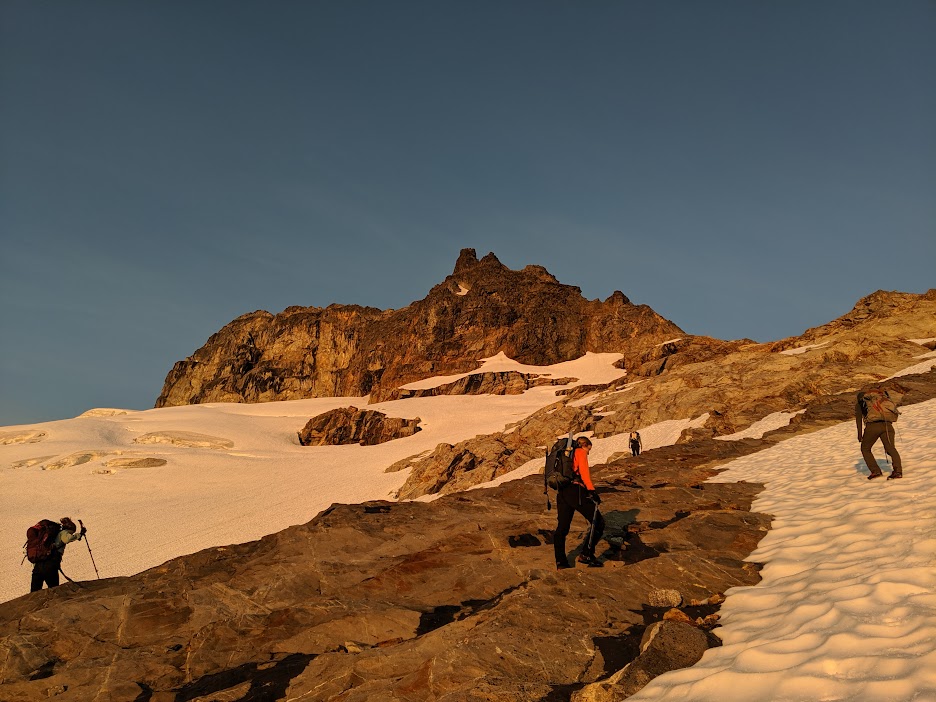
Exhausted from the day, and we were pretty excited to finally find camping and drop our packs. We got to camp around 6pm. There is a small stream as you continue up the trail, and a really big stream if you continue past it and descend the hillside. We ate dinner and the clouds parted for a brief 20 minutes giving us a beautiful view of our objective:
With rain forecasted at 4pm the next day, we set our alarms for 330am and left camp at 4am. The first few parts of the trail disappear and reappear. Brian Starlin and Jan Abendroth both have excellent write ups for cross reference of the route. Follow the ridge up to rock bands, there are cairns scattered throughout. We hiked and scrambled through the rocks bands until reaching the toe of the glacier.
We dropped packs and got roped up. We had brought 4 pickets, but didn't end up using any of them. We ascended the glacier, deciding to cross between the two rock bands instead of below. You can actually just do a traversing climb of the glacier and skirt all crevasses. We discovered this on the descent. I would recommend this over dropping below the first crevasse and then front pointing up the next slope as we did on the way there.
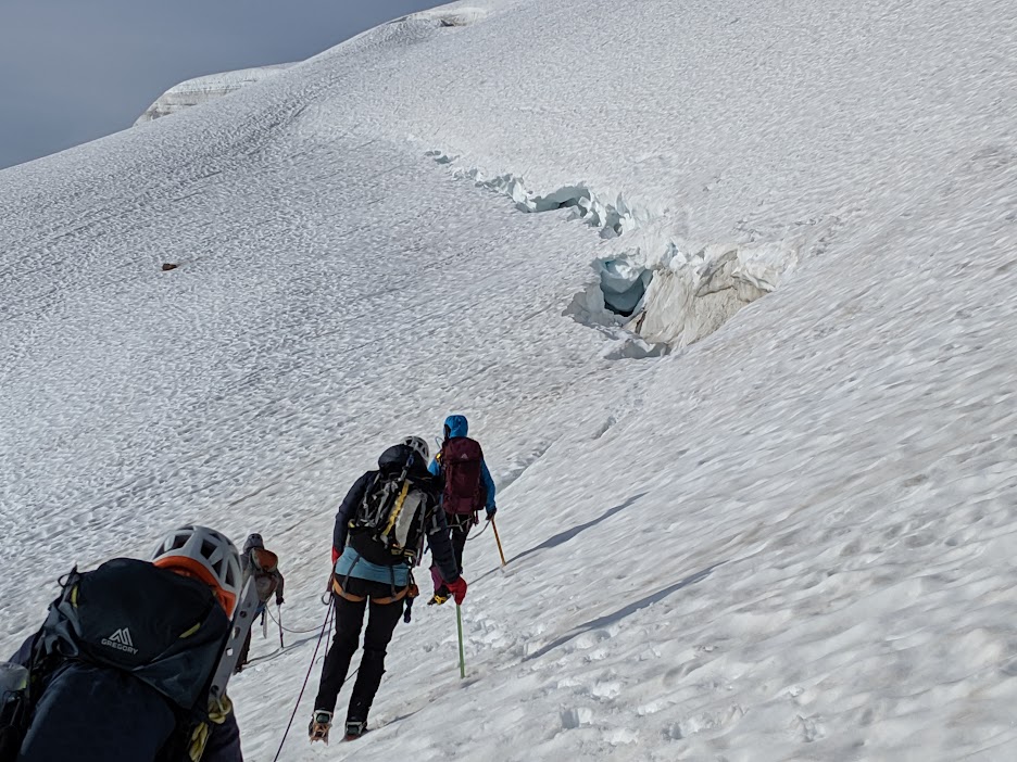
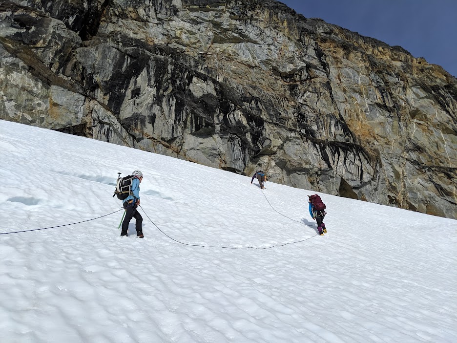
The glacier was not trivial, but it was on the shorter side. One around the first curl of the corkscrew, off the glacier, and back on rock, we took off our harnesses and left everything attached to rope. From here there is a faint trail that wraps around the mountain and continues up. Stay on trail, as one of the trip reports says "If you think your off trail, you are. Go back." You will clim two gulleys. The first one is pretty mellow and straight forward. The second one has a fair amount of lose rock in it. Be Careful. We stayed close and we very mindful of our steps up and down this part. From there continued up. Be mindful at the base of the second gulley to not go looking for 5th class moves, when you can find 4th class in the gulley.. (this move was not on route we soon discovered after Sherrie followed our scramble leader up the rock face)
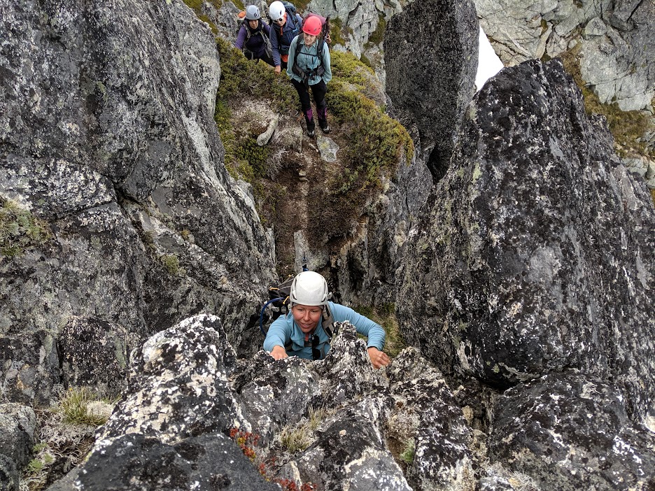
We found the infamous bear hug move! and half the team went left and the other half right. Both ways reach the top on similar terrain.

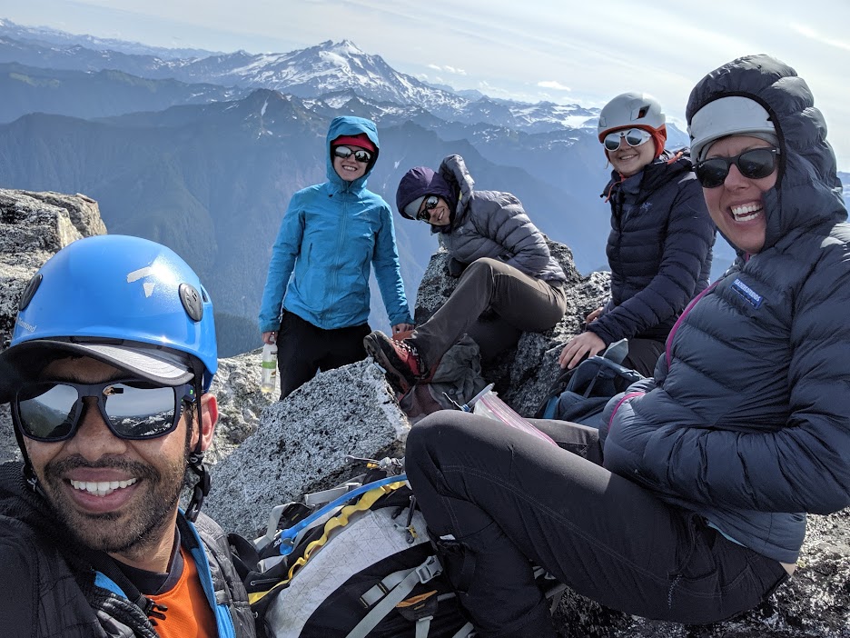
Reached the summit at around 9am, recorded our names in the registry and took lots of selfies:
We then began our decent and went down fast. We were back at camp at 1230pm. Packed up, stopped twice for two short ten minutes breaks and made it to the final log crossing just as it started to lightly rain! We were incredibly thankful that we barely hit the window. We dropped our packs at our cars at 430pm and it began to downpour shortly after.
All in all, it was a great climb with lots of adventure and some great memories.. We all agreed we were not that "fit party" that could climb this route in a day. Maybe in September.. but not in July.