Trip Report
Basic Alpine Climb - Sloan Peak/Corkscrew Route
bedal creek approach. route in excellent condition. no snow after exiting the glacier onto the corkscrew
- Sat, Jul 15, 2017 — Sun, Jul 16, 2017
- Basic Alpine Climb - Sloan Peak/Corkscrew Route
- Sloan Peak/Corkscrew Route
- Climbing
- Successful
- Road rough but passable
-

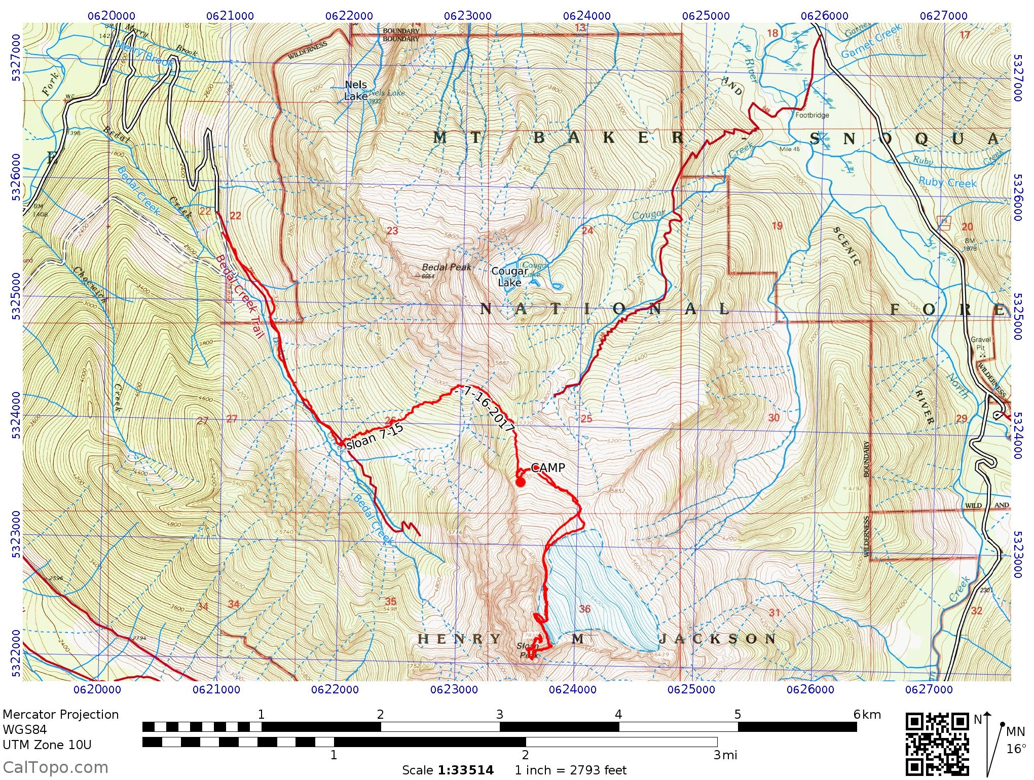
quick and dirty route info: drive mt loop highway a little more than 4 mi east of barlow pass and drive up the signed 4096 road to its end(limited parking). hike nice bedal creek trail to 3560', just past a seasonal stream and follow flags uphill(ene) to ~4900', then follow cairns and a path across pleasant meadows over to the sloan/bedal saddle(poor, but usable camp spot). ascend ridge climber's right to nice camping at 5850' on ridge.
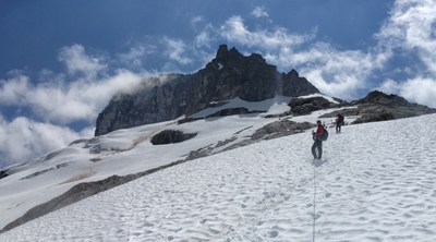
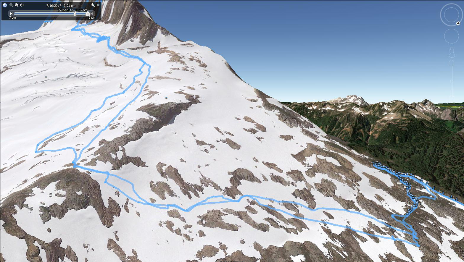
from 5850' camp, traverse ese .5mi(descending and ascending where necessary)to the ~5900' saddle .15mi wsw of 5852, then ascend ssw to attain the glacier at ~6800' close to sloan's e face, take glacier s to the corkscrew route path on sloan's s face at ~7180', follow path to asccent gully(don't be tempted to walk past) and ascend to its top, then continue on path to summit(class 3 with proper route-finding)
two of us who had done both the cougar creek(standard) and the bedal creek approach previously, agreed we liked the bedal creek approach much better - easier, nicer environment. the upper meadows were very nice on the way to the bedal/sloan saddle - easy walking, flowers, views. the off-trail portion between the bedal creek trail and the bedal/sloan saddle, because we were on-route, was not that bad - no real brush, just travel in the under-story of big trees. it was still off-trail travel, so more rugged than a trail, but not bad at all. it would be easy to get off-route.
ps - the flagging from the bedal creek trail was said to be done by search and rescue. the flags are abundant, about every 30-60'. either someone not experienced in off-trail travel flagged the route or their agenda had different purposes(that is my guess) than standard off-trail travel, as there were many spots the route could have gone a few feet right or left into much better terrain. it was not awful as we followed the flagging on the way down, less we had to work more. it was better to have it flagged, than if some holier-than-thou sort, tore down all the flags. although it would be nice if someone experienced in doing so, could fix the flagging(it would not take a lot).
4:19 car to camp 3.72mi 3058' gain
3:58 camp to summit
0:44 summit stay
2:16 summit to camp
0:41 break camp and rest
2:26 camp to car
day two total 7.96mi 3433' gain
14:24 car to car (not including camping) 11.68mi 6491' gain
water: along bedal creek trail, at camp 5850, not much between bedal creek trail and camp
equipment: ice axe, crampons, 30m ropes
equipment brought, but not used: 3 pickets
references: dave fish's excellent book: https://www.amazon.com/Rambling-Scrambling-around-Mountain-Loop/dp/1477485368
compare to cougar creek approach 8-19-2010 stats:
12.62mi 6573' gain
7:50 car to summit
0:53 summit stay
5:21 summit to car
14:04 car to car

 Brett Dyson