Trip Report
Basic Alpine Climb - McMillan Spire/West Ridge
A two day successful climb of the West Ridge route on West McMillan Spire. Tacoma Mountaineers group of five: Jeff Wirtz, Lance Garland, Jason Leubner, Spencer Kirk, & Jonathan Foster.
- Sat, Jul 27, 2019 — Sun, Jul 28, 2019
- Basic Alpine Climb - McMillan Spire/West Ridge
- McMillan Spire/West Ridge
- Climbing
- Successful
-

- Road suitable for all vehicles
A first outing into the true heart of the Cascades.
The Pickets need no introduction, as their larger than life reputation precedes them. My first introduction to the Pickets was from a climbing friend who had mentioned them and correctly named them as Washington's most difficult hidden gems. Now having only scratched the surface of what these complex giants have to offer, I understand what he meant.
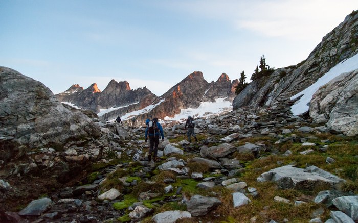
Saturday, July 27th 2019, a Tacoma Mountaineers team of five consisting of our climb lead, Jeff Wirtz, and four climbers, Lance Garland, Jason Leubner, Spencer Kirk, and myself, set out from the upper Goodell Creek campground (its fateful claim to fame being the lowest trailhead in the Cascades at 152m) cautiously aware of the Cascadian folk lore we were headed for. Originally we had intended to make this a three day climb (approach day I, summit day II, descent day III), but a small low pressure system moved in Saturday morning, forcing us to reduce our trip to two days. Had we kept our original schedule we would have been summiting in the low pressure cell Saturday morning which Jeff wisely kept us from. The downside, we now had 32km to travel and 2,900m (ascent and descent) to dispatch with in only 36hrs.
I'll start by noting that the exclusively enjoyable factor of this trail is that it is very well segmented, meaning that each length is easily identifiable and notably different from the rest. There is, what we took to calling, "the road", the approach, the root-pull, the trail, the notch, and the ascent. I will try to do each of these lengths their due.
The Road. Being the first section of trail you hit, this thankfully starts out comfortable in terms of gain. As the trail's namesake suggests, you are skirting the Goodell Creek, though in early summer it runs far closer to a river, and keeps you relatively low for 6km. The trail is a climbers trail, in that it is single track, overgrown, and inhospitable compared to the trails most are accustomed to in the Cascades. It had rained Friday night into Saturday morning, soaking all of the underbrush that has well overgrown the trail, leaving it heavy and loaded with rainwater for us. Lance, myself, and Spencer opted to start in shorts which I feel was the right call. Not even 1km in and all five of us were soaked. The bugs are worth mentioning as well as they had a hay day with us. Even with long sleeves and some deet, they were swarming us for the entirety of the morning, the only reprieve was to swat and keep moving. Roughly .5km before the end of the road is a creek crossing, this is the final reliable source of water along the trail until you reach Terror Basin. We took our first break and refilled water here.
The Approach. As you come to the end of the road, you reach a small circle in the woods that has clearly been walked over and knocked down. There is a large wooden arrow made of downed debris pointing N/NE. This section has been touted as "a mailbox on steroids", which I won't disagree with. If you take the average pitch of mailbox OT, double it, add slick roots, endless blow downs, limbs and brush thick enough to obscure your vision, and throw in some third class on route scrambling, you have the approach. This length climbs 1,070m in 2.5km. It is without doubt the most unrelenting, grueling approach I have encountered, even over that of Mt Stone in the Olympics (if you know, you know). While the approach is a burner, and leaves you absolutely gassed, the descent of this same length is what makes it truly terrible. Jamming your toes into your toe box on that steep of terrain after a two day climb where your feet are already worked will leave you in considerable pain, at least it did me.
The Root-Pull. After finally dispatching the approach, though it only goes 2.5km it does take a considerable amount of time, you reach and elevation of 1,590m bringing you to a vertical wall of dusted out roots. Trekking poles away, because this is where the hand over hand begins. Scrambling upward about 100m, some careful footwork and good handholds brings you to the top of the root-pull. This is slow going, but it is far more enjoyable than the two lengths you have already completed.
The Trail. Finally, the forest begins to relent and offer the first fruits of your labor. Maybe. On our approach, the clouds persisted and we could see little if anything, though on our descent we could see everything we had missed on day I. Breaking atop the root-pull, the trail eventually makes itself seen, a true single track of heather-lined, Tolkien-reminiscent, Cascadian dream terrain. The pitch levels out a bit and though you are still on the gain, it is nothing compared to the approach. If I recall correctly, there are three drainage gullies that you must cross, an annoyingly unwelcome sight, continuing to prevent any chance of finding a rhythm or cadence. They require a few veggie belays, and some sit and spin moves to get into, but after the root-pull, you are accustomed to moving in this fashion. Right around 1,700m you reach a section of rock slabs that may or may not have snow and running water. We were lucky enough to make use of this water source as I had already blown through the 2L I had filtered back at the creek crossing before the approach. Refilling here was the boost I needed to keep moving and get into camp. Do your best to stay on trail and on the slabs through this length. There are a significant amount of heather and wild flowers here, but it is obvious folks less virtuous tend to venture off trail continuing to disturb the natural state of things. Keep it low impact. At this point, with low visibility or otherwise, you should be able to see the notch, the last vertical push of approach day.
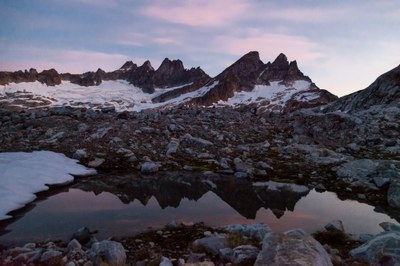
The Notch. Make your way over dinner plate sized granite plates, and onto what snow is remaining at the saddle of the notch. Once atop the notch, you are looking into Terror Basin, and your first unobstructed, well earned sight of the Southern Pickets: The Chopping Block, Pinnacle Peak, Twin Needles, Mount Terror, Mount Degenhardt, Inspiration Peak, the McMillan Spires, and Elephant Butte. Take a minute to breathe that in, it is a sight reserved for the echelon of cascadian climbers who are crazy enough to endure the worst in order to experience the best. It is truly an iconic sight. Begin descending the remaining snow trending left, headed towards a faint series of switchbacks that can be seen as the only broken ground on the slope. We worked through this section by pulling our group tight, and clustering at switchbacks in order to avoid any one climber climbing above another. This really ends up being a length of scree skiing, which makes falling debris an ever present hazard. The notch drops roughly 180m from the saddle of the notch to the Terror Basin floor, and should only take 10-15 minutes to work through. Eventually it begins to level out and spits you out right into camp.
At this point in the day, our team was soaked, twice and three times over, from rain-laden underbrush and sweat. Rolling our tired bodies into camp we immediately dropped rucks and changed into clean, dry layers. To note, I brought a total of three pairs of medium weight trekking socks, three pairs of underwear, shorts, climbing pants, a sunshirt, two base layers and by the end of the trip they were all soiled. I would recommend bringing at least this breakdown, if not an additional set of socks/underwear in case of emergency or an additional day out. To keep in mind, we were only out for 36hrs and a single overnight.
There is plenty of running water through the Terror Basin, though it is filled with glacial silt and needs to be filtered and boiled. Jason, Lance, and Jeff all tented, while Spencer and I opted for bivys. There are plenty of tent sites on bare ground, and a new bivy site big enough for two side by side climbers plus gear. We went to sleep under a broken cloudy sky in anticipation of it clearing, but knew the possibility existed that the cloud cover would stay, in which case we would be bailing. No point in summiting in cloud cover. I woke at 2200 to a star-punched sky, with the McMillan Spires behind our bivy, silently watching over us. At that point, I knew we were on. 0400 alarms, here we come.
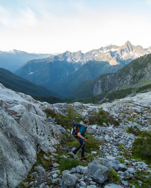
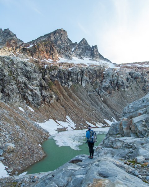
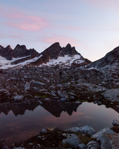
We woke quickly, made breakfast and coffee, laced up, and we were off. What a sunrise that was. Potentially the most concentrated event of alpenglow I've ever experienced. The purple that painted the mountains that morning is a sight I will never forget. Spencer and I snapped photos on the run as Jeff motored us towards the glacial lake crossing at 1,700m, trying to keep up as we hopped over boulders, slid down snow filters, and scampered up a series of slabs. For the most part we stayed high as we traversed in hopes of avoiding unnecessary gain/loss. This served us well. Once we reached the unnamed glacial lake (unmistakably and remarkable turquoise), we crossed paths with our new friend Theresa. She explained her story and why she was there solo as we continued on into the formerly glaciated granite slabs. Ascending these slabs is simple enough, a bit taxing, but relatively easy terrain compared to everything you have passed by this point. The slabs break up in a ledge system until you reach the base of the snow finger, the col between W McMillan Spire and Inspiration Peak.
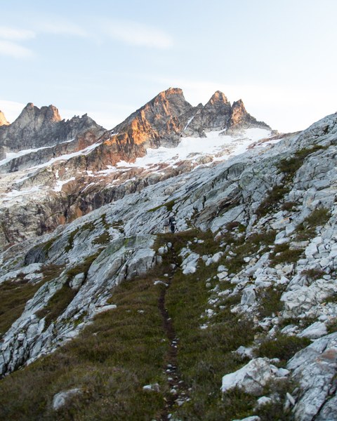
At this point (roughly 1,950m), we stopped to don crampons, axes, and helmets. Theresa was much quicker than the five of us so she moved on ahead and we would not see her again until the summit, that girl was on a mission! It was nearly here a year prior when Jeff had attempted this route with a different team and had to bail because the snow finger had collapsed, and on upper 4th/low 5th class unprotectable terrain, the only way to reach the top of the filter is if the snow is solid enough to ascend.
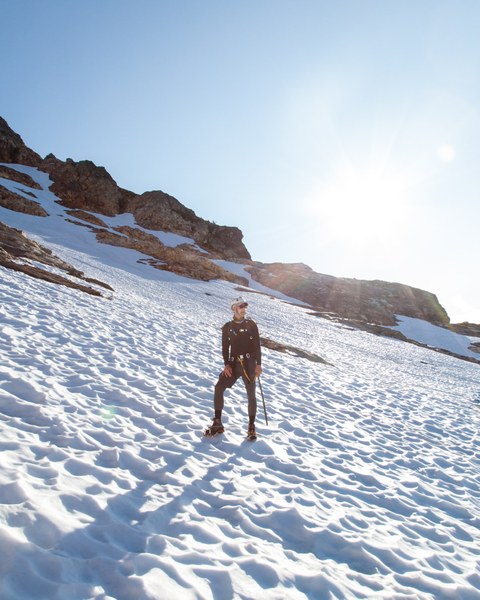
It was a special moment when we finally had the top of the finger in view, knowing it would go. This length may have been my favorite of the entire weekend. Our team made quick work of the finger, and we cruised up to the saddle. Atop the saddle we got our first look into the Northern Pickets, as well as Kulshan and Shuksan dominating the Western skyline.
Here, we admittedly got a little off route, though we were very close to the established route. We ended up making some stiff 5.4 - 5.5 moves still in crampons that felt great, but knew we would have to find another way down. Without a rope to rap, there was no down climbing where we had come up from. I will take a minute to note that The Mountaineers list this climb as a basic climb, strenuous 5 technical 2. I respectfully disagree with this rating based on the route variation we took. While there is no glacier travel, rope work, or rock placements (making an argument for the technical 2 rating) I strongly hold that the level of technique and footwork required to pull off this climb warrants a stiffer technical rating. I can confidently say that as a basic student I would not have been successful on this climb. The strenuous 5 rating holds true in my opinion, but coupled with a more realistic technical rating, this should be listed as an intermediate climb by virtue of all that this climb demands. If I were in the position of a climb leader I would be highly reluctant to take basic students on this route, and I commend Jeff for taking anybody on this climb, furthermore two years running. The terrain was chossy, slabby, unprotectable, with dozens of large loose plates, and dynamic route finding. This is in no form or fashion a basic climb. It is demanding, technical, requires a high level of mental fortitude, comfort with sheer exposure, and high class scrambling throughout. High class scrambling and steep snow is what Spencer and I cut our teeth on before we knew it was what we were doing, so this section, while spicy, felt like our bread and butter. When you can get into your flowstate of experiencing your movement and tuning out the unrelenting no fall zone something really special happens. That being said, your foot work needs to be absolute dynamite for this climb, and even if it is, this will still push you.
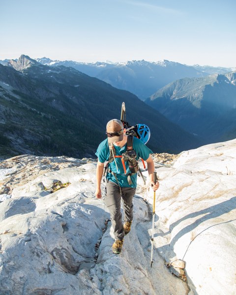
At some point the chossy scramble fest came to a close, culminating in the summit of West McMillan Spire, and our first summit in the Pickets. Even in broad, bleached daylight, some of the most humbling sights I've seen. Everything from Tahoma to the Canadian boarder was visible that morning. Hello, Cascadia!
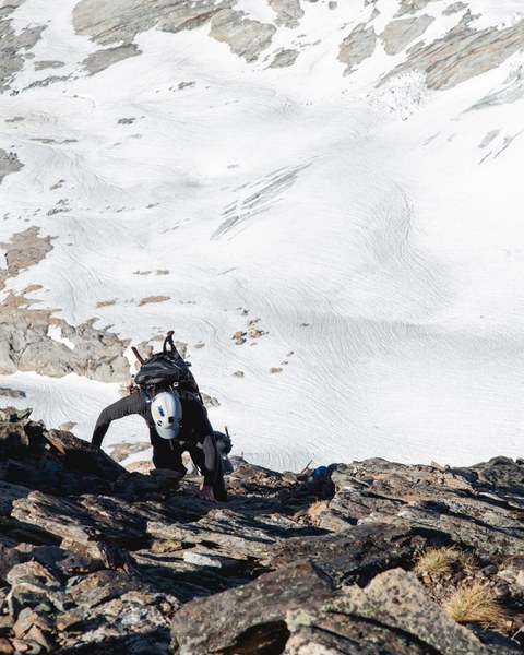
Having pushed ourselves on the ascent, we knew well that we were only half way, and the fun half was behind us. We signed the register, took a few photos, fueled up, and began our descent. Thankfully we found the (if I can say this) the established route down, though that may be reaching. Unpacking the slippery, shale slope was no easy task. It would go from loose movement underfoot to 4th class down climbing. More than once I was finger locking, smearing, underclinging, crimping, edging, flagging, and even two very memorable dynos. I will reiterate that this is not a beginner climb. You must be comfortable making big, committing moves in mountaineering boots, with no room for mistakes. The runout on a fall would certainly result in a painful tomahawk, ending with a long drop, and fatality into either the Terror or Inspiration glaciers. Again we kept our team close and our movement tight to avoid kicking debris down onto each other which served us well. We eventually made our way back to the climber's trail and down to the beginning of the quickly melting snow finger. We smeared ourselves against the rock and put crampons back on, jumping onto the snow we began the sweaty job of descending the finger.
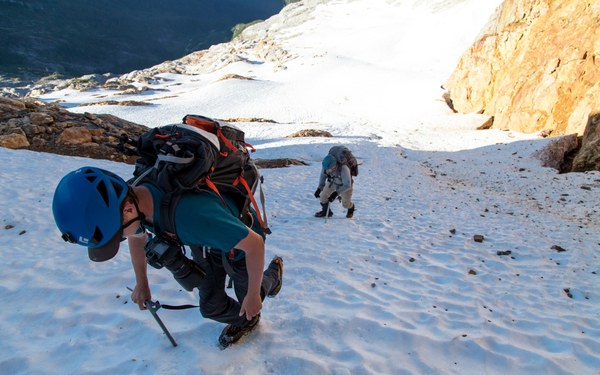
Most of the team did some mixture of plunge stepping and down climbing. I ended up boot skiing most of it which felt great on my already tired knees. This spit us back out at the small plateau where we put on crampons earlier that morning. We ditched the hardware and helmets, filtered water from the snowmelt, and laced up for our blistering trot back to camp. Temperatures had jumped 15 - 20 degrees by this point and the wind was intermittent at best. We were sweating ourselves silly, and this length really did not have much gain/loss. We were within 60m - 80m of the elevation of camp, it was just a lot of traversing, and edging over the slabs.
Eventually sauntering back into camp, we dropped rucks and pealed off our sweat soaked layers. This is where it was made abundantly clear how nice it would have been to have a third day to dedicate to the full descent. 1330 and nearing the heat of the day by this point, we gave ourselves an hour to rest, filter water, break camp, change clothes, and lace up to tackle our next length. Had we had an extra day, we would have had fresh legs, some new skin, a full meal, and some time to breathe, it certainly would have been nice, but not this time.
I won't bore you with retelling the monotonous descent as it is functionally the same as the ascent in reverse, only this time we had far superior views. I will however leave you with a few stats that I hope will continue to put this climb into quantifiable terms for those interested in tackling it in the future.
- 2 days (35hrs), 0900 Saturday - 2000 Sunday
- 32km round trip
- 2,900m ascent
- 2,900m descent
- 14L water consumed (just me, only peed twice)
- 6,000~ calories consumed (just me, no waste)
This climb had a bit of just about everything the Cascades have to offer with the exception of glacier travel, rock placements, and rope work. It was a very full experience, and one I will not soon forget. I am grateful to our climb lead, Jeff Wirtz, who handpicked this team, and organized every detail of this climb to keep us safe and give us the best chance of success. It went without a hitch, just a ton of work.
One down.
 Jonathan Foster