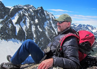
The Fin/Northwest Ridge
At the south end of Kangaroo Ridge are The Tomahawk and The Fin. The Fin is a challenging rock climb for beginners. Expect beautiful views of the North Cascades and some solitude on this climb. Times: 3-4 hrs to the col and 3-4 hrs to the summit.
Getting There
Drive SR-20 (North Cascades Highway) to Washington Pass. Continue 1 mile to the hairpin turn and park in large turnout.
Approach
Hike southeast through open forest and open slopes on right side of valley to Kangaroo Pass. Locate The Tomahawk to the southeast from Kangaroo Pass. The Fin is just beyond. Descend open slopes toward a meadow (or follow the route towards Kangaroo Temple), then ascend mostly open talus until you can turn left and scramble to the Tomahawk-Fin Col.
Ascent
Start climbing at the col and ascend the Northwest Ridge in 5-6 pitches of Class 4 climbing. First 60 percent of route has friable rock but almost all rockfall would go harmlessly down one side of the ridge or the other. Some large loose rocks have been reported. Last 40 percent of the route is enjoyable - exposed but easy climbing on solid granite.
Descent
Descend 150 feet of Class 2-3 via Southeast Ridge to a saddle, then down snow or talus. If a return to the Tomahawk-Fin Col is desired, downclimb the Southeast Ridge to the saddle, drop another 100-200 feet and then traverse over to the col on a very good way trail.
Trip Profile
| SEGMENT | TIME (HR) | ELEVATION GAIN (FT) |
|---|---|---|
| Trailhead to Col | 3-4 | 1,500 |
| Col to Summit | 3-4 | 600 |
| Summit to Trailhead | 3-4 |
Equipment
Standard rock gear.
Notes
- It can be done in one day from Seattle with an early departure or with a can car camp.
- Because of the fragile environment, do not camp anywhere along the approach to the climb.
- Use caution especially on the 2nd pitch where rockfall danger to climbers below is greatest.
- Some parties have traversed right at the col to make the 1st pitch more challenging. This is not recommended because of rockfall. Stay on the ridge!
- The key to climbing this route quickly is to avoid rope drag. Choosing the straightest line and utilizing double and triple runners can turn the first three pitches in one full-rope-length pitch the entire climb into 3.5 pitches.
- The approach is a cross-country rout and can take up to 2 hours longer in late season because of brush, although most brush can be avoided.
- Suitable Activities: Climbing
- Climbing Category: Basic Alpine
- Seasons: July, August, September, October
- Weather: View weather forecast
- Difficulty: Basic Alpine Climb, Strenuous 2, Technical 2, Basic Experience Climb
- Length: 6.0 None
- Elevation Gain: 2,800 ft
- 7,360 ft
-
Land Manager:
Okanogan-Wenatchee National Forests
Lake Chelan-Sawtooth Wilderness, Chelan Ranger District (OWNF)
- Parking Permit Required: Northwest Forest Pass
- Recommended Party Size: 12
- Maximum Party Size: 12
- Maximum Route/Place Capacity: 12
- USGS Washington Pass
- USGS Silver Star Mtn
- USGS Gilbert
- Green Trails Washington Pass No. 50
- Green Trails Stehekin No. 82
- Trails Illustrated North Cascades National Park
There are no resources for this route/place. Log in and send us updates, images, or resources.
