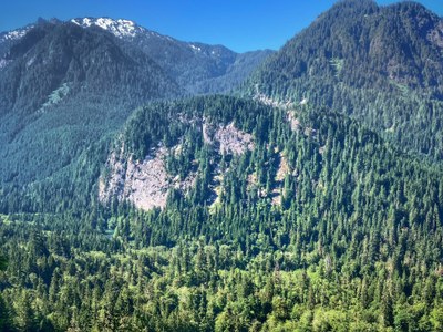
Stegosaurus Butte
A short, easy scramble to a viewpoint in the Middle Fork Snoqualmie River valley.
getting there
Take Exit 34 off of I-90 and turn left onto 468 Ave SE. In a half mile, turn right onto SE Middle Fork Road (Forest Road 56). Drive 12 miles to the Middle Fork Trailhead (1,000 ft).
Hiking & Scrambling Route
From the Middle Fork parking lot, cross the bridge over the river and turn right. Look for an unsigned but obvious boot path on the left a little less than 0.2 miles from the bridge. Don't be lured by faint boot paths and head up too early. Follow the steep but obvious trail to the top for views of Preacher Mountain and Mount Garfield.
Notes
- In winter and spring this is typically a snow scramble.
- In summer and fall, it typically a hike on an unmaintained trail (aka boot path or climber's trail)
Information FOr leaders
Permits
As of 2017, the Snoqualmie Ranger District considers Mountaineers trips and courses to be "nominal use". Leaders should print and copy this designation letter to show rangers they may see on trail or carry a digital copy on their phone.
- Suitable Activities: Day Hiking, Scrambling
- Seasons: Year-round
- Weather: View weather forecast
- Difficulty: *Varies*, Easy, Strenuous 1, Technical 1
- Length: 2.2 mi
- Elevation Gain: 1,100 ft
- 2,100 ft
-
Land Manager:
Mount Baker-Snoqualmie National Forest
Snoqualmie Ranger District (MBSNF)
- Parking Permit Required: Northwest Forest Pass
- Recommended Party Size: 12
- Maximum Party Size: 12
- Maximum Route/Place Capacity: 12
- Green Trails Middle Fork Snoqualmie No. 174SX
There are no resources for this route/place. Log in and send us updates, images, or resources.
