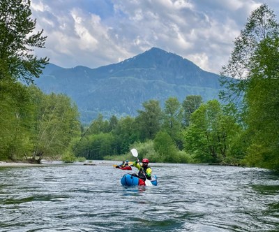
Snoqualmie River (South fork)
A beginner friendly whitewater packraft just east of Seattle near North Bend. It is a Class II/II+ run depending on the river's level with typical wood hazards and an abandoned weir making for an unusual river obstacle.
FLOW
- NOAA Gauge: SF SNOQUALMIE--NEAR GARCIA (GARW1)
- 300 - 2,500 cfs: Runnable
- Average Gradiant: 31 feet per mile
PUT-INS
- Twin Falls Trailhead: Take Exit 34 off of I-90, turn right onto 468th Ave SE, and drive ~0.5 mile to SE 159th St. Turn left and continue another 0.5 mile to the Lower Twin Falls Trailhead parking lot at the road's end (620 ft). The put-in is about thirty feet from the south end of the parking lot.
- Percolator Pool: From the Twin Falls Trailhead parking lot hike the Twin Falls Trail upstream ~0.5 mile. Just before the trail starts to ascend, turn right onto a trail that leads down to the river. This pool is at the bottom of the second of two Class V drops and is the upper put-in.
TAKE-OUTS
- 436th Street Bridge: Take Exit 32 off of I-90, turn right, and drive to the big bridge that crosses the river. Park on the right side of the road both before or after the bridge. There are use trails on both sides of the downstream side of the bridge. Eddying out is easier on river left and there is a wider pull out so parking after the bridge may be easier.
ON THE RIVER
The highlight of this trip is in Waskowitz Canyon, which can become a single long Class II+ boulder slalom at higher flows. Pass under a footbridge, pass a camp on river right, and then see houses on river left. After going under the next bridge, houses begin to appear on river right, and the canyon opens up. After a small rapid that makes a sharp left turn, there is a long pool and a weir. There are several runnable slots in the weir, mostly left of center. The easiest portage is on the far left. The main hazard here is not the rapid, but logs that get caught on the weir during high water events.
Putting in at the upper put-in at Percolator Pool adds spice to this run. From here to the lower put-in lot is Class III in a much narrower river with many small boulder drops and holes in higher flow. From the parking lot to 436th Street bridge it calms down to Class II.
NOTES
- For a longer day, this route can be done as a double header with the Club Stretch, Powerhouse, or other runs on the Snoqualmie River near North Bend.
- It is possible to scout most of the upper section from the Twin Falls Trail. Scouting of the lower section is possible from the Snoqualmie Valley Trail off of SE 145th Street, from the 468th Street bridge, and from the 436th Street bridge.
- Learn more on American Whitewater's Snoqualmie, S. Fork: 2. Twin Falls State Park to 436th St. Bridge web page.
- Suitable Activities: Packrafting
- Seasons: March, April, May, June, October, November
- Weather: View weather forecast
- Difficulty: *Varies*, Class II River, Class II+ River, Class III River
- Length: 3.7 mi
- Land Manager: Land Manager Varies
- Parking Permit Required: Discover Pass
- Recommended Party Size: 12
- Maximum Party Size: 12
- Maximum Route/Place Capacity: 12
- Green Trails Mount Si NRCA No. 206S
- Green Trails Rattlesnake Mtn No. 205S
There are no resources for this route/place. Log in and send us updates, images, or resources.
