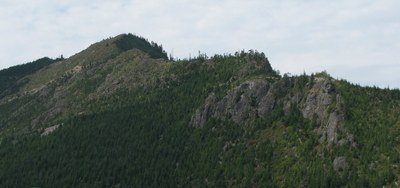
Songbird Peak, Machu Picchu & Greenway Mountain
Songbird Peak is also know as MMM and Midmountain Mountain. It an easy to moderate scramble from Change Creek which is a good hike on its own with views from Hall Point. A short rock scramble at the top gives good views of Mount Teneriffe and Green Mountain to the west, Mailbox Peak to the north and Snoqualmie Pass to the east. Easter Island, Machu Picchu, and Greenway Mountains are all good destinations on their own or combined with any of the other peaks.
getting there
Take Exit 38 off of I-90 and park in the climbers parking area at Change Creek (1,210 ft).
On the Trail
Change Creek
5.6 miles round trip, 2,275 feet of elevation gain
Hike 2.8 miles on the trail that follows Change Creek. Enjoy unique views of Mailbox Peak, Dirtybox Peak, and Dirty Harry's Peak from both Olallie Knob and Hall Point. At the turn around point is a small pond.
approach & ascent
Songbird Peak (4,240 ft)
6 miles round trip, 3,100 feet of elevation gain, Difficulty: Strenuous 3, Technical 3
Follow the prominent climbers trail up the west side of Change Creek to the Deception Crags climbing crag on the Iron Horse Trail. Travel east on the Palouse to Cascades State Park Trail (formerly Iron Horse/John Wayne Trail) less than 200 yards and there will be an unmarked trail to the right of trestle fencing heading up the hill. The rough trail begins between the trestle bridges that span Change Creek and Hall Creek. It can be hard to find so start looking for it just after crossing the bridge. A few feet up the trail a sign reading “Change Creek Trail” will confirm you’re on the right trail.
There is a trail to the right at 2,390 ft that leads to an overlook know as Ollalie Knob. It has a view comparable to Dirty Harry's balcony. A prominent prow rock marks the turn. The main trail goes left of the prow and the easy to miss trail that heads back on the right goes to the overlook. This route has very little scrambling over all and adding the side trail makes it much more challenging. It is also the first scrambling of the route with very imposing exposure. About 100 feet past the overlook side trail there is a sign for "Change Creek Vista." A few hundred feet past this sign is the turn off to Hall Point, another optional side trip that leads to a balcony overlook like Dirty Harry's Balcony. This is roughly the half way point.
At the Hall Point junction, bear right towards Mount Washington. Travel 0.25 mile to a side trail heading back on the left. Look for the "J's Landing" sign, an open area that looks a bit like a rock quarry with moderately good views. Just past here look for the "MMM Ridge Trail" sign and follow it. The trail becomes a very old logging road, and shortly after that are views of "the pyramid" down to the left (southeast). The trail/road switchbacks up and behind to the ridge. The scrambling starts here. Pay attention and look back on the way up, because there are a couple of places that are easy miss on the return descent. Most of the scrambling is short, easy rock, but there is one challenging rock traverse. Follow the ridge to the summit (4,240 ft) at the top of a grassy slope.
Machu Picchu (3,600 ft)
6 miles round trip, 2,400 feet of elevation gain, Difficulty: Strenuous 3, Technical 3
Songbird Peak (4,240 ft) & Greenway Mountain (4,640 ft)
8 miles round trip, 3,300 feet of elevation gain, Difficulty: Strenuous 3, Technical 3
Machu Picchu (3,600 ft) & Greenway Mountain (4,640 ft)
10 miles round trip, 3,300 feet of elevation gain, Difficulty: Strenuous 3, Technical 3
notes
- There is not much scrambling , but this is a great beginning rock scramble.
- It is a better, much less crowded conditioner than Tiger Mountain.
- The views better than from Dirty Harry's balcony.
- It's a good "after hours" scramble near Seattle.
Information for leaders
Permit information
As of 2017, the Snoqualmie Ranger District considers Mountaineers trips and courses to be "nominal use". Leaders should print and copy this designation letter to show rangers they may see on trail or carry a digital copy on their phone.
- Suitable Activities: Day Hiking, Scrambling
- Seasons: Year-round
- Weather: View weather forecast
- Difficulty: *Varies*, Strenuous 3, Technical 3, Winter Scramble
- Length: 6.0 mi
- Elevation Gain: 3,000 ft
- 4,240 ft
-
Land Manager:
Mount Baker-Snoqualmie National Forest
Snoqualmie Ranger District (MBSNF)
- Parking Permit Required: Discover Pass
- Recommended Party Size: 12
- Maximum Party Size: 12
- Maximum Route/Place Capacity: 12
- Green Trails Mount Si NRCA No. 206S
- Green Trails Bandera No. 206
- USGS Chester Morse Lake
This is a list of titles that represent the variations of trips you can take at this route/place. This includes side trips, extensions and peak combinations. Not seeing a title that fits your trip? Log in and send us updates, images, or resources.
- Songbird Peak
- Machu Picchu
- Greenway Mountain
- Songbird Peak & Machu Picchu
- Songbird Peak & Greenway Mountain
- Machu Picchu & Greenway Mountain
- MMM Ridge
- MMM Peak
- Midmountain Mountain
- Point 4240
- Change Creek
- Hall Point
- Ollalie Knob & Hall Point
There are no resources for this route/place. Log in and send us updates, images, or resources.
