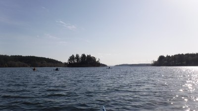
Pitt Passage
Sea kayak this 1.5 nm passage on south Puget Sound. At less than 2 knots, currents are typically mild, but they can be exciting in the shallow areas around Pitt Island and Wyckoff Schoals to the north.
launch points
The passage can be accessed from Penrose State Park or Fox Island to the north, or Key peninsula launches such as 72nd St. or Anderson Island to the south.
on the water
Pitt Passage connects Carr Inlet to the north with Drayton and Balch Passages to the south. The passage is 1.5 nm long and experiences mild currents, less than 2 knots. This passage can be exciting because of shallow areas around Pitt Island and Wyckoff Schoals to the north. The passage can have winds above other local areas because of fetch and funneling.
notes
- Please note that landing on Pitt Island and McNeil island is prohibited. These islands are clearly signed to stay away.
- This area is very scenic and has low marine traffic.
- Suitable Activities: Sea Kayaking
- Seasons: Year-round
- Weather: View weather forecast
- Length: 10.0 nm
- Land Manager: Land Manager Varies
- Parking Permit Required: see Land Manager
- Recommended Party Size: 12
- Maximum Party Size: 12
- Maximum Route/Place Capacity: 12
- NOAA Puget Sound: Southern Part No. 18448
There are no resources for this route/place. Log in and send us updates, images, or resources.
