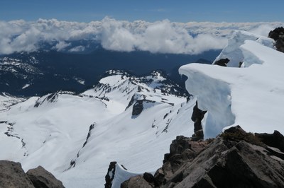
Cowlitz Gap & Rocks (winter)
A winter goal for skiers, snowshoers and scramblers, that starts at the Paradise Visitor Center of Mount Rainier National Park. This moderate 8 mile trip, with 2,400 feet of elevation gain, has open 360-degree views of the glaciers of Mount Rainier, the Tatoosh Range and other nearby peaks.
getting there
From SR-7 in Elbe, turn east onto SR-706, both known as the National Park Highway. Continue through the Nisqually Entrance of Mount Rainier National Park. Be prepared to pay the fee just after entering the park. Drive 19 miles to Paradise.
Winter drivers in the park are required to have snow chains, and may be required to install them at Longmire.
Approach & ASCENT
Mazama Ridge
From Paradise, take the trail to Mazama Ridge, then head north towards the Paradise Glacier. Contour along the ridge between the Paradise Glacier and the Williwaukas Glacier to Cowlitz Gap (7,100 ft).
Golden Gate Loop
A loop through Golden Gate can make a more interesting, though more demanding trip. From Paradise follow the road and trail northeast into Edith Creek Basin, then ascended to the ridge to the east, topping out at Golden Gate or a little to its southeast (the final slope can be steep and can be icy). Cross the plateau heading northeast and drop into the upper Paradise Valley. Contour at 6,40 ft passing through some rock bands. Then head up the valley to Cowlitz Gap. Return by way of the Stevens Van Trump Monument and the conventional access to Mazama Ridge.
cowlitz rocks
From Cowlitz Gap, approach Cowlitz Rocks (7,450 ft) from the west or northwest, depending on rock and snow conditions.
EQUIPMENT
Crampons may be needed and a GPS could be useful in case of whiteout.
Information for LEADERS
This area is used by our branches to host snow field trips and is a generally popular winter exploration area. Please check other routes/places to ensure we don't have multiple Mountaineers groups going to the same area.
- Suitable Activities: Backcountry Skiing, Scrambling, Snowshoeing
- Snowshoeing Category: Intermediate
- Seasons: January, February, March, December
- Weather: View weather forecast
- View avalanche forecast.
- Difficulty: Moderate, M1 Intremediate Ski, Winter Scramble
- Length: 8.0 mi
- Elevation Gain: 2,400 ft
- 7,450 ft
-
Land Manager:
Mount Rainier National Park
Mount Rainier Wilderness
- Parking Permit Required: National Park Entrance Fee
- Recommended Party Size: 12
- Maximum Party Size: 12
- Maximum Route/Place Capacity: 12
- USGS Mt Rainier East
- Green Trails Mt Rainier East No. 270
- Green Trails Paradise No. 270S
- Green Trails Mount Rainier Wonderland No. 269SX
There are no resources for this route/place. Log in and send us updates, images, or resources.
