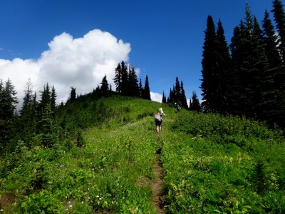
Pacific Crest Trail: Stevens Pass to White Pass
This 36.3 mile moderate section of the Pacific Crest Trail (PCT) with 5,300 feet of elevation gain crosses long stretches of high meadow flower fields past several lakes, with views of Glacier Peak at many points along the way. Intermediate destinations along the route include Lake Valhalla, Lake Janus, Grizzly Peak, Pear Lake, Cady Pass, Lake Sally Ann, Dishpan Gap, Kodak Peak, Meander Meadow and Indian Pass.
getting there
stevens pass
Drive SR 2 to Stevens Pass (approximately 82 miles from Seattle). Park at the Pacific Crest Trail parking lot on the north side of the highway. Consider taking the Northwestern Trailways bus from Seattle to Stevens Pass.
north fork sauk river trailhead
Drive SR 530 (Mountain Loop Highway) and turn easy on Forest Road 49 (about 7 miles north of Barlow Pass).
Note: It is about 3 hours of driving between these two trailheads, a very long, 6-hour car shuttle at each end. This route is best planned as a key swap or by riding the bus to Stevens Pass and coordinating a ride back to Seattle.
Little Wenatchee Ford Trailhead
Drive SR 2 to Coles Corner and turn north onto SR 207. Just past Lake Wenatchee, turn left (west) onto Forest Road 65 and follwo it to its end.
Note: This is an alternate exit that requires backtracking several miles or leaving the PCT before White Pass, but, at 1.5 hours between trailheads, it is a shorter car shuttle.
on the trail
The Pacific Crest Trail (PCT) north from Stevens Pass climbs gradually along the highway for about 1.8 miles before turning sharply west and then climbing steeply north to a high point above Lake Valhalla, with Lichtenburg Mountain looming above. From Lake Valhalla it's 1.8 miles to Union Gap and a junction with a 0.9 mile side trail descending to another trailhead on the Smith Brook road (an alternative starting point). The trail descends 2.2 miles from Union Gap to Lake Janus before climbing again, 1100 feet in 1.5 miles, before moderating as it traverses above Margaret and Glasses Lake through meadows to Grizzly Peak at 5,700 ft. The trail turns northward and traverses, then descends 3.3 miles to Wenatchee Pass, and a junction with Trail No. 1506.
From this junction, the PCT goes west for 0.7 miles to Pear Lake and a junction at 4,900 ft with the Meadow Creek Trail. The PCT then continues north and climbs a ridgeline to a high point of 5,200 ft before dropping through Saddle Gap to a 4,900-foot junction with the West Cady Ridge Trail. The PCT switchbacks down steeply over the next 1.6 miles to a junction with the Pass Creek Trail, No. 1053. In another 0.3 miles, at Cady Pass, the Cady Creek Trail, No. 1501.
Continuing north from Cady Pass, the trail climbs 1,300 feet in approximately 2 miles, follows a ridge with great meadows and views, and then descends slightly to Lake Sally Ann and a junction with the Cady Ridge Trail, No. 1532 (a potential exit to the Little Wenatchee Ford Trailhead). Reach Dishpan Gap in 1.4 miles and a junction with the North Fork Skykomish River Trail, No. 1051, and the June Mountain Trail, No. 5510. The PCT turns east here and climbs over Sauk Pass to a junction with the Little Wenatchee River Trail (a potential exit to the Little Wenatchee Ford Trailhead). Beyond Meander meadow, take a short walk-up on a faint side trail through the huckleberries to splendid views from the top of Kodak Peak.
About a half mile beyond Kodak Peak, the PCT turns north again for 1.0 miles to Indian Pass and a junction with the Indian Creek Trail, No. 1502, then 2 miles to the junction with the White River Trail, No. 1507 before completing its journey through meadows to White Pass, 2.3 miles from the White River Trail junction.
North Fork Sauk River Exit: From White Pass, walk 0.7 miles north to the junction with the North Fork Sauk River trail and descend 8.2 miles to the trailhead on the North Fork Sauk River Road (Forest Road 49).
Little Wenatchee Ford Exit: An alternative exit. Exit early or turn around and head south on the PCT and hike out either the Little Wenatchee River Trail (13.8 miles from White Pass) or the Cady Ridge Trail (16.4 miles from White Pass) to the Little Wenatchee Ford trailhead.
PCT Miles
- Stevens Pass to Lake Valhalla: 5.4 miles
- Lake Valhalla to Union Gap: 1.8 miles
- Union Gap to Lake Janus: 2.2 miles
- Lake Janus to Grizzly Peak: 4.7 miles
- Grizzly peak to Trail No. 1506: 3.3 miles
- Trail No. 1506 to Pear Lake: 0.7 miles
- Pear Lake to West Cady Ridge Trail junction: 4.7 miles
- West Cady Ridge trail junction to Cady Pass: 1.9 miles
- Cady Pass to Lake Sally Ann: 4.3 miles
- Lake Sally Ann to Dishpan Gap: 1.4 miles
- Dishpan Gap to Meander Meadow: 0.9 miles
- Meander meadow to Indian Pass: 1.7 miles
- Indian Pass to White River Trail junction: 2 miles
- White River trail jct to White Pass: 2.3 miles
- White Pass to North Fork Sauk River trail junction: 0.7 miles
- Suitable Activities: Backpacking
- Seasons: July, August, September, October
- Weather: View weather forecast
- Difficulty: Moderate/Strenuous, Moderate, Strenuous
- Length: 36.3 mi
- Elevation Gain: 5,300 ft
- 6,118 ft
-
Land Manager:
Okanogan-Wenatchee National Forests
Henry M Jackson Wilderness, Wenatchee River Ranger District (OWNF)
- Parking Permit Required: Northwest Forest Pass
- Recommended Party Size: 12
- Maximum Party Size: 12
- Maximum Route/Place Capacity: 12
- Green Trails Stevens Pass No. 176
- Green Trails Benchmark Mtn No. 144
- Green Trails Glacier Peak No. 112
- Green Trails Sloan Peak No. 111
- Trails Illustrated Glacier Peak Wilderness
There are no resources for this route/place. Log in and send us updates, images, or resources.
