Nooksack River (North Fork)
Glaciers on the slopes of Mount Baker keep this river flowing from late spring to early fall, providing paddling opportunities when other rivers are too low. It can be done as a Class II or Class III run depending on the put in.
FLOW
- 500 - 700 CFS: low runnable
- 700 - 900 CFS: prime runnable
- 900 - 1200 CFS: high runnable, pushy and self re-entry key
- 1200 - 2000 CFS: very pushy, not recommended for packrafts
- NOAA Gauge: NF NOOKSACK − NEAR GLACIER (NFNW1)
- USGS Gauge: NF Nooksack River BL Cascade Creek NR Glacier, WA - 12205000
put-ins
This run is approximately 30 miles from Bellingham, just east of Maple Falls on SR-542.
- Horseshoe Bend Bridge: SR-542, Milepost 35.4. This is the Class III put-in. Access is on the upstream river right side of the SR-542 Bridge across from Douglas Fir Campground. Parking is available in a large dirt parking lot on the east side of the highway, which also serves the Horseshoe Bend Trailhead.
- Gallop Creek Confluence: SR-542, Milepost 33.3, Vaughn Avenue in Glacier. This is the Class II put-in. In the town of Glacier, take Vaughn Ave one block north. Park in front of the Forest Service house on the corner of Vaughn and Forest Street. Walk 100 feet east on Forest Street to a trail on the left. The trail parallels Gallop Creek through the forest north to the river. It is a 5-6 minute walk to the confluence of Gallop Creek and North Fork.
TAKE-OUTS
- Warnick Bridge: SR-542, Milepost 30.7. For a shorter trip this is the take-out. Parking near the bridge is limited but Whatcom County owns a small parking area at mile 30.7. You can hike upstream towards the bridge where a good eddy and beach on the downstream river right side of the bridge provides good access.
- Maple Falls DNR Site: SR-542, Milepost 27.3. For a longer trip this is the take out. Access is on a small parcel of DNR land (waypoint is 48.9238, -122.0519). There is an obvious dirt road and room for a couple cars to park near the road. Please do not block the dirt road as outfitters and other boaters use it to pull trailers in and out.
ON THE RIVER
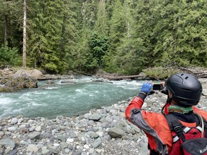
 This reach is characterized by two distinct sections. The upper section from Horseshoe Bend to Gallop Creek features several Class III rapids formed by bedrock features and boulders through a nice canyon. The canyon starts about 0.7 miles down river from Horseshoe Bend Bridge and is marked by a sharp right turn at the end of the houses on river left. The biggest and most risky drop is just around the corner and is typically portaged on river right due to multiple wood hazards and a significant ledge drop which may push Class IV at certain water levels. Once in the canyon itself, there are six distinct drops that can be scouted, and even portaged, on river left unless the river is flooding. The canyon is about 1 mile long. There is one more big rapid just after the confluence with Glacier Creek. This is a long Class III ramp with some very chaotic waves and boulders hidden in the opaque glacial water. If you're here mainly for the rapids in the canyon, you can exit at the Gallop Creek Trail and run laps of the 2.25 mile stretch from Horseshoe Bend to Gallop Creek.
The next section starts at Gallop Creek, 2.25 miles into the run. From this point down, the river spreads out across broad gravel bars. The rapids loose their punch but it's still a beautiful river and full of long Class II ramps with very fun wave trains. Keep a watch for wood hazards as there are numerous trees teetering on the brink of falling into the river and creating new strainers.
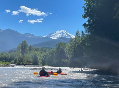
Continue downstream to Warnick Bridge and enjoy a couple Class II rapids and opportunities to explore the fossil beds on river right. Past Warnick Bridge where the river opens up into a wider valley with some spectacular views of Mount Baker and more Class II rapids. This section is characterized by braiding through many islands and cobble bars. Picking a line with a channel deep enough for a smooth ride can be difficult.
The full run from Horseshoe Bend to the Maple Falls DNR site is 9.0 river miles. The Class II reach from Gallop Creek to Maple Falls DNR is 6.5 river miles. Stay alert for logs, especially on the lower segment of the run, as it is not uncommon to have them completely blocking the channel.
NOTES
- Trips can be 2 to 8.5 river miles.
- Trips can be as short as 2.25 miles if only running the upper Class III canyon section, up to 9.0 river miles if taking out at Maple Falls, and longer. The river can be floated all the way to the confluence with Middle Fork for a much longer day.
- Glacier melt water feeds this river long after other river runs are going dry.
- The annual Nooksack Slalom Race is held in October each year organized by the League of Northwest Whitewater Racers.
-
Learn more on American Whitewater's, Nooksack, N. Fork: 3 - Douglas Fir Campground to Mt. Baker Highway Milepost 27 web page.
Important River Use Guidelines
The Nooksack River is an important river for Chinook salmon which are protected under the Endangered Species Act. These fish are particularly vulnerable when spawning (August thru September). American Whitewater has developed the following guidelines with the US Forest Service for recreational activities on the North Fork Nooksack for their protection:
- Avoid recreational activities that include contact access on the water (e.g. paddling, fishing, wading) from August 15th to October 15th. During this period of low water, which occurs during the Chinook spawning period, fish are particularly vulnerable to disturbance from boats that pass overhead or individuals wading in the river. An exception is allowed at higher flows above 1000 cfs (as measured by the USGS gauge).
- Following the completion of spawning in mid October, eggs in gravel are vulnerable through the end of March. Do not get out of your boat or wade in the river in areas where the substrate is smaller than the size of a grapefruit as you could crush eggs by walking in areas with gravel.
By following these voluntary guidelines we can protect fish and provide recreational opportunities. By demonstrating cooperation with these guidelines we can avoid mandatory river closures and retain this more flexible alternative.
Horseshoe Bend Trail
This is a 1.9-mile trail (3.8 miles round-trip) that meanders along the banks of the mighty Nooksack River through a forest of giant moss-covered cedars, hemlocks, and firs.
- Suitable Activities: Day Hiking, Packrafting, Trail Running
- Seasons: Year-round
- Weather: View weather forecast
- Difficulty: Class II River, Class III River, Easy, Easy
- Length: 9.0 mi
- Land Manager: Land Manager Varies
- Parking Permit Required: see Land Manager
- Recommended Party Size: 7
- Maximum Party Size: 12
- Maximum Route/Place Capacity: 12
This is a list of titles that represent the variations of trips you can take at this route/place. This includes side trips, extensions and peak combinations. Not seeing a title that fits your trip? Log in and send us updates, images, or resources.
- Horseshoe Bend Trail
There are no resources for this route/place. Log in and send us updates, images, or resources.
