Nisqually Delta & Reach
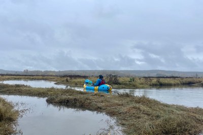
Sea kayak or packraft the Nisqually River Delta, the Nisqually Reach in South Puget Sound, and Medicine Creek, (aka McAllister Creek). Explore the Billy Frank Jr. Nisqually National Wildlife Refuge, a 762 acre protected estuary and home to many bird and aquatic species.
Launch points
- Nisqually River Public Access: From Seattle, head south on I-5 past JBLM, take exit 116, and turn left onto Nisqually Rd SW for 2.5 miles. Turn left onto 6th Ave SE for 0.4 miles to its end at the river. A Discover Pass is required. It is an uneven dirt parking lot for many vehicles. Do not leave valuables in cars.
- Luhr's Landing (aka Luhr Beach) in the Nisqually Delta: This is the only permitted launch site within the wildlife refuge. From Seattle, head south on I-5 past JBLM, take exit 114 onto Martin Way E for 1.1 miles, and turn right onto Meridian Road NE for 2.6 miles. Turn right onto 46th Ave NE for 0.2 miles, then turn left onto D Milluhr Rd NE for 0.5 miles to it's end at the bay. There is a historical information center, bathrooms, and a boat launch.
- Tolmie State Park: From Seattle, head south on I-5, take exit 111 in Lacey, and keep right to merge onto Marvin Rd for 3.5 miles. Turn right onto 56th Ave NE for 0.5 miles, turn left onto Hill St NE for 0.5 miles, then turn left onto 61st Ave NE for 0.4 miles. The parking lot is back from the water and is not very convenient for boaters.
On the Water
There is a channel to Puget Sound from Luhr's Landing. This channel is roughly marked by wood posts but it shifts location. Outside the channel are extensive mud flats. On a falling tide, these become exposed faster than a paddler can move to deep water. Some of the mud flats are sand but there are areas of soft mud so walking off the flats may be impossible. It is safest to cross the flats on a rising tide.
Most of the delta is within the Billy Frank Jr. Nisqually National Wildlife Refuge. Most of the refuge may paddled, but exiting boats is not allowed. There is a sanctuary area in which boating is not allowed—its boundary is reported to be well marked. The best map of the refuge, including sanctuary boundary is the park brochure (see the land manager below).
With proper tides, exploration can include McAllister Creek on the west and Salmon Creek on the east with a connection back to the Nisqually River.
notes
- It is critical to check the Tide Chart. The tide can rise and fall in excess of 10 feet on a given day, more than 1 foot per hour, moving the shoreline 2 miles in and out. The delta dries at lower tide levels stranding many an unwary boater.
- The nearest river gauge is Nisqually River at McKenna. Avoid the river when it is flooding.
- From Nisqually River Public Access to the mouth of the river is 4.3 river miles. Watch for wood obstacles and steer clear of buoys, which hold fishing nets that could present a tangle hazard.
- From the mouth of the river to Luhr's Landing is approximately 1.3 miles depending on the tide. At low tide you may need to circle out into the Sound to find deep enough water.
- From Luhr's Landing up McAllister Creek to the I-5 bridge is 3.3 river miles. In high tide the direct route is 2 miles. The Creek can be explored for another mile or so upstream until it gets too narrow and choked off by wood.
- Duck hunting occurs in Fall. Wear bright colors and bring whistles to alert hunters if they are shooting in your direction.
- Medicine Creek is the site of the historic Medicine Creek Treaty of 1854, signed by Governor Isaac Stevens and Chief Leschi.
- Suitable Activities: Packrafting, Sea Kayaking
- Seasons: Year-round
- Weather: View weather forecast
- Difficulty: Sea Kayak III, Class I River
- Land Manager: Nisqually National Wildlife Refuge
- Parking Permit Required: Discover Pass
- Recommended Party Size: 12
- Maximum Party Size: 12
- Maximum Route/Place Capacity: 12
- MapTech Puget Sound Chart No. 100
- see Land Manager
This is a list of titles that represent the variations of trips you can take at this route/place. This includes side trips, extensions and peak combinations. Not seeing a title that fits your trip? Log in and send us updates, images, or resources.
- Billy Frank Jr. Nisqually National Wildlife Refuge
- Ketron Island Circumnavigation
- Nisqually Delta
- Nisqually National Wildlife Refuge
There are no resources for this route/place. Log in and send us updates, images, or resources.
