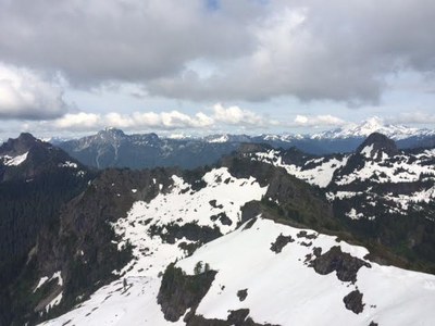
Mount Dickerman
A strenuous 8.6 mile hike with 3900 ft in elevation gain. The trail starts in forest, graduates to meadows and ends with panoramic views of mountains including Mt Baker, Glacier Peak, Mt Rainier, Three Fingers and the Monte Cristo Peaks.
Getting There
Drive the Mountain Loop Highway east toward Verlot. Turn left at the sign for the Mount Dickerman Trailhead, the trailhead for the Mount Dickerman and Perry Creek Trails (1,800 ft). If you reach Barlow Pass on the highway turnaround, you've gone just a bit too far.
On the Trail
8.6 miles round trip, 3,875 feet of elevation gain
Hike the Mount Dickerman Trail to the summit or Mount Dickerman (5,723 ft).
Approach & Ascent
8.6 miles round trip, 3,875 feet of elevation gain, difficulty: Strenuous 3, Technical 2
In winter and spring this is a scramble. Hike the Mount Dickerman Trail to snow line, then generally north uphill to attain the ridge. After exiting the forest for the last time, make a 90° right turn uphill to the summit ridge. Traverse east along south side of ridge to the summit (5,723 ft).
Notes
- HAZARD: There is a waterfall gully located at 4,200 ft where the trail traverses under a steep rock face. The rock funnels snow down into a fan of compressed snow and ice. It can become very steep. Because of the shade from trees, the pile often survives into June. After the snow melts it isn't hazardous, but when snow-covered, it can be steep and a slip can be deadly. In such conditions, an ice ax is mandatory and possibly even crampons. Be prepared to turn around if not properly trained and equipped. Two fatalities were reported in 2006.
- Suitable Activities: Day Hiking, Scrambling
- Seasons: July, August, September, October
- Weather: View weather forecast
- Difficulty: Strenuous, Strenuous 3, Technical 2
- Length: 8.6 mi
- Elevation Gain: 3,875 ft
- 5,723 ft
-
Land Manager:
Mount Baker-Snoqualmie National Forest
Skykomish Ranger District (MBSNF)
- Parking Permit Required: Northwest Forest Pass
- Recommended Party Size: 12
- Maximum Party Size: 12
- Maximum Route/Place Capacity: 12
- Green Trails Mountain Loop Highway No. 111SX
- Green Trails Sloan Peak No. 111
- USGS Sloan Peak
There are no resources for this route/place. Log in and send us updates, images, or resources.
